Estimated Value: $2,399,000 - $3,370,000
--
Bed
3
Baths
2,888
Sq Ft
$996/Sq Ft
Est. Value
About This Home
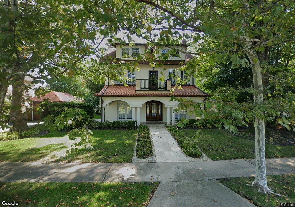
This home is located at 7 Atlantic Ave, Deal, NJ 07723 and is currently estimated at $2,876,292, approximately $995 per square foot. 7 Atlantic Ave is a home located in Monmouth County with nearby schools including Deal Elementary School, Hope Academy Charter School, and St. Mary of the Assumption School.
Ownership History
Date
Name
Owned For
Owner Type
Purchase Details
Closed on
Jan 17, 2006
Sold by
Maijor Rayna
Bought by
Gindi Aaron and Gindi Susan
Current Estimated Value
Home Financials for this Owner
Home Financials are based on the most recent Mortgage that was taken out on this home.
Original Mortgage
$300,000
Outstanding Balance
$169,321
Interest Rate
6.34%
Mortgage Type
New Conventional
Estimated Equity
$2,706,971
Purchase Details
Closed on
Jul 14, 1998
Sold by
Rocky Marilyn
Bought by
Maijor Rayna and Maijor Victori
Home Financials for this Owner
Home Financials are based on the most recent Mortgage that was taken out on this home.
Original Mortgage
$166,000
Interest Rate
6.92%
Create a Home Valuation Report for This Property
The Home Valuation Report is an in-depth analysis detailing your home's value as well as a comparison with similar homes in the area
Home Values in the Area
Average Home Value in this Area
Purchase History
| Date | Buyer | Sale Price | Title Company |
|---|---|---|---|
| Gindi Aaron | $999,000 | -- | |
| Maijor Rayna | $207,000 | -- |
Source: Public Records
Mortgage History
| Date | Status | Borrower | Loan Amount |
|---|---|---|---|
| Open | Gindi Aaron | $300,000 | |
| Previous Owner | Maijor Rayna | $166,000 |
Source: Public Records
Tax History Compared to Growth
Tax History
| Year | Tax Paid | Tax Assessment Tax Assessment Total Assessment is a certain percentage of the fair market value that is determined by local assessors to be the total taxable value of land and additions on the property. | Land | Improvement |
|---|---|---|---|---|
| 2025 | $8,251 | $2,185,300 | $1,478,200 | $707,100 |
| 2024 | $8,225 | $1,932,300 | $1,298,000 | $634,300 |
| 2023 | $8,225 | $1,788,000 | $1,236,000 | $552,000 |
| 2022 | $8,052 | $1,283,500 | $895,900 | $387,600 |
| 2021 | $5,817 | $1,238,700 | $874,600 | $364,100 |
| 2020 | $5,990 | $839,000 | $269,900 | $569,100 |
| 2019 | $5,817 | $820,400 | $254,600 | $565,800 |
| 2018 | $5,406 | $779,000 | $254,600 | $524,400 |
| 2017 | $5,315 | $762,600 | $254,600 | $508,000 |
| 2016 | $4,976 | $711,900 | $238,000 | $473,900 |
| 2015 | $4,937 | $690,500 | $238,000 | $452,500 |
| 2014 | $4,095 | $573,500 | $231,100 | $342,400 |
Source: Public Records
Map
Nearby Homes
- 18 Lady Bess Dr
- 222 Cedar Ave
- 104 Lake Dr
- 309 Spier Ave
- 127 Cedar Ave
- 510 Blanchard Pkwy
- 48 Neptune Ave
- 608 Wildwood Rd
- 519 Laurel Ave
- 309 Hume St
- 160 Ocean Ave
- 312 Hume St
- 15 Buena Vista Ct
- 34 Bruns Rd
- 408 Crosby Ave
- 10 Campbell Ct
- 405 Buttermere Ave
- 205 Edgemont Dr Unit 3
- 205 Edgemont Dr Unit 1
- 460 Runyan Ave
- 000 Atlantic Ave
- 44 Woodford Rd
- 102 Monmouth Dr
- 17 Lakeview Rd
- 17 Lakeview Rd Unit WINTER
- 15 Lakeview Rd
- 11 Lakeview Rd
- 110 Monmouth Dr
- 0 Atlantic Ave
- 9 Lady Bess Dr
- 7 Lady Bess Dr
- 11 Lady Bess Dr
- 16 Lakeview Rd
- 20 Atlantic Ave
- 39 Woodford Rd
- 111 Monmouth Dr
- 10 Lakeview Rd
- 5 Lady Bess Dr
- 35 Woodford Rd
- 13 Lady Bess Dr