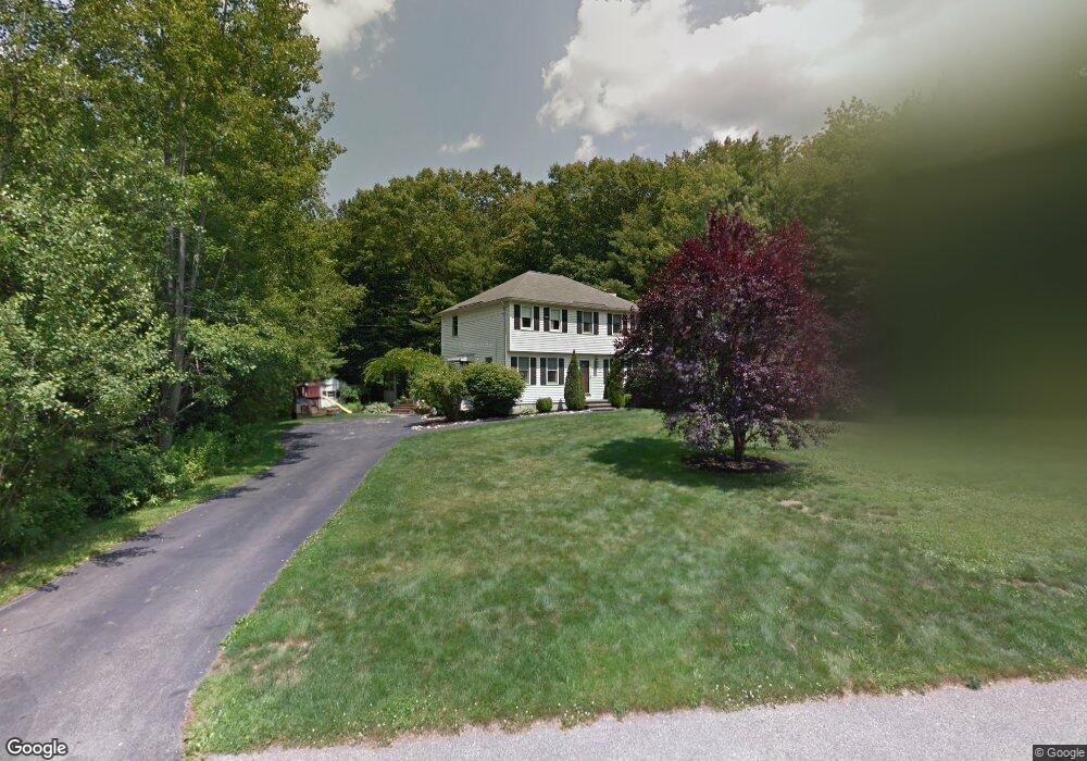
7 Blueberry Hill Rd Dracut, MA 01826
Estimated Value: $671,951 - $756,000
3
Beds
2
Baths
1,700
Sq Ft
$422/Sq Ft
Est. Value
About This Home
This home is located at 7 Blueberry Hill Rd, Dracut, MA 01826 and is currently estimated at $717,988, approximately $422 per square foot. 7 Blueberry Hill Rd is a home located in Middlesex County with nearby schools including Joseph A. Campbell Elementary School, Richardson Middle School, and Dracut Senior High School.
Ownership History
Date
Name
Owned For
Owner Type
Purchase Details
Closed on
Nov 18, 2010
Sold by
Moran Peter C and Moran Samantha J
Bought by
Moran Peter C
Current Estimated Value
Purchase Details
Closed on
Jul 31, 2007
Sold by
Miner Carol and Miner Rene
Bought by
Moran Peter C and Moran Samantha J
Home Financials for this Owner
Home Financials are based on the most recent Mortgage that was taken out on this home.
Original Mortgage
$269,000
Interest Rate
6.78%
Mortgage Type
Purchase Money Mortgage
Purchase Details
Closed on
Jul 28, 1995
Sold by
Draco Homes Inc
Bought by
Miner Rene and Miner Carol
Home Financials for this Owner
Home Financials are based on the most recent Mortgage that was taken out on this home.
Original Mortgage
$146,600
Interest Rate
7.56%
Mortgage Type
Purchase Money Mortgage
Create a Home Valuation Report for This Property
The Home Valuation Report is an in-depth analysis detailing your home's value as well as a comparison with similar homes in the area
Home Values in the Area
Average Home Value in this Area
Purchase History
| Date | Buyer | Sale Price | Title Company |
|---|---|---|---|
| Moran Peter C | -- | -- | |
| Moran Peter C | $367,000 | -- | |
| Miner Rene | $162,900 | -- |
Source: Public Records
Mortgage History
| Date | Status | Borrower | Loan Amount |
|---|---|---|---|
| Previous Owner | Moran Peter C | $269,000 | |
| Previous Owner | Miner Rene | $134,000 | |
| Previous Owner | Miner Rene | $146,600 |
Source: Public Records
Tax History Compared to Growth
Tax History
| Year | Tax Paid | Tax Assessment Tax Assessment Total Assessment is a certain percentage of the fair market value that is determined by local assessors to be the total taxable value of land and additions on the property. | Land | Improvement |
|---|---|---|---|---|
| 2025 | $6,043 | $597,100 | $255,700 | $341,400 |
| 2024 | $5,890 | $563,600 | $243,700 | $319,900 |
| 2023 | $5,703 | $492,500 | $212,100 | $280,400 |
| 2022 | $5,650 | $459,700 | $192,900 | $266,800 |
| 2021 | $5,450 | $418,900 | $175,200 | $243,700 |
| 2020 | $5,284 | $395,800 | $169,900 | $225,900 |
| 2019 | $5,063 | $368,200 | $161,800 | $206,400 |
| 2018 | $5,081 | $359,300 | $161,800 | $197,500 |
| 2017 | $5,152 | $359,300 | $161,800 | $197,500 |
| 2016 | $5,120 | $345,000 | $162,600 | $182,400 |
| 2015 | $4,958 | $332,100 | $162,600 | $169,500 |
| 2014 | $4,653 | $321,100 | $162,600 | $158,500 |
Source: Public Records
Map
Nearby Homes
- 315 Broadway Rd Unit 7
- 241 Broadway Rd Unit 50
- 67 Foxhill Ln Unit 67
- 785 Broadway Rd
- 109 Meadow Creek Dr
- 35 Thissell Ave
- 7 Wildwood St Unit A24
- 675 Robbins Ave Unit 1
- 4 Hazelwood Ave Unit 12
- 700 Robbins Ave Unit 6
- 121 Old Marsh Hill Rd
- 820 Methuen St Unit 820
- 650 Robbins Ave Unit 33
- 931 Methuen St Unit 6
- 167 Betty Ann Ln
- 12 Hayfield Rd
- 67 Lincoln Ln
- 1572 Bridge St
- 321 Old Marsh Hill Rd
- 173 Brook St
- 30 Blueberry Hill Rd
- 13 Blueberry Hill Rd
- 176 Trout Brook Rd
- 186 Trout Brook Rd
- 14 Blueberry Hill Rd
- 6 Blueberry Hill Rd
- 20 Blueberry Hill Rd
- 196 Trout Brook Rd
- 177 Trout Brook Rd
- 187 Trout Brook Rd
- 197 Trout Brook Rd
- 167 Trout Brook Rd
- 164 Trout Brook Rd
- 157 Trout Brook Rd
- 206 Trout Brook Rd
- 207 Trout Brook Rd
- 154 Trout Brook Rd
- 36 Colonial Dr
- 216 Trout Brook Rd
- 145 Trout Brook Rd