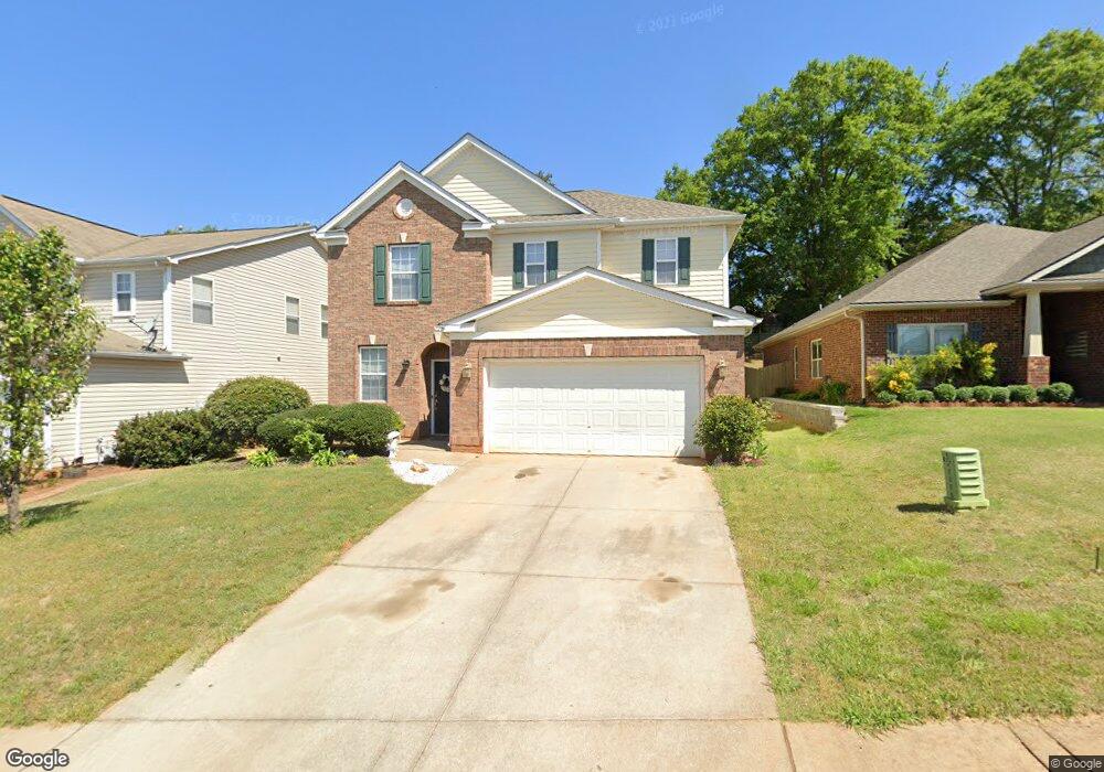
7 Border Ave Simpsonville, SC 29680
Estimated Value: $326,000 - $375,000
4
Beds
3
Baths
2,287
Sq Ft
$150/Sq Ft
Est. Value
About This Home
This home is located at 7 Border Ave, Simpsonville, SC 29680 and is currently estimated at $343,189, approximately $150 per square foot. 7 Border Ave is a home located in Greenville County with nearby schools including Ellen Woodside Elementary School, Woodmont Middle School, and Woodmont High School.
Ownership History
Date
Name
Owned For
Owner Type
Purchase Details
Closed on
Dec 7, 2006
Sold by
Kb Home South Carolina Inc
Bought by
Sandoval Lewis and Sandoval Bolivia
Current Estimated Value
Home Financials for this Owner
Home Financials are based on the most recent Mortgage that was taken out on this home.
Original Mortgage
$130,800
Outstanding Balance
$76,810
Interest Rate
6.36%
Mortgage Type
Purchase Money Mortgage
Estimated Equity
$266,379
Create a Home Valuation Report for This Property
The Home Valuation Report is an in-depth analysis detailing your home's value as well as a comparison with similar homes in the area
Home Values in the Area
Average Home Value in this Area
Purchase History
| Date | Buyer | Sale Price | Title Company |
|---|---|---|---|
| Sandoval Lewis | $163,500 | None Available |
Source: Public Records
Mortgage History
| Date | Status | Borrower | Loan Amount |
|---|---|---|---|
| Open | Sandoval Lewis | $130,800 |
Source: Public Records
Tax History
| Year | Tax Paid | Tax Assessment Tax Assessment Total Assessment is a certain percentage of the fair market value that is determined by local assessors to be the total taxable value of land and additions on the property. | Land | Improvement |
|---|---|---|---|---|
| 2025 | $4,305 | $13,550 | $2,500 | $11,050 |
| 2024 | $4,305 | $11,780 | $1,790 | $9,990 |
| 2023 | $4,162 | $11,780 | $1,790 | $9,990 |
| 2022 | $3,984 | $11,780 | $1,790 | $9,990 |
| 2021 | $3,932 | $11,780 | $1,790 | $9,990 |
| 2020 | $3,627 | $10,240 | $1,560 | $8,680 |
| 2019 | $3,628 | $10,240 | $1,560 | $8,680 |
| 2018 | $3,429 | $10,240 | $1,560 | $8,680 |
| 2017 | $3,377 | $10,240 | $1,560 | $8,680 |
| 2016 | $3,282 | $170,740 | $26,000 | $144,740 |
| 2015 | $3,282 | $170,740 | $26,000 | $144,740 |
| 2014 | $3,235 | $171,100 | $25,000 | $146,100 |
Source: Public Records
Map
Nearby Homes
- 27 Border Ave
- 130 Scottish Ave
- Craftsman Plan at Riverpointe
- Portland II Plan at Riverpointe
- Skandia II Plan at Riverpointe
- Polar Plan at Riverpointe
- Aurora II Plan at Riverpointe
- English - Single Level Plan at Riverpointe
- Nordea Plan at Riverpointe
- Portland Plan at Riverpointe
- Baltic Plan at Riverpointe
- Craftsman II Plan at Riverpointe
- 6 Adrian Way
- 100 Adrian Way
- 802 Worchester Place
- 210 Pinonwood Dr
- 3 Eclipse St
- 210 Scottish Ave
- 1105 Farming Creek Dr
- 220 Scottish Ave
- 9 Border Ave
- 5 Border Ave
- 11 Border Ave
- 3 Border Ave
- 1 Border Ave
- 15 Border Ave
- 1129 Neely Ferry Rd
- 10 Border Ave
- 8 Border Ave
- 17 Border Ave
- 12 Border Ave
- 19 Border Ave
- 14 Border Ave
- 1127 Neely Ferry Rd
- 16 Border Ave
- 21 Border Ave
- 101 Scottish Ave Unit FT 199
- 101 Scottish Ave
- 101 Scottish Ave
- 103 Scottish Ave
Your Personal Tour Guide
Ask me questions while you tour the home.