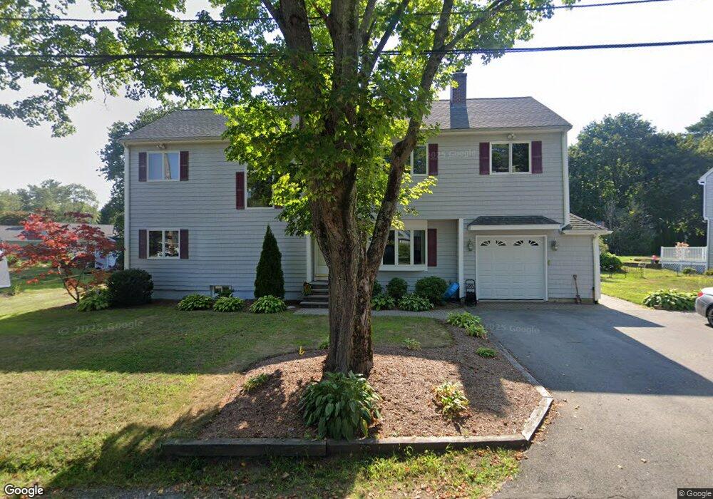
7 Bradford Rd South Hamilton, MA 01982
Estimated Value: $743,000 - $1,100,000
3
Beds
4
Baths
2,870
Sq Ft
$343/Sq Ft
Est. Value
About This Home
This home is located at 7 Bradford Rd, South Hamilton, MA 01982 and is currently estimated at $983,257, approximately $342 per square foot. 7 Bradford Rd is a home located in Essex County with nearby schools including Winthrop School, Cutler Elementary School, and Bessie Buker Elementary School.
Ownership History
Date
Name
Owned For
Owner Type
Purchase Details
Closed on
Oct 24, 2022
Sold by
Russo Lynda L and Russo Robert B
Bought by
Lynda L Russo Lt
Current Estimated Value
Purchase Details
Closed on
Oct 30, 1992
Sold by
Powell Richard C and Powell Elizabeth
Bought by
Russo Robert B and Russo Lynda
Create a Home Valuation Report for This Property
The Home Valuation Report is an in-depth analysis detailing your home's value as well as a comparison with similar homes in the area
Home Values in the Area
Average Home Value in this Area
Purchase History
| Date | Buyer | Sale Price | Title Company |
|---|---|---|---|
| Lynda L Russo Lt | -- | None Available | |
| Russo Robert B | $130,000 | -- |
Source: Public Records
Mortgage History
| Date | Status | Borrower | Loan Amount |
|---|---|---|---|
| Previous Owner | Russo Robert B | $150,000 | |
| Previous Owner | Russo Robert B | $150,000 | |
| Previous Owner | Russo Robert B | $90,000 | |
| Previous Owner | Russo Robert B | $10,000 |
Source: Public Records
Tax History Compared to Growth
Tax History
| Year | Tax Paid | Tax Assessment Tax Assessment Total Assessment is a certain percentage of the fair market value that is determined by local assessors to be the total taxable value of land and additions on the property. | Land | Improvement |
|---|---|---|---|---|
| 2025 | $13,152 | $840,400 | $265,900 | $574,500 |
| 2024 | $12,485 | $826,300 | $265,900 | $560,400 |
| 2023 | $12,364 | $756,700 | $251,600 | $505,100 |
| 2022 | $12,141 | $679,000 | $227,000 | $452,000 |
| 2021 | $11,641 | $664,800 | $227,000 | $437,800 |
| 2020 | $11,945 | $703,500 | $227,000 | $476,500 |
| 2019 | $11,351 | $688,800 | $220,300 | $468,500 |
| 2018 | $10,611 | $654,200 | $208,000 | $446,200 |
| 2017 | $10,303 | $612,900 | $194,400 | $418,500 |
| 2016 | $10,091 | $585,000 | $178,300 | $406,700 |
| 2015 | $9,550 | $558,800 | $169,800 | $389,000 |
| 2014 | $9,158 | $526,300 | $173,600 | $352,700 |
Source: Public Records
Map
Nearby Homes
- 17 Canter Brook Ln Unit 17
- 23 Lincoln Ave
- 211 Linden St
- 315 Lake Dr
- 88 Maple St
- 42 Maple St
- 115 Pleasant St
- NHN Hamilton Heights
- 45 Willow St
- 17 Patton Dr
- 169 Main St
- 0 Meyer Ln
- 18 Larch Row
- 2 Lily Ln
- 137 Cherry St
- 117 Perkins Row
- 173 Miles River Rd
- 16 Pine Hill Rd Unit 16
- 137 Perkins Row
- 946 Bay Rd Unit 2