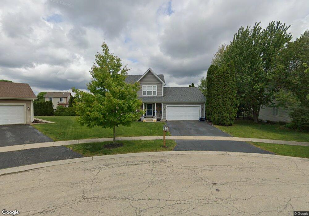
7 Brittany Ct Bolingbrook, IL 60440
Balstrode Park NeighborhoodEstimated Value: $364,419 - $400,000
3
Beds
3
Baths
1,608
Sq Ft
$242/Sq Ft
Est. Value
About This Home
This home is located at 7 Brittany Ct, Bolingbrook, IL 60440 and is currently estimated at $388,355, approximately $241 per square foot. 7 Brittany Ct is a home located in Will County with nearby schools including Jamie Mcgee Elementary School, Jane Addams Middle School, and Brooks Middle School.
Ownership History
Date
Name
Owned For
Owner Type
Purchase Details
Closed on
Jan 27, 2005
Sold by
Sramek Robert A and Estate Of Tracy L Sramek
Bought by
Sramek Robert M and Sramek Geraldine
Current Estimated Value
Home Financials for this Owner
Home Financials are based on the most recent Mortgage that was taken out on this home.
Original Mortgage
$234,000
Outstanding Balance
$119,564
Interest Rate
5.83%
Mortgage Type
Purchase Money Mortgage
Estimated Equity
$268,791
Purchase Details
Closed on
Feb 15, 1994
Sold by
Cole Taylor Bank
Bought by
Sramek Robert A and Sramek Tracy L
Home Financials for this Owner
Home Financials are based on the most recent Mortgage that was taken out on this home.
Original Mortgage
$140,900
Interest Rate
7.84%
Create a Home Valuation Report for This Property
The Home Valuation Report is an in-depth analysis detailing your home's value as well as a comparison with similar homes in the area
Home Values in the Area
Average Home Value in this Area
Purchase History
| Date | Buyer | Sale Price | Title Company |
|---|---|---|---|
| Sramek Robert M | $260,000 | First American Title Ins Co | |
| Sramek Robert A | $148,500 | Land Title Group Inc |
Source: Public Records
Mortgage History
| Date | Status | Borrower | Loan Amount |
|---|---|---|---|
| Open | Sramek Robert M | $234,000 | |
| Previous Owner | Sramek Robert A | $140,900 |
Source: Public Records
Tax History
| Year | Tax Paid | Tax Assessment Tax Assessment Total Assessment is a certain percentage of the fair market value that is determined by local assessors to be the total taxable value of land and additions on the property. | Land | Improvement |
|---|---|---|---|---|
| 2024 | $9,900 | $115,196 | $21,216 | $93,980 |
| 2023 | $9,900 | $103,649 | $19,089 | $84,560 |
| 2022 | $9,278 | $93,445 | $17,210 | $76,235 |
| 2021 | $8,192 | $87,373 | $16,092 | $71,281 |
| 2020 | $7,940 | $84,500 | $15,563 | $68,937 |
| 2019 | $7,684 | $80,476 | $14,822 | $65,654 |
| 2018 | $7,377 | $77,025 | $14,186 | $62,839 |
| 2017 | $7,023 | $73,009 | $13,446 | $59,563 |
| 2016 | $6,819 | $69,500 | $12,800 | $56,700 |
| 2015 | $6,736 | $66,700 | $12,300 | $54,400 |
| 2014 | $6,736 | $66,700 | $12,300 | $54,400 |
| 2013 | $6,736 | $68,000 | $12,500 | $55,500 |
Source: Public Records
Map
Nearby Homes
- 181 Hillside Dr Unit 2
- 333 Claridge Cir
- 4 Pennsbury Ct
- 177 Shady Ln
- 1086 Lily Field Ln
- 8 Lily Ct
- 4 Franklin Ct Unit 2
- 1150 Coventry Ln
- 234 Butternut Dr
- 811 Beech Dr
- 250 Butternut Dr
- 217 S Orchard Dr
- VACANT W Boughton Rd
- 118 Springleaf Dr Unit 5
- 261 Bryant Way
- 164 Galewood Dr
- 565 Emerson Cir Unit 6
- 224 Kedvale Ct
- 228 Elkhorn Ct Unit B
- 401 Foxborough Trail
- 8 Brittany Ct
- 6 Brittany Ct
- 943 W Briarcliff Rd
- 939 W Briarcliff Rd
- 951 W Briarcliff Rd
- 9 Brittany Ct
- 5 Brittany Ct
- 935 W Briarcliff Rd
- 963 W Briarcliff Rd
- 931 W Briarcliff Rd
- 973 W Briarcliff Rd
- 2 Brittany Ct
- 4 Brittany Ct
- 977 W Briarcliff Rd
- 3 Brittany Ct
- 1 Brittany Ct
- 981 W Briarcliff Rd
- 985 W Briarcliff Rd
- 940 W Briarcliff Rd
- 948 W Briarcliff Rd