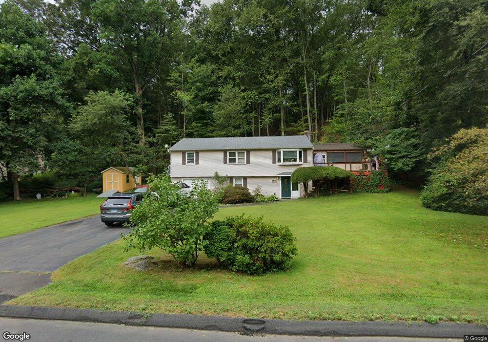
7 Brookside Dr Burlington, CT 06013
Estimated Value: $332,000 - $379,000
3
Beds
1
Bath
1,056
Sq Ft
$337/Sq Ft
Est. Value
About This Home
This home is located at 7 Brookside Dr, Burlington, CT 06013 and is currently estimated at $355,802, approximately $336 per square foot. 7 Brookside Dr is a home located in Hartford County with nearby schools including Lake Garda Elementary School, Har-Bur Middle School, and Lewis S. Mills High School.
Ownership History
Date
Name
Owned For
Owner Type
Purchase Details
Closed on
Sep 28, 2006
Sold by
Keen Randolph and Keen Phayvanh
Bought by
Tarlowski Konrad K
Current Estimated Value
Purchase Details
Closed on
Jun 18, 2002
Sold by
Gavette Denise R
Bought by
Keen Randolph and Keen Phayvanh
Create a Home Valuation Report for This Property
The Home Valuation Report is an in-depth analysis detailing your home's value as well as a comparison with similar homes in the area
Home Values in the Area
Average Home Value in this Area
Purchase History
| Date | Buyer | Sale Price | Title Company |
|---|---|---|---|
| Tarlowski Konrad K | $227,000 | -- | |
| Keen Randolph | $170,000 | -- | |
| Tarlowski Konrad K | $227,000 | -- | |
| Keen Randolph | $170,000 | -- |
Source: Public Records
Mortgage History
| Date | Status | Borrower | Loan Amount |
|---|---|---|---|
| Open | Keen Randolph | $231,000 | |
| Closed | Keen Randolph | $220,000 |
Source: Public Records
Tax History
| Year | Tax Paid | Tax Assessment Tax Assessment Total Assessment is a certain percentage of the fair market value that is determined by local assessors to be the total taxable value of land and additions on the property. | Land | Improvement |
|---|---|---|---|---|
| 2025 | $5,173 | $194,460 | $49,280 | $145,180 |
| 2024 | $5,037 | $194,460 | $49,280 | $145,180 |
| 2023 | $4,479 | $139,090 | $54,810 | $84,280 |
| 2022 | $4,548 | $139,090 | $54,810 | $84,280 |
| 2021 | $4,646 | $139,090 | $54,810 | $84,280 |
| 2020 | $4,632 | $139,090 | $54,810 | $84,280 |
| 2019 | $4,590 | $139,090 | $54,810 | $84,280 |
| 2018 | $4,195 | $129,080 | $54,810 | $74,270 |
| 2017 | $4,131 | $129,080 | $54,810 | $74,270 |
| 2016 | $4,079 | $129,080 | $54,810 | $74,270 |
| 2015 | $4,014 | $129,080 | $54,810 | $74,270 |
| 2014 | $3,853 | $129,080 | $54,810 | $74,270 |
Source: Public Records
Map
Nearby Homes
- 8 Gateshead Way
- 26 George Washington Turnpike
- 52 Wood Creek Rd
- 8 Old Field Rd
- 8919 Taine Mountain Rd
- 12 Woodside St
- 50 Woodhaven Dr
- 61 Litchfield Rd
- 10 Stone Ridge Crossing
- 39 Jerome Ave
- 55 Depot Place
- 42 Keene Place
- 24 Green Woods Ln
- 23 Keyes St
- 19 Village View Ln
- 2 Ventres Way
- 60 Wildcat Rd
- 361D George Washington Turnpike
- Map Block # 1-04-8 ( George Washington Turnpike
- 32 Canterbury Ln
Your Personal Tour Guide
Ask me questions while you tour the home.