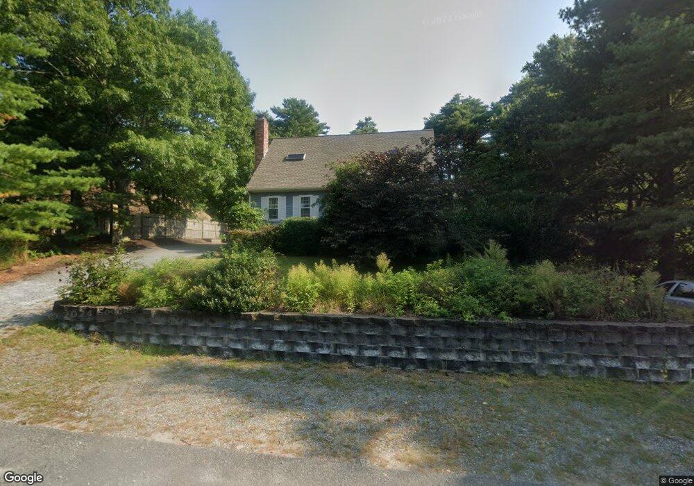
7 Burgee Ln Wareham, MA 02571
Estimated Value: $608,486 - $694,000
3
Beds
3
Baths
1,466
Sq Ft
$445/Sq Ft
Est. Value
About This Home
This home is located at 7 Burgee Ln, Wareham, MA 02571 and is currently estimated at $652,372, approximately $445 per square foot. 7 Burgee Ln is a home located in Plymouth County.
Ownership History
Date
Name
Owned For
Owner Type
Purchase Details
Closed on
Oct 14, 2020
Sold by
Bowen George A and Bowen Elizabeth A
Bought by
Coady Ft
Current Estimated Value
Purchase Details
Closed on
May 22, 2018
Sold by
David F Robertson Ft 2 and Robertson
Bought by
Cote Michael and Cote Anne M
Home Financials for this Owner
Home Financials are based on the most recent Mortgage that was taken out on this home.
Original Mortgage
$363,298
Interest Rate
4.4%
Mortgage Type
FHA
Purchase Details
Closed on
Aug 1, 2013
Sold by
Robertson David and Robertson Christina G
Bought by
David F Robertson Ft and Robertson
Purchase Details
Closed on
Jun 30, 2004
Sold by
Tullio Anthony and Tullio Cheryl
Bought by
Robertson David and Robertson Christina G
Create a Home Valuation Report for This Property
The Home Valuation Report is an in-depth analysis detailing your home's value as well as a comparison with similar homes in the area
Purchase History
| Date | Buyer | Sale Price | Title Company |
|---|---|---|---|
| Coady Ft | $1,113,000 | None Available | |
| Cote Michael | $370,000 | -- | |
| Cote Michael J | $370,000 | -- | |
| David F Robertson Ft | -- | -- | |
| Robertson David | $345,000 | -- | |
| Cote Michael J | $370,000 | -- | |
| David F Robertson Ft | -- | -- | |
| Robertson David F | $345,000 | -- |
Source: Public Records
Mortgage History
| Date | Status | Borrower | Loan Amount |
|---|---|---|---|
| Previous Owner | Cote Michael J | $363,298 |
Source: Public Records
Tax History
| Year | Tax Paid | Tax Assessment Tax Assessment Total Assessment is a certain percentage of the fair market value that is determined by local assessors to be the total taxable value of land and additions on the property. | Land | Improvement |
|---|---|---|---|---|
| 2025 | $5,314 | $510,000 | $166,700 | $343,300 |
| 2024 | $5,445 | $484,900 | $128,800 | $356,100 |
| 2023 | $5,174 | $430,100 | $117,500 | $312,600 |
| 2022 | $4,829 | $366,400 | $117,500 | $248,900 |
| 2021 | $5,086 | $355,200 | $117,500 | $237,700 |
| 2020 | $9,544 | $343,900 | $117,500 | $226,400 |
| 2019 | $3,895 | $293,100 | $121,100 | $172,000 |
| 2018 | $3,661 | $268,600 | $121,100 | $147,500 |
| 2017 | $3,606 | $268,100 | $121,100 | $147,000 |
| 2016 | $3,740 | $276,400 | $139,000 | $137,400 |
| 2015 | $3,613 | $276,400 | $139,000 | $137,400 |
| 2014 | $3,576 | $278,300 | $139,000 | $139,300 |
Source: Public Records
Map
Nearby Homes
- 65 Great Neck Rd
- 8 Over Jordan Rd
- 14 Over Jordan Rd
- 0 Squaw's Path
- 200 Great Neck Rd
- 3 Hazel St
- 391 Onset Ave
- 10 Beacon St Unit 83
- 10 East Blvd
- 124 Minot Ave Unit 1
- 10 East Blvd
- 55 Minot Ave Unit 55
- 7 Knowles Ave
- 20 Evergreen St
- 20 Evergreen St
- 35 Locust St
- 35 Locust St
- 3 Carleton St Unit 3
- 32 Carleton St Unit 32
- 10 Oak St
Your Personal Tour Guide
Ask me questions while you tour the home.