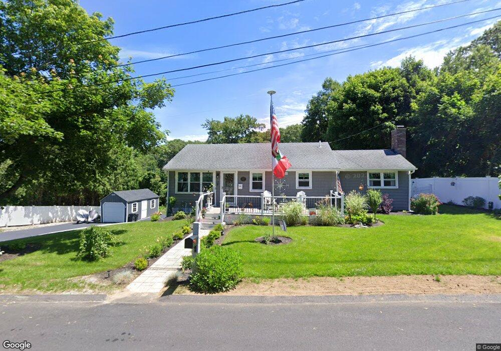
7 Capt Peter Simpson Rd Millbury, MA 01527
Armory Village NeighborhoodEstimated Value: $439,166 - $591,000
4
Beds
2
Baths
1,160
Sq Ft
$428/Sq Ft
Est. Value
About This Home
This home is located at 7 Capt Peter Simpson Rd, Millbury, MA 01527 and is currently estimated at $497,042, approximately $428 per square foot. 7 Capt Peter Simpson Rd is a home located in Worcester County with nearby schools including Elmwood Street Elementary School, Raymond E. Shaw Elementary School, and Millbury Junior/Senior High School.
Ownership History
Date
Name
Owned For
Owner Type
Purchase Details
Closed on
Feb 5, 2020
Sold by
Doug Will Llc
Bought by
Oconnell Sean P and Oconnell Catherine A
Current Estimated Value
Home Financials for this Owner
Home Financials are based on the most recent Mortgage that was taken out on this home.
Original Mortgage
$260,000
Outstanding Balance
$229,853
Interest Rate
3.74%
Mortgage Type
New Conventional
Estimated Equity
$267,189
Purchase Details
Closed on
Aug 29, 2019
Sold by
Us Bank Na Tr
Bought by
Doug Will Llc
Purchase Details
Closed on
Dec 20, 2018
Sold by
Orsi Neal C and Us Bank Na Tr
Bought by
Us Bank Na Tr
Purchase Details
Closed on
Feb 1, 2001
Sold by
Colonial Rt and Miles
Bought by
Orsi Neal C
Create a Home Valuation Report for This Property
The Home Valuation Report is an in-depth analysis detailing your home's value as well as a comparison with similar homes in the area
Home Values in the Area
Average Home Value in this Area
Purchase History
| Date | Buyer | Sale Price | Title Company |
|---|---|---|---|
| Oconnell Sean P | $320,000 | None Available | |
| Oconnell Sean P | $320,000 | None Available | |
| Oconnell Sean P | $320,000 | None Available | |
| Oconnell Sean P | $320,000 | None Available | |
| Doug Will Llc | $171,000 | -- | |
| Doug Will Llc | $171,000 | -- | |
| Doug Will Llc | $171,000 | -- | |
| Doug Will Llc | $171,000 | -- | |
| Us Bank Na Tr | $190,823 | -- | |
| Us Bank Na Tr | $190,823 | -- | |
| Us Bank Na Tr | $190,823 | -- | |
| Us Bank Na Tr | $190,823 | -- | |
| Orsi Neal C | $15,000 | -- | |
| Orsi Neal C | $131,000 | -- | |
| Orsi Neal C | $15,000 | -- | |
| Orsi Neal C | $15,000 | -- | |
| Orsi Neal C | $131,000 | -- | |
| Orsi Neal C | $15,000 | -- |
Source: Public Records
Mortgage History
| Date | Status | Borrower | Loan Amount |
|---|---|---|---|
| Open | Oconnell Sean P | $260,000 | |
| Closed | Oconnell Sean P | $260,000 |
Source: Public Records
Tax History
| Year | Tax Paid | Tax Assessment Tax Assessment Total Assessment is a certain percentage of the fair market value that is determined by local assessors to be the total taxable value of land and additions on the property. | Land | Improvement |
|---|---|---|---|---|
| 2025 | $5,335 | $398,400 | $112,100 | $286,300 |
| 2024 | $4,902 | $370,500 | $103,800 | $266,700 |
| 2023 | $4,477 | $309,800 | $72,900 | $236,900 |
| 2022 | $4,325 | $288,300 | $72,900 | $215,400 |
| 2021 | $4,239 | $274,700 | $72,900 | $201,800 |
| 2020 | $3,506 | $228,700 | $72,900 | $155,800 |
| 2019 | $3,365 | $212,300 | $66,200 | $146,100 |
| 2018 | $3,172 | $194,100 | $66,200 | $127,900 |
| 2017 | $3,143 | $191,300 | $66,200 | $125,100 |
| 2016 | $2,923 | $177,600 | $66,200 | $111,400 |
| 2015 | $2,946 | $179,000 | $70,400 | $108,600 |
| 2014 | $2,799 | $163,700 | $70,400 | $93,300 |
Source: Public Records
Map
Nearby Homes
- 2 Jessica j Dr
- 5 Mogren Dr
- 4 Jessica j Dr
- 8 Sycamore Cir
- 128 Worcester Providence Turnpike
- 124 Worcester Providence Turnpike
- 7 Canal St
- 37-39 Main St
- Lot 1 Cooper Rd
- 8 Autumn Gate Cir
- 8 Lincoln Ave
- 38 W Main St
- 17 Lincoln Ave
- 168 Burbank Rd
- 20 Woodridge Rd
- 66 Buttonwood Ave
- 46 Lexington Rd
- 2 Riverlin Pkwy
- 152 W Main St Unit A
- 99 Burbank Road Lot 182
- 7 Captain Peter Simpson Rd
- 5 Capt Peter Simpson Rd
- 5 Capt Peter Simpson Rd Unit B
- 11 Capt Peter Simpson Rd
- 13 Thomas Hill Rd
- 4 Capt Peter Simpson Rd
- 13 Capt Peter Simpson Rd
- 3 Capt Peter Simpson Rd
- 14 Thomas Hill Rd
- 2 Capt Peter Simpson Rd
- 12 Capt Peter Simpson Rd
- 15 Capt Peter Simpson Rd
- 11 Thomas Hill Rd
- 1 Capt Peter Simpson Rd
- 12 Thomas Hill Rd
- 14 Capt Peter Simpson Rd
- 17 Capt Peter Simpson Rd
- 4 Aldrich Ave
- 16 Capt Peter Simpson Rd
- 3 Aldrich Ave
Your Personal Tour Guide
Ask me questions while you tour the home.