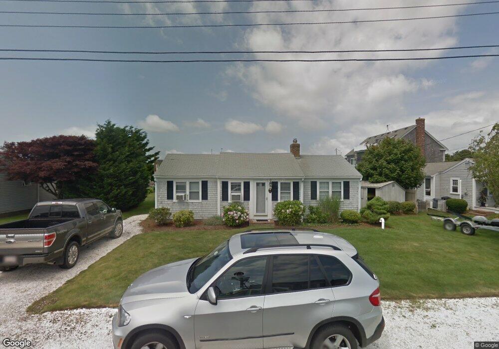
7 Captain Doane Way West Dennis, MA 02670
West Dennis NeighborhoodEstimated Value: $1,340,000 - $1,795,767
3
Beds
2
Baths
1,142
Sq Ft
$1,296/Sq Ft
Est. Value
About This Home
This home is located at 7 Captain Doane Way, West Dennis, MA 02670 and is currently estimated at $1,479,692, approximately $1,295 per square foot. 7 Captain Doane Way is a home located in Barnstable County with nearby schools including Dennis-Yarmouth Regional High School and St. Pius X. School.
Ownership History
Date
Name
Owned For
Owner Type
Purchase Details
Closed on
Mar 8, 2011
Sold by
Wojtkowski Albert S and Wojtkowski Richard N
Bought by
Wojtkowski Bros Inc
Current Estimated Value
Purchase Details
Closed on
Jun 29, 2007
Sold by
Cugno Kathleen P
Bought by
Wojtkowski Albert S and Wojtkowski Andrew F
Home Financials for this Owner
Home Financials are based on the most recent Mortgage that was taken out on this home.
Original Mortgage
$720,000
Interest Rate
6.24%
Mortgage Type
Purchase Money Mortgage
Create a Home Valuation Report for This Property
The Home Valuation Report is an in-depth analysis detailing your home's value as well as a comparison with similar homes in the area
Home Values in the Area
Average Home Value in this Area
Purchase History
| Date | Buyer | Sale Price | Title Company |
|---|---|---|---|
| Wojtkowski Bros Inc | -- | -- | |
| Wojtkowski Albert S | $895,000 | -- |
Source: Public Records
Mortgage History
| Date | Status | Borrower | Loan Amount |
|---|---|---|---|
| Previous Owner | Wojtkowski Albert S | $720,000 |
Source: Public Records
Tax History Compared to Growth
Tax History
| Year | Tax Paid | Tax Assessment Tax Assessment Total Assessment is a certain percentage of the fair market value that is determined by local assessors to be the total taxable value of land and additions on the property. | Land | Improvement |
|---|---|---|---|---|
| 2025 | $6,846 | $1,581,100 | $1,115,300 | $465,800 |
| 2024 | $6,603 | $1,504,200 | $1,072,500 | $431,700 |
| 2023 | $6,388 | $1,367,800 | $975,000 | $392,800 |
| 2022 | $4,992 | $891,500 | $602,300 | $289,200 |
| 2021 | $5,141 | $852,600 | $590,400 | $262,200 |
| 2020 | $5,056 | $828,800 | $590,400 | $238,400 |
| 2019 | $4,882 | $791,200 | $578,900 | $212,300 |
| 2018 | $5,269 | $831,100 | $631,400 | $199,700 |
| 2017 | $4,932 | $801,900 | $608,500 | $193,400 |
| 2016 | $5,351 | $819,500 | $660,100 | $159,400 |
| 2015 | $4,995 | $780,500 | $660,100 | $120,400 |
| 2014 | $4,956 | $780,500 | $660,100 | $120,400 |
Source: Public Records
Map
Nearby Homes
- 2 Rita Mary Way
- 14 Schoolhouse Ln
- 178 School St
- 209 Main St Unit 3
- 209 Main St Unit 6
- 209 Main St Unit 1
- 209 Main St Unit 2
- 209 Main St Unit 4
- 209 Main St Unit 5
- 181 Pleasant St
- 23 Doric Ave
- 308 Old Main St
- 45 Seth Ln
- 40 Kelley Rd
- 401 Main St Unit 201
- 401 Main St Unit 101
- 745 Willow St
- 22 Powhatan Rd
- 29 Bass River Rd
- 467 Main St
- 9 Captain Doane Way
- 1 Surfside Rd
- 3 Captain Doane Way
- 11 Captain Doane Way
- 10 Captain Doane Way
- 6 Captain Doane Way
- 14 Captain Doane Way
- 19 Captain Doane Way
- 2 Captain Doane Way
- 6 Wendy Way
- 10 Wendy Way
- 14 Wendy Way
- 46 Merchant Ave
- 33 Merchant Ave
- 4 Surfside Rd
- 8 Surfside Rd
- 29 Merchant Ave
- 17 Surfside Rd
- 12 Surfside Rd
- 41 Merchant Ave