Estimated Value: $991,911 - $1,250,000
4
Beds
3
Baths
2,216
Sq Ft
$500/Sq Ft
Est. Value
About This Home
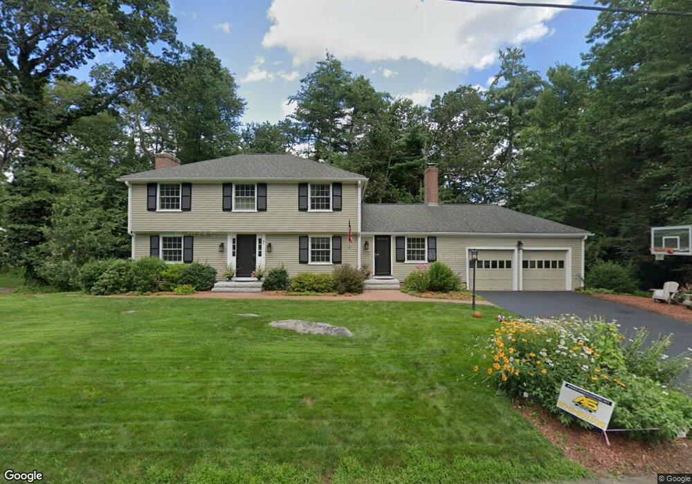
This home is located at 7 Captain Forbush Ln, Acton, MA 01720 and is currently estimated at $1,107,478, approximately $499 per square foot. 7 Captain Forbush Ln is a home located in Middlesex County with nearby schools including Acton-Boxborough Regional High School.
Ownership History
Date
Name
Owned For
Owner Type
Purchase Details
Closed on
May 15, 2014
Sold by
Rychlik Bruce R and Rychlik Kristina W
Bought by
Kristina W Rychlik T and Rychlik Bruce R
Current Estimated Value
Purchase Details
Closed on
Dec 13, 2004
Sold by
Lakeview Rt and Little Robert J
Bought by
Rychlik Bruce R and Rychlik Kristina W
Home Financials for this Owner
Home Financials are based on the most recent Mortgage that was taken out on this home.
Original Mortgage
$333,700
Interest Rate
5.63%
Mortgage Type
Purchase Money Mortgage
Create a Home Valuation Report for This Property
The Home Valuation Report is an in-depth analysis detailing your home's value as well as a comparison with similar homes in the area
Home Values in the Area
Average Home Value in this Area
Purchase History
| Date | Buyer | Sale Price | Title Company |
|---|---|---|---|
| Kristina W Rychlik T | -- | -- | |
| Rychlik Bruce R | $649,000 | -- |
Source: Public Records
Mortgage History
| Date | Status | Borrower | Loan Amount |
|---|---|---|---|
| Previous Owner | Rychlik Bruce R | $333,700 |
Source: Public Records
Tax History Compared to Growth
Tax History
| Year | Tax Paid | Tax Assessment Tax Assessment Total Assessment is a certain percentage of the fair market value that is determined by local assessors to be the total taxable value of land and additions on the property. | Land | Improvement |
|---|---|---|---|---|
| 2025 | $15,221 | $887,500 | $369,400 | $518,100 |
| 2024 | $14,256 | $855,200 | $369,400 | $485,800 |
| 2023 | $13,904 | $791,800 | $335,900 | $455,900 |
| 2022 | $13,405 | $689,200 | $291,800 | $397,400 |
| 2021 | $13,087 | $646,900 | $270,000 | $376,900 |
| 2020 | $12,348 | $641,800 | $270,000 | $371,800 |
| 2019 | $11,814 | $609,900 | $270,000 | $339,900 |
| 2018 | $11,618 | $599,500 | $270,000 | $329,500 |
| 2017 | $11,497 | $603,200 | $270,000 | $333,200 |
| 2016 | $11,292 | $587,200 | $270,000 | $317,200 |
| 2015 | $10,550 | $553,800 | $270,000 | $283,800 |
| 2014 | $10,237 | $526,300 | $270,000 | $256,300 |
Source: Public Records
Map
Nearby Homes
- 285 Central St Unit 285
- 9 Elm St Unit 1
- 5 Elm St Unit 1
- 89 Windsor Ave
- 31 Mohawk Dr
- 4,7,8 Crestwood Ln
- 169 Main St
- 92 Willow St Unit 3
- 92 Willow St Unit 2
- 90 Willow St Unit 1
- 4 Huron Rd
- 19 Railroad St Unit C2
- 23 John Swift Rd
- 129 Main St Unit 129
- 129 Main St
- 131 Main St
- 5 Oakwood Rd
- 8 Laurel Ct
- 86 School St
- 68 Macintosh Ln
- 16 Captain Browns Ln
- 16 Captain Brown's Ln
- 9 Captain Forbush Ln
- 5 Captain Forbush Ln
- 14 Captain Browns Ln
- 10 Captain Forbush Ln
- 8 Captain Forbush Ln
- 8 Capt Forbush La
- 12 Captain Browns Ln
- 12 Captain Forbush Ln
- 6 Captain Forbush Ln
- 3 Captain Forbush Ln
- 17 Captain Browns Ln
- 20 Captain Brown's Ln
- 11 Captain Forbush Ln
- 19 Captain Browns Ln
- 15 Captain Browns Ln
- 20 Captain Browns Ln
- 17 Deacon Hunt Dr
- 15 Deacon Hunt Dr