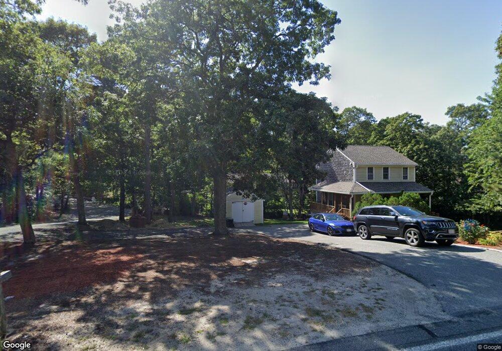
7 Captain Harris Cir Dennis, MA 02638
Dennis Village NeighborhoodEstimated Value: $506,000 - $644,000
6
Beds
2
Baths
3,348
Sq Ft
$175/Sq Ft
Est. Value
About This Home
This home is located at 7 Captain Harris Cir, Dennis, MA 02638 and is currently estimated at $586,473, approximately $175 per square foot. 7 Captain Harris Cir is a home located in Barnstable County with nearby schools including Dennis-Yarmouth Regional High School.
Ownership History
Date
Name
Owned For
Owner Type
Purchase Details
Closed on
Apr 27, 2006
Sold by
Brett Lucy M and Brett Robert C
Bought by
Brooks Marie A
Current Estimated Value
Home Financials for this Owner
Home Financials are based on the most recent Mortgage that was taken out on this home.
Original Mortgage
$255,200
Outstanding Balance
$146,993
Interest Rate
6.4%
Mortgage Type
Purchase Money Mortgage
Estimated Equity
$439,480
Create a Home Valuation Report for This Property
The Home Valuation Report is an in-depth analysis detailing your home's value as well as a comparison with similar homes in the area
Home Values in the Area
Average Home Value in this Area
Purchase History
| Date | Buyer | Sale Price | Title Company |
|---|---|---|---|
| Brooks Marie A | $319,000 | -- |
Source: Public Records
Mortgage History
| Date | Status | Borrower | Loan Amount |
|---|---|---|---|
| Open | Brooks Marie A | $255,200 |
Source: Public Records
Tax History Compared to Growth
Tax History
| Year | Tax Paid | Tax Assessment Tax Assessment Total Assessment is a certain percentage of the fair market value that is determined by local assessors to be the total taxable value of land and additions on the property. | Land | Improvement |
|---|---|---|---|---|
| 2025 | $2,997 | $692,100 | $163,500 | $528,600 |
| 2024 | $2,770 | $631,000 | $164,700 | $466,300 |
| 2023 | $2,679 | $573,600 | $149,700 | $423,900 |
| 2022 | $2,485 | $443,800 | $122,600 | $321,200 |
| 2021 | $2,761 | $457,900 | $120,200 | $337,700 |
| 2020 | $2,680 | $439,400 | $120,200 | $319,200 |
| 2019 | $2,400 | $389,000 | $129,600 | $259,400 |
| 2018 | $1,996 | $314,800 | $112,200 | $202,600 |
| 2017 | $1,883 | $306,100 | $112,200 | $193,900 |
| 2016 | $1,911 | $292,700 | $140,200 | $152,500 |
| 2015 | $1,701 | $265,800 | $140,200 | $125,600 |
| 2014 | $1,510 | $237,800 | $112,200 | $125,600 |
Source: Public Records
Map
Nearby Homes
- 59 Main St Unit 19-2
- 59 Route 6a Unit 29-4
- 268 Main St
- 51 Bray Farm Rd N
- 6 Nimble Hill Dr
- 6 Thomas Ct
- 15 Signal Hill Dr
- 13 Covey Dr
- 35 Crown Grant Dr
- 42 John Hall Cartway Unit 42
- 64 Kates Path
- 50 John Hall Cartway
- 50 John Hall Cartway Unit 50
- 44 Stratford Ln
- 34 Kates Path
- 34 Kates Path Unit 34
- 228 Kates Path
- 17 Kates Path Unit A
- 645 Main St Back Lot
- 111 Merchant Ave
- 131 S Yarmouth Rd
- 137 S Yarmouth Rd
- 3 Captain Harris Cir
- 8 Captain Harris Cir
- 141 S Yarmouth Rd
- 14 Captain Freemans Rd
- 132 S Yarmouth Rd
- 126 S Yarmouth Rd
- 8 Captain Freemans Rd
- 136 S Yarmouth Rd
- 149 S Yarmouth Rd
- 4 Thoreau Dr
- 115 S Yarmouth Rd
- 142 S Yarmouth Rd
- 167 Route 6a
- 167 Massachusetts 6a
- 167 Massachusetts 6a
- 146 S Yarmouth Rd
- 11 Walden Place
- 79 Captain Prestons Rd