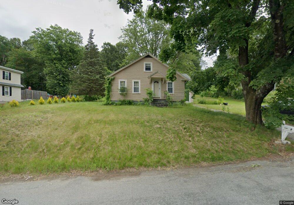
7 Carlstrom Ln Millbury, MA 01527
Estimated Value: $455,000 - $544,000
3
Beds
2
Baths
1,120
Sq Ft
$452/Sq Ft
Est. Value
About This Home
This home is located at 7 Carlstrom Ln, Millbury, MA 01527 and is currently estimated at $506,612, approximately $452 per square foot. 7 Carlstrom Ln is a home located in Worcester County with nearby schools including Elmwood Street Elementary School, Raymond E. Shaw Elementary School, and Millbury Junior/Senior High School.
Ownership History
Date
Name
Owned For
Owner Type
Purchase Details
Closed on
Aug 23, 2011
Sold by
Tracy Matthew D and Tracy Shannon N
Bought by
Buteau Norman E and Buteau Jayne E
Current Estimated Value
Home Financials for this Owner
Home Financials are based on the most recent Mortgage that was taken out on this home.
Original Mortgage
$233,916
Outstanding Balance
$162,337
Interest Rate
4.62%
Mortgage Type
Purchase Money Mortgage
Estimated Equity
$344,275
Purchase Details
Closed on
Jun 8, 2004
Sold by
Hughes Gladys E
Bought by
Tracy Matthew D and Tracy Shannon N
Home Financials for this Owner
Home Financials are based on the most recent Mortgage that was taken out on this home.
Original Mortgage
$238,000
Interest Rate
5.94%
Mortgage Type
Purchase Money Mortgage
Create a Home Valuation Report for This Property
The Home Valuation Report is an in-depth analysis detailing your home's value as well as a comparison with similar homes in the area
Home Values in the Area
Average Home Value in this Area
Purchase History
| Date | Buyer | Sale Price | Title Company |
|---|---|---|---|
| Buteau Norman E | $240,000 | -- | |
| Buteau Norman E | $240,000 | -- | |
| Tracy Matthew D | $280,000 | -- | |
| Tracy Matthew D | $280,000 | -- |
Source: Public Records
Mortgage History
| Date | Status | Borrower | Loan Amount |
|---|---|---|---|
| Open | Buteau Norman E | $233,916 | |
| Closed | Tracy Matthew D | $233,916 | |
| Previous Owner | Tracy Matthew D | $238,000 |
Source: Public Records
Tax History Compared to Growth
Tax History
| Year | Tax Paid | Tax Assessment Tax Assessment Total Assessment is a certain percentage of the fair market value that is determined by local assessors to be the total taxable value of land and additions on the property. | Land | Improvement |
|---|---|---|---|---|
| 2025 | $5,359 | $400,200 | $128,800 | $271,400 |
| 2024 | $5,979 | $451,900 | $119,100 | $332,800 |
| 2023 | $5,442 | $376,600 | $83,300 | $293,300 |
| 2022 | $5,112 | $340,800 | $83,300 | $257,500 |
| 2021 | $3,062 | $330,300 | $83,300 | $247,000 |
| 2020 | $4,837 | $315,500 | $83,300 | $232,200 |
| 2019 | $5,329 | $336,200 | $82,900 | $253,300 |
| 2018 | $3,312 | $290,000 | $82,900 | $207,100 |
| 2017 | $3,118 | $274,600 | $86,600 | $188,000 |
| 2016 | $4,342 | $263,800 | $86,600 | $177,200 |
| 2015 | $4,301 | $261,300 | $92,300 | $169,000 |
| 2014 | $3,815 | $223,100 | $92,300 | $130,800 |
Source: Public Records
Map
Nearby Homes
- 0 Auburn Rd
- 32 Horne Way
- 58 Beach St
- 101 Horne Way
- 152 W Main St Unit A
- 214 W Main St
- 11 Laurel Dr
- 33 Tainter Hill Rd Unit 33B
- 318 W Main St
- 5- 33 Tainter Hill Rd Unit 33A
- 5- 33 Tainter Hill Rd
- 394 1/2 Greenwood St
- 38 Singletary Rd
- 359 W Main St
- 130 Singletary Ave
- 2 Camden Dr
- 29 Winwood Rd
- 4 Jessica j Dr
- 17 Atwood Ave
- 6 Whitetail Run
- 5 Carlstrom Ln
- 6 Carlstrom Ln
- 8 Carlstrom Ln
- 11 Carlstrom Ln
- 10 Carlstrom Ln
- 3 Carleton Rd
- 47 (LOT 1) Carleton Rd
- 5 Carleton Rd
- 1 Carleton Rd
- 7 Carleton Rd
- 1 Carlstrom Ln
- 12 Carlstrom Ln
- 13 Carlstrom Ln
- 17 Carlstrom Ln
- 15 Carlstrom Ln Unit 17
- 9 Carleton Rd
- 2 Carleton Rd
- 11 Carleton Rd
- 4 Carleton Rd
- 14 Carlstrom Ln