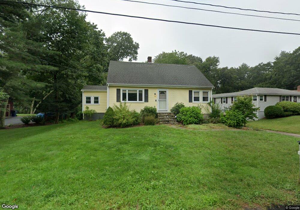
7 Center St Medway, MA 02053
Estimated Value: $569,000 - $628,000
3
Beds
2
Baths
1,447
Sq Ft
$411/Sq Ft
Est. Value
About This Home
This home is located at 7 Center St, Medway, MA 02053 and is currently estimated at $594,335, approximately $410 per square foot. 7 Center St is a home located in Norfolk County with nearby schools including John D. McGovern Elementary School, Burke-Memorial Elementary, and Medway Middle School.
Ownership History
Date
Name
Owned For
Owner Type
Purchase Details
Closed on
Jun 14, 2013
Sold by
Ellis Adam T and Ellis Cynthia R
Bought by
Ellis Adam T
Current Estimated Value
Purchase Details
Closed on
Dec 19, 2000
Sold by
Crane David J and Crane Carol A
Bought by
Ellis Adam T and Ellis Cynthia R
Home Financials for this Owner
Home Financials are based on the most recent Mortgage that was taken out on this home.
Original Mortgage
$177,600
Interest Rate
7.7%
Mortgage Type
Purchase Money Mortgage
Purchase Details
Closed on
Mar 12, 1991
Sold by
Gallagher Ethel F
Bought by
Crane David J and Crane Carol A
Create a Home Valuation Report for This Property
The Home Valuation Report is an in-depth analysis detailing your home's value as well as a comparison with similar homes in the area
Home Values in the Area
Average Home Value in this Area
Purchase History
| Date | Buyer | Sale Price | Title Company |
|---|---|---|---|
| Ellis Adam T | -- | -- | |
| Ellis Adam T | $222,000 | -- | |
| Crane David J | $50,000 | -- |
Source: Public Records
Mortgage History
| Date | Status | Borrower | Loan Amount |
|---|---|---|---|
| Previous Owner | Crane David J | $177,600 | |
| Previous Owner | Crane David J | $177,600 | |
| Previous Owner | Crane David J | $90,000 |
Source: Public Records
Tax History Compared to Growth
Tax History
| Year | Tax Paid | Tax Assessment Tax Assessment Total Assessment is a certain percentage of the fair market value that is determined by local assessors to be the total taxable value of land and additions on the property. | Land | Improvement |
|---|---|---|---|---|
| 2025 | $6,947 | $487,500 | $288,800 | $198,700 |
| 2024 | $7,020 | $487,500 | $288,800 | $198,700 |
| 2023 | $6,754 | $423,700 | $239,300 | $184,400 |
| 2022 | $6,692 | $395,300 | $212,400 | $182,900 |
| 2021 | $6,218 | $356,100 | $195,900 | $160,200 |
| 2020 | $5,929 | $338,800 | $181,500 | $157,300 |
| 2019 | $5,749 | $338,800 | $181,500 | $157,300 |
| 2018 | $5,522 | $312,700 | $156,800 | $155,900 |
| 2017 | $5,475 | $305,500 | $156,800 | $148,700 |
| 2016 | $5,203 | $287,300 | $138,600 | $148,700 |
| 2015 | $4,919 | $269,700 | $123,800 | $145,900 |
| 2014 | $4,942 | $262,300 | $132,000 | $130,300 |
Source: Public Records
Map
Nearby Homes
- 2 King Phillip St
- 12 Kelley St
- 23 Anchorage Rd
- 14 Sanford St Unit 15
- 14 Sanford St Unit 56
- 17 Anchorage Rd
- 20 Broad St Unit A
- 20 Broad St
- 69 Elm St
- 9 Sanford St
- 0 Elm St
- 6 Norfolk Ave
- 22 Sunset Dr
- 329 Village St
- 21 Riverside Rd
- 50 Main St
- 12 Gorwin Dr
- 229 Bent St
- 0 Pond Unit 73416512
- 0 Pond Unit 24285018