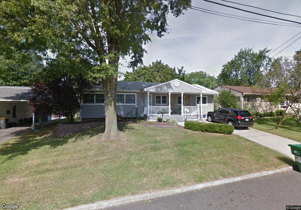
7 Columbia Rd Parlin, NJ 08859
Estimated Value: $530,595 - $603,000
3
Beds
2
Baths
1,368
Sq Ft
$405/Sq Ft
Est. Value
About This Home
This home is located at 7 Columbia Rd, Parlin, NJ 08859 and is currently estimated at $553,399, approximately $404 per square foot. 7 Columbia Rd is a home located in Middlesex County with nearby schools including Old Bridge High School and New Road School of Parlin.
Ownership History
Date
Name
Owned For
Owner Type
Purchase Details
Closed on
Jan 31, 2019
Sold by
Orzulski Dale
Bought by
Rich Tara
Current Estimated Value
Home Financials for this Owner
Home Financials are based on the most recent Mortgage that was taken out on this home.
Original Mortgage
$319,113
Outstanding Balance
$285,952
Interest Rate
5.5%
Mortgage Type
FHA
Estimated Equity
$267,447
Purchase Details
Closed on
Apr 25, 2012
Sold by
Orszulki Dale and Orszulski Alice
Bought by
Orzulski Dale
Home Financials for this Owner
Home Financials are based on the most recent Mortgage that was taken out on this home.
Original Mortgage
$182,500
Interest Rate
4.59%
Mortgage Type
New Conventional
Create a Home Valuation Report for This Property
The Home Valuation Report is an in-depth analysis detailing your home's value as well as a comparison with similar homes in the area
Home Values in the Area
Average Home Value in this Area
Purchase History
| Date | Buyer | Sale Price | Title Company |
|---|---|---|---|
| Rich Tara | $325,000 | Unitas Title Agency Llc | |
| Orzulski Dale | -- | Ort |
Source: Public Records
Mortgage History
| Date | Status | Borrower | Loan Amount |
|---|---|---|---|
| Open | Rich Tara | $319,113 | |
| Previous Owner | Orzulski Dale | $182,500 |
Source: Public Records
Tax History Compared to Growth
Tax History
| Year | Tax Paid | Tax Assessment Tax Assessment Total Assessment is a certain percentage of the fair market value that is determined by local assessors to be the total taxable value of land and additions on the property. | Land | Improvement |
|---|---|---|---|---|
| 2025 | $7,566 | $128,600 | $50,000 | $78,600 |
| 2024 | $7,276 | $128,600 | $50,000 | $78,600 |
| 2023 | $7,276 | $128,600 | $50,000 | $78,600 |
| 2022 | $7,113 | $128,600 | $50,000 | $78,600 |
| 2021 | $5,213 | $128,600 | $50,000 | $78,600 |
| 2020 | $6,894 | $128,600 | $50,000 | $78,600 |
| 2019 | $6,782 | $128,600 | $50,000 | $78,600 |
| 2018 | $6,710 | $128,600 | $50,000 | $78,600 |
| 2017 | $6,508 | $128,600 | $50,000 | $78,600 |
| 2016 | $6,386 | $128,600 | $50,000 | $78,600 |
| 2015 | $6,271 | $128,600 | $50,000 | $78,600 |
| 2014 | $6,170 | $128,600 | $50,000 | $78,600 |
Source: Public Records
Map
Nearby Homes
- 11 Dartmouth Rd
- 0-0 Confidential Ave
- 41 Pinetree Dr
- 18 Pinetree Dr
- 107 Ernston Rd
- 3010 Cheesequake Rd
- 3 Campbell Dr
- 19 Cypress Dr
- 33 Elm Terrace
- 21 Becker Dr
- 48 Cedar Terrace
- 1072 Bordentown Ave
- 41 Kendall Dr
- 96 Brewster Cir
- 90 Cori St
- 41 Oakwood Dr
- 20 Gillen Dr
- 75 Woodmere Dr Unit 906
- 75 Woodmere Dr
- 7 Kenneth Ave
- 9 Columbia Rd
- 5 Columbia Rd
- 26 Bucknell Rd
- 24 Bucknell Rd
- 3 Columbia Rd
- 4 Columbia Rd
- 8 Columbia Rd
- 133 Princeton Rd
- 11 Columbia Rd
- 135 Princeton Rd
- 28 Bucknell Rd
- 22 Bucknell Rd
- 30 Bucknell Rd
- 131 Princeton Rd
- 137 Princeton Rd
- 4 Fordham Rd
- 10 Columbia Rd
- 13 Columbia Rd
- 25 Bucknell Rd
- 20 Bucknell Rd