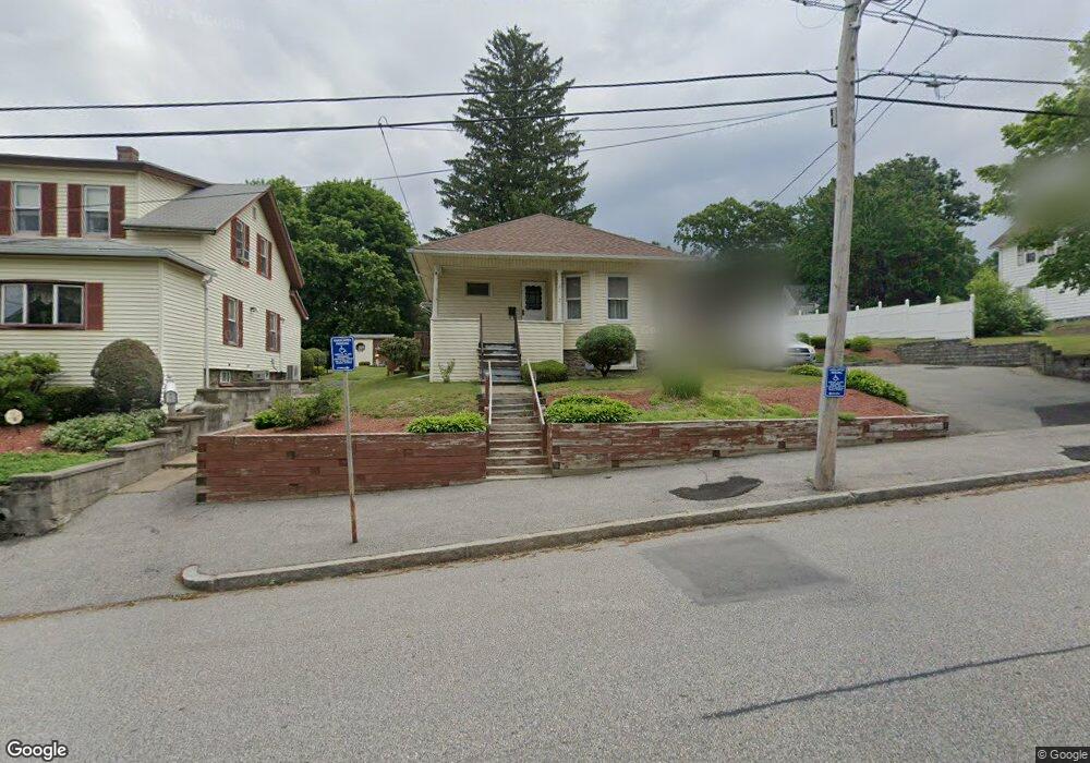
7 Commonwealth Ave Worcester, MA 01604
Grafton Hill NeighborhoodEstimated Value: $352,000 - $394,000
2
Beds
1
Bath
1,007
Sq Ft
$364/Sq Ft
Est. Value
About This Home
This home is located at 7 Commonwealth Ave, Worcester, MA 01604 and is currently estimated at $366,287, approximately $363 per square foot. 7 Commonwealth Ave is a home located in Worcester County with nearby schools including Jacob Hiatt Magnet School, Chandler Magnet, and Lake View Elementary School.
Ownership History
Date
Name
Owned For
Owner Type
Purchase Details
Closed on
May 28, 2024
Sold by
Hannam Kevin J
Bought by
Kevin J Jannam Ret and Hannam
Current Estimated Value
Purchase Details
Closed on
Jul 8, 1993
Sold by
Stapinski Paul F and Stapinski Susan
Bought by
Hannam Kevin J
Home Financials for this Owner
Home Financials are based on the most recent Mortgage that was taken out on this home.
Original Mortgage
$37,500
Interest Rate
7.43%
Mortgage Type
Purchase Money Mortgage
Create a Home Valuation Report for This Property
The Home Valuation Report is an in-depth analysis detailing your home's value as well as a comparison with similar homes in the area
Home Values in the Area
Average Home Value in this Area
Purchase History
| Date | Buyer | Sale Price | Title Company |
|---|---|---|---|
| Kevin J Jannam Ret | -- | None Available | |
| Kevin J Jannam Ret | -- | None Available | |
| Hannam Kevin J | $57,500 | -- | |
| Hannam Kevin J | $57,500 | -- |
Source: Public Records
Mortgage History
| Date | Status | Borrower | Loan Amount |
|---|---|---|---|
| Previous Owner | Hannam Kevin J | $37,500 |
Source: Public Records
Tax History
| Year | Tax Paid | Tax Assessment Tax Assessment Total Assessment is a certain percentage of the fair market value that is determined by local assessors to be the total taxable value of land and additions on the property. | Land | Improvement |
|---|---|---|---|---|
| 2025 | $4,114 | $311,900 | $118,700 | $193,200 |
| 2024 | $4,052 | $294,700 | $118,700 | $176,000 |
| 2023 | $3,873 | $270,100 | $103,200 | $166,900 |
| 2022 | $3,518 | $231,300 | $82,600 | $148,700 |
| 2021 | $3,287 | $201,900 | $66,100 | $135,800 |
| 2020 | $3,237 | $190,400 | $66,100 | $124,300 |
| 2019 | $3,064 | $170,200 | $59,500 | $110,700 |
| 2018 | $3,063 | $162,000 | $59,500 | $102,500 |
| 2017 | $2,937 | $152,800 | $59,500 | $93,300 |
| 2016 | $2,784 | $135,100 | $43,800 | $91,300 |
| 2015 | $2,711 | $135,100 | $43,800 | $91,300 |
| 2014 | $2,640 | $135,100 | $43,800 | $91,300 |
Source: Public Records
Map
Nearby Homes
- 360 Hamilton St
- 19 Middlesex Ave
- Lot B Crawford St
- 21 Middlesex Ave Unit 102
- 496 Hamilton St
- 41 Modoc St
- 12 Benham St
- 10 County St
- 241 Lake Ave
- 143 Commonwealth Ave
- 143 Dorcester
- 80 Delmont Ave
- 155 Hamilton St Unit 4
- 68 Dartmouth St
- 63 Progressive St
- 34 Robin Rd
- 103 Hamilton St
- 16 Arborwood Dr
- 365 Lake Ave
- 24 Ingleside Ave
- 5 Commonwealth Ave
- 13 Commonwealth Ave
- 3 Commonwealth Ave
- 4 Middlesex Ave
- 8 Middlesex Ave
- 1 Commonwealth Ave
- 15 Commonwealth Ave
- 12 Middlesex Ave
- 6 Commonwealth Ave
- 10 Commonwealth Ave
- 420 Hamilton St
- 12 Commonwealth Ave
- 416 Hamilton St
- 408 Hamilton St
- 428 Hamilton St
- 2 Commonwealth Ave
- 16 Middlesex Ave
- 14 Commonwealth Ave
- 19 Commonwealth Ave
- 396 Hamilton St
Your Personal Tour Guide
Ask me questions while you tour the home.