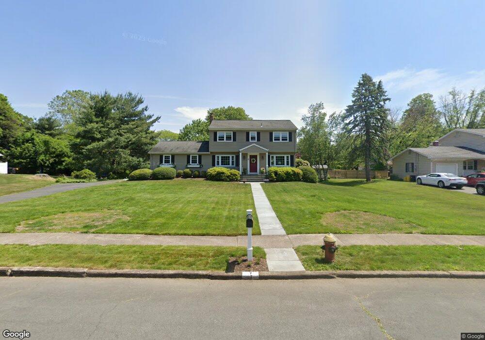
7 Corey Dr Ewing, NJ 08628
Ewingville NeighborhoodEstimated Value: $410,825 - $516,000
Studio
--
Bath
1,994
Sq Ft
$238/Sq Ft
Est. Value
About This Home
This home is located at 7 Corey Dr, Ewing, NJ 08628 and is currently estimated at $474,706, approximately $238 per square foot. 7 Corey Dr is a home located in Mercer County with nearby schools including Ewing High School, Trenton Stem-To-Civics Charter School, and Villa Victoria Academy.
Ownership History
Date
Name
Owned For
Owner Type
Purchase Details
Closed on
Jun 5, 1997
Sold by
Hovnanian K
Bought by
Andre Frances Shandor
Current Estimated Value
Purchase Details
Closed on
Mar 24, 1990
Sold by
Kendall William R and Kendall Stemhagen A
Bought by
Reap Michael B and Reap Ann M
Create a Home Valuation Report for This Property
The Home Valuation Report is an in-depth analysis detailing your home's value as well as a comparison with similar homes in the area
Home Values in the Area
Average Home Value in this Area
Purchase History
| Date | Buyer | Sale Price | Title Company |
|---|---|---|---|
| Andre Frances Shandor | $211,141 | -- | |
| Reap Michael B | $182,000 | -- |
Source: Public Records
Tax History
| Year | Tax Paid | Tax Assessment Tax Assessment Total Assessment is a certain percentage of the fair market value that is determined by local assessors to be the total taxable value of land and additions on the property. | Land | Improvement |
|---|---|---|---|---|
| 2025 | $10,120 | $257,300 | $92,800 | $164,500 |
| 2024 | $9,512 | $257,300 | $92,800 | $164,500 |
| 2023 | $9,512 | $257,300 | $92,800 | $164,500 |
| 2022 | $9,255 | $257,300 | $92,800 | $164,500 |
| 2021 | $9,029 | $257,300 | $92,800 | $164,500 |
| 2020 | $8,900 | $257,300 | $92,800 | $164,500 |
| 2019 | $8,668 | $257,300 | $92,800 | $164,500 |
| 2018 | $7,812 | $147,900 | $57,100 | $90,800 |
| 2017 | $7,994 | $147,900 | $57,100 | $90,800 |
| 2016 | $7,886 | $147,900 | $57,100 | $90,800 |
| 2015 | $7,781 | $147,900 | $57,100 | $90,800 |
| 2014 | $7,760 | $147,900 | $57,100 | $90,800 |
Source: Public Records
Map
Nearby Homes
- 20 Corey Dr
- 2 Rockleigh Dr
- 235 Masterson Ct
- 146 Masterson Ct
- 222 Masterson Ct
- 231 Masterson Ct
- 13 Hickory Hill Dr
- 27 Bayberry Rd
- 19 van Saun Dr
- 30 Upper Ferry Rd
- 632 Timberlake Dr
- 311 Timberlake Dr
- 532 Timberlake Dr
- 53 Carlton Ave
- 2148 Pennington Rd
- 1247 Lower Ferry Rd
- 18 Kyle Way
- 59 Kyle Way
- 41 Harding St
- 194 Bull Run Rd
Your Personal Tour Guide
Ask me questions while you tour the home.