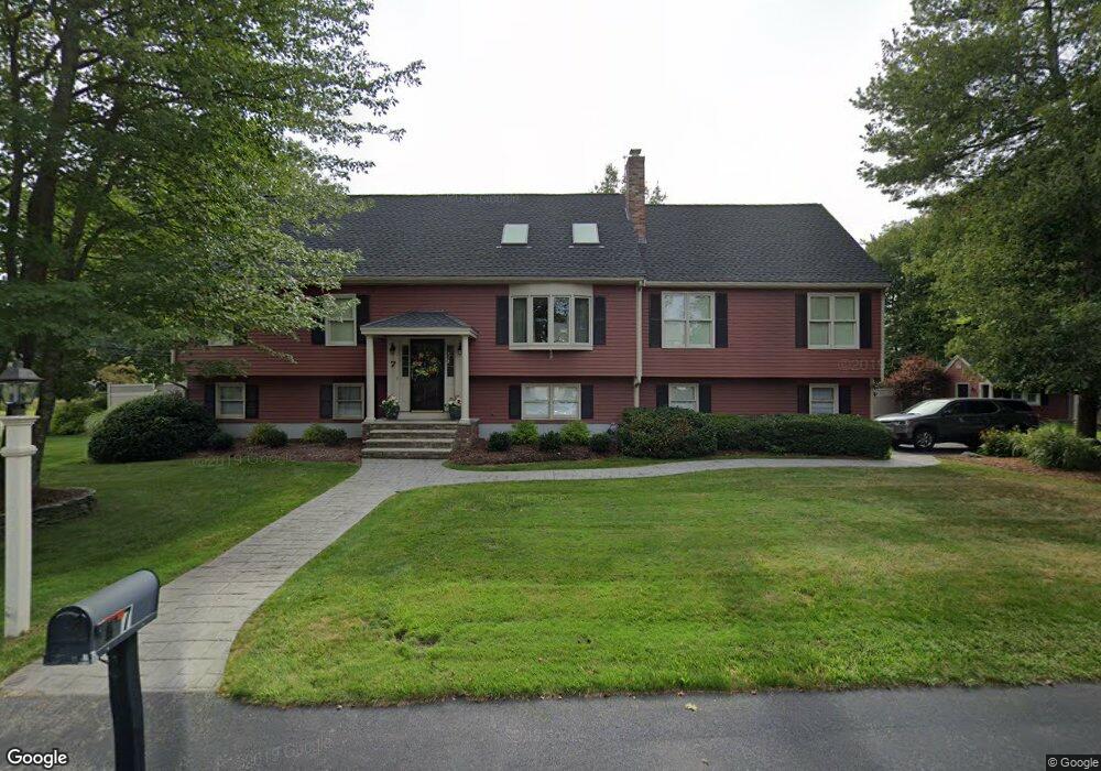
7 Crabtree Ln Abington, MA 02351
Estimated Value: $835,773 - $975,000
3
Beds
4
Baths
3,560
Sq Ft
$258/Sq Ft
Est. Value
About This Home
This home is located at 7 Crabtree Ln, Abington, MA 02351 and is currently estimated at $917,693, approximately $257 per square foot. 7 Crabtree Ln is a home located in Plymouth County with nearby schools including Woodsdale School, Beaver Brook Elementary School, and Abington Middle School.
Ownership History
Date
Name
Owned For
Owner Type
Purchase Details
Closed on
Sep 14, 2020
Sold by
Rossborough David A and Rossborough Donna M
Bought by
Crabtree Lane Rt
Current Estimated Value
Purchase Details
Closed on
Oct 15, 1985
Bought by
Rossborough David A and Rossborough Donna M
Create a Home Valuation Report for This Property
The Home Valuation Report is an in-depth analysis detailing your home's value as well as a comparison with similar homes in the area
Home Values in the Area
Average Home Value in this Area
Purchase History
| Date | Buyer | Sale Price | Title Company |
|---|---|---|---|
| Crabtree Lane Rt | -- | None Available | |
| Rossborough David A | $105,000 | -- |
Source: Public Records
Mortgage History
| Date | Status | Borrower | Loan Amount |
|---|---|---|---|
| Previous Owner | Rossborough David A | $200,000 | |
| Previous Owner | Rossborough David A | $225,563 |
Source: Public Records
Tax History Compared to Growth
Tax History
| Year | Tax Paid | Tax Assessment Tax Assessment Total Assessment is a certain percentage of the fair market value that is determined by local assessors to be the total taxable value of land and additions on the property. | Land | Improvement |
|---|---|---|---|---|
| 2025 | $9,109 | $697,500 | $262,300 | $435,200 |
| 2024 | $9,453 | $706,500 | $261,200 | $445,300 |
| 2023 | $9,576 | $673,900 | $228,600 | $445,300 |
| 2022 | $9,491 | $623,600 | $192,300 | $431,300 |
| 2021 | $10,503 | $637,300 | $183,700 | $453,600 |
| 2020 | $10,781 | $634,200 | $170,500 | $463,700 |
| 2019 | $10,173 | $585,000 | $170,500 | $414,500 |
| 2018 | $9,475 | $531,700 | $170,500 | $361,200 |
| 2017 | $9,689 | $528,000 | $170,500 | $357,500 |
| 2016 | $9,212 | $513,800 | $156,300 | $357,500 |
| 2015 | $8,867 | $521,600 | $156,300 | $365,300 |
Source: Public Records
Map
Nearby Homes
- 209 Hancock St
- 89 Presidential Dr
- 164 Hancock St
- 451 Lincoln St
- 10 Mccue Cir
- 5 Chamberlain St
- 257 Rockland St Unit 257
- 32 Warren St
- 9 Karen Ln
- 840 Hancock St
- 676 Bedford St
- 0 Bedford St
- 1042 Washington St
- 221 Chestnut St
- 8 Kingswood Dr Unit D5
- 1353 Washington St
- 38 Lantern Ln
- 133 Andrew Ford Way
- 89 Andrew Ford Way
- 79 Groveland St