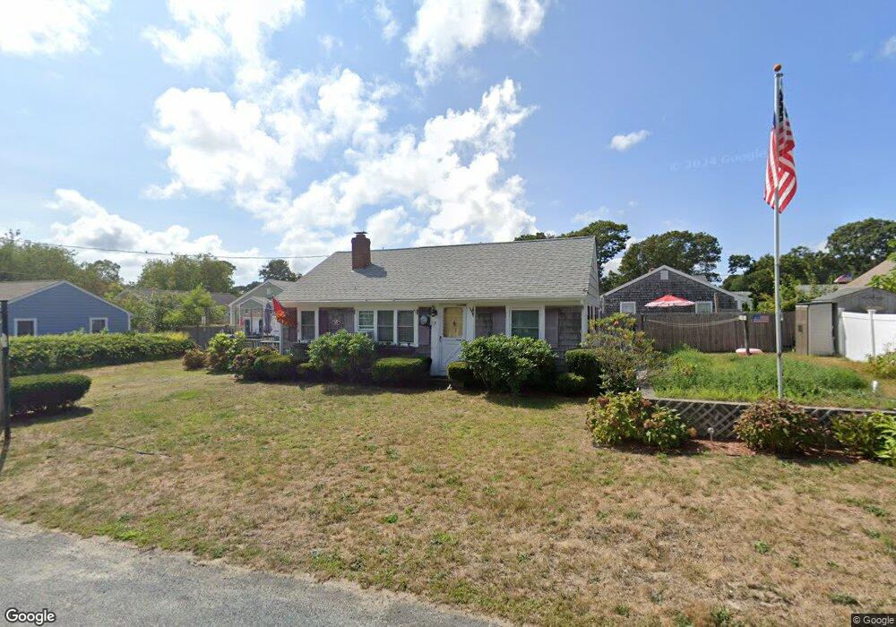
7 Cranberry Ln Dennis Port, MA 02639
Dennis Port NeighborhoodEstimated Value: $392,000 - $512,568
2
Beds
1
Bath
800
Sq Ft
$549/Sq Ft
Est. Value
About This Home
This home is located at 7 Cranberry Ln, Dennis Port, MA 02639 and is currently estimated at $439,142, approximately $548 per square foot. 7 Cranberry Ln is a home located in Barnstable County with nearby schools including Dennis-Yarmouth Regional High School and St. Pius X. School.
Ownership History
Date
Name
Owned For
Owner Type
Purchase Details
Closed on
May 1, 2018
Sold by
Mcdonnell George F and Mcdonnell Nancy J
Bought by
Mcdonnell George F
Current Estimated Value
Purchase Details
Closed on
Sep 24, 1999
Sold by
Wilson Margaret R
Bought by
Mcdonnell George F and Mcdonnell Nancy J
Purchase Details
Closed on
Jul 30, 1993
Sold by
Greska Alice Pat
Bought by
Wilson Margaret R
Create a Home Valuation Report for This Property
The Home Valuation Report is an in-depth analysis detailing your home's value as well as a comparison with similar homes in the area
Home Values in the Area
Average Home Value in this Area
Purchase History
| Date | Buyer | Sale Price | Title Company |
|---|---|---|---|
| Mcdonnell George F | -- | -- | |
| Mcdonnell George F | $94,000 | -- | |
| Wilson Margaret R | $80,000 | -- |
Source: Public Records
Tax History Compared to Growth
Tax History
| Year | Tax Paid | Tax Assessment Tax Assessment Total Assessment is a certain percentage of the fair market value that is determined by local assessors to be the total taxable value of land and additions on the property. | Land | Improvement |
|---|---|---|---|---|
| 2025 | $1,790 | $413,300 | $186,600 | $226,700 |
| 2024 | $1,637 | $372,900 | $179,400 | $193,500 |
| 2023 | $1,584 | $339,100 | $163,100 | $176,000 |
| 2022 | $1,540 | $275,000 | $146,900 | $128,100 |
| 2021 | $2,754 | $267,000 | $164,600 | $102,400 |
| 2020 | $2,699 | $237,100 | $144,100 | $93,000 |
| 2019 | $1,388 | $225,000 | $141,200 | $83,800 |
| 2018 | $2,457 | $209,800 | $134,500 | $75,300 |
| 2017 | $2,323 | $197,700 | $124,800 | $72,900 |
| 2016 | $1,292 | $197,900 | $134,500 | $63,400 |
| 2015 | $1,180 | $184,400 | $121,000 | $63,400 |
| 2014 | $1,144 | $180,200 | $115,200 | $65,000 |
Source: Public Records
Map
Nearby Homes
- 31 Easy St
- 22 Wixon Rd
- 22 Ferncliff Rd
- 19 Standish Way
- 72 Bassett Ln
- 37 Beach Hills Rd
- 37-A Beach Hills Rd
- 80 Michaels Ave
- 262 Old Wharf Rd Unit 67
- 262 Old Wharf Rd Unit 5
- 262 Old Wharf Rd Unit 5
- 262 Old Wharf Rd Unit 20
- 262 Old Wharf Rd Unit 87
- 102 Sea St
- 4 Coffey Ln
- 268 Main St
- 125 Main St Unit 3
- 241 Old Wharf Rd Unit 82
- 241 Old Wharf Rd Unit 127
- 241 Old Wharf Rd Unit 90
- 5 Cranberry Ln
- 12 Holiday Ln
- 11 Cranberry Ln
- 10 Holiday Ln
- 14 Holiday Ln
- 6 Cranberry Ln
- 2 Cranberry Ln
- 10 Cranberry Ln
- 8 Holiday Ln
- 18 Holiday Ln
- 3 Cranberry Ln
- 3 Toms Path
- 6 Holiday Ln
- 16 Toms Path
- 0 Shad Hole Rd Unit 2008689
- 0 Shad Hole Rd Unit 2007465
- 0 Shad Hole Rd Unit 2005562
- 0 Shad Hole Rd Unit 8042398
- 0 Shad Hole Rd Unit 9902951
- 0 Shad Hole Rd Unit 1 9906745