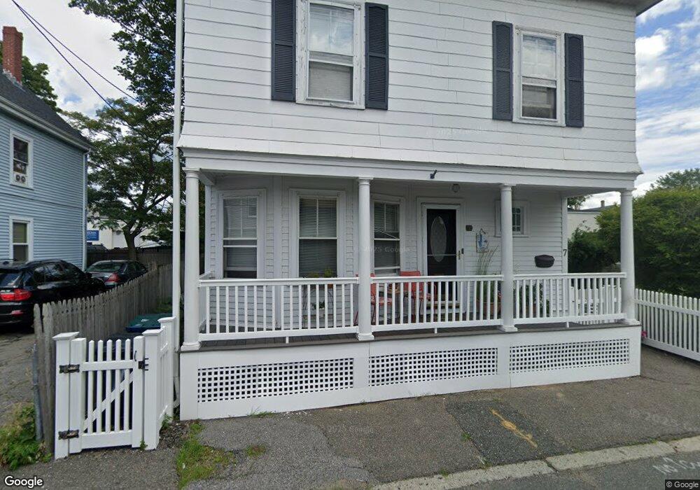
7 Cromwell St Salem, MA 01970
Bridge Street NeighborhoodEstimated Value: $576,874 - $650,000
4
Beds
1
Bath
1,800
Sq Ft
$331/Sq Ft
Est. Value
About This Home
This home is located at 7 Cromwell St, Salem, MA 01970 and is currently estimated at $595,969, approximately $331 per square foot. 7 Cromwell St is a home located in Essex County with nearby schools including Carlton Elementary School, Saltonstall School, and Bates Elementary School.
Ownership History
Date
Name
Owned For
Owner Type
Purchase Details
Closed on
Aug 29, 2003
Sold by
Waite Kathi R and Waite Robert C
Bought by
Spatafora Carl and Wright Eileen
Current Estimated Value
Purchase Details
Closed on
Dec 8, 1994
Sold by
Trull Richard B
Bought by
Waite Robert C and Waite Kathi R
Purchase Details
Closed on
Aug 3, 1994
Sold by
Kuezunski Helen H Est
Bought by
Trull Richard B
Create a Home Valuation Report for This Property
The Home Valuation Report is an in-depth analysis detailing your home's value as well as a comparison with similar homes in the area
Home Values in the Area
Average Home Value in this Area
Purchase History
| Date | Buyer | Sale Price | Title Company |
|---|---|---|---|
| Spatafora Carl | $271,500 | -- | |
| Waite Robert C | $116,000 | -- | |
| Trull Richard B | $43,000 | -- |
Source: Public Records
Mortgage History
| Date | Status | Borrower | Loan Amount |
|---|---|---|---|
| Open | Trull Richard B | $168,000 | |
| Closed | Trull Richard B | $90,000 | |
| Closed | Trull Richard B | $217,200 |
Source: Public Records
Tax History Compared to Growth
Tax History
| Year | Tax Paid | Tax Assessment Tax Assessment Total Assessment is a certain percentage of the fair market value that is determined by local assessors to be the total taxable value of land and additions on the property. | Land | Improvement |
|---|---|---|---|---|
| 2025 | $5,184 | $457,100 | $171,400 | $285,700 |
| 2024 | $5,044 | $434,100 | $162,400 | $271,700 |
| 2023 | $4,770 | $381,300 | $150,400 | $230,900 |
| 2022 | $4,612 | $348,100 | $141,300 | $206,800 |
| 2021 | $4,754 | $344,500 | $141,300 | $203,200 |
| 2020 | $4,500 | $311,400 | $122,100 | $189,300 |
| 2019 | $4,412 | $292,200 | $116,100 | $176,100 |
| 2018 | $4,283 | $278,500 | $110,700 | $167,800 |
| 2017 | $3,998 | $252,100 | $90,200 | $161,900 |
| 2016 | $3,875 | $247,300 | $85,400 | $161,900 |
| 2015 | $3,769 | $229,700 | $77,000 | $152,700 |
Source: Public Records
Map
Nearby Homes
- 14 Lathrop St
- 85 Bridge St Unit 4
- 10 Andrew St Unit 2A
- 156 Bridge St Unit B
- 14 Mall St Unit B
- 31 N Washington Square Unit 3
- 16 Williams St
- 5 Larchmont Rd Unit 3
- 11 Williams St Unit 2
- 41 Dearborn St
- 7 Forrester St
- 40 Essex St Unit 2
- 16 Franklin St Unit 2403
- 16 Franklin St Unit 1303
- 7 Curtis St Unit 1
- 131 Derby St Unit 3 Front
- 44 Orne St Unit 44
- 12 Summit Ave Unit 4
- 11 Church St Unit 203
- 112 North St