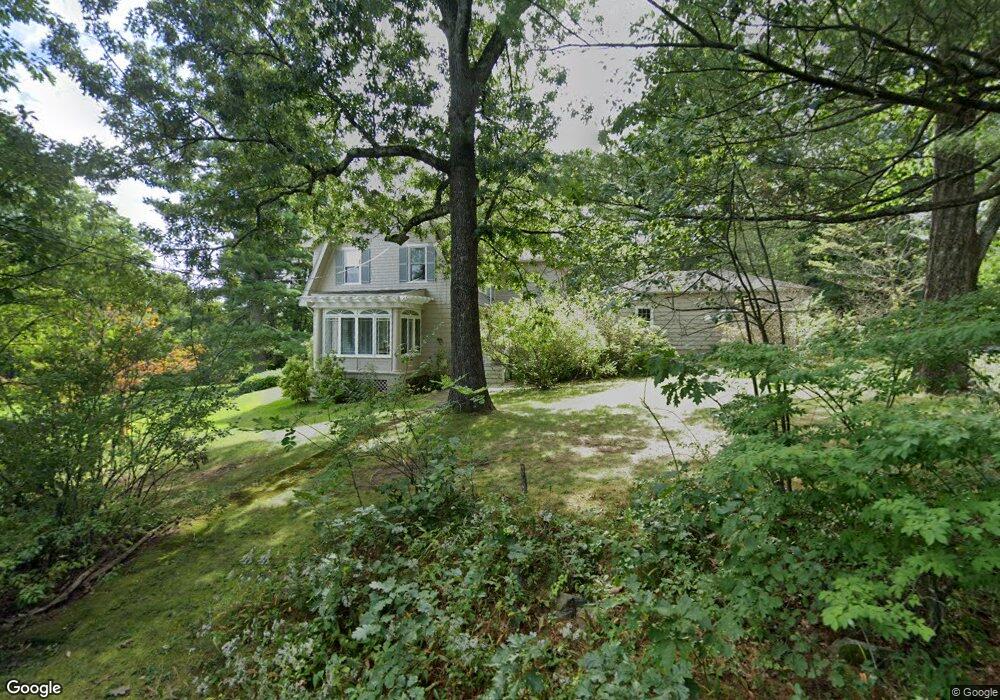
7 Curve St Sherborn, MA 01770
Estimated Value: $871,647 - $1,641,000
4
Beds
2
Baths
2,204
Sq Ft
$509/Sq Ft
Est. Value
About This Home
This home is located at 7 Curve St, Sherborn, MA 01770 and is currently estimated at $1,121,912, approximately $509 per square foot. 7 Curve St is a home located in Middlesex County with nearby schools including Pine Hill Elementary School, Dover-Sherborn Regional Middle School, and Dover-Sherborn Regional High School.
Ownership History
Date
Name
Owned For
Owner Type
Purchase Details
Closed on
Mar 19, 2018
Sold by
Brodie Douglas S
Bought by
Brodie Douglas S and Brodie Sarah B
Current Estimated Value
Purchase Details
Closed on
Oct 21, 1991
Sold by
Brodie Douglas S and Brodie Sarah B
Bought by
Brodie Sarah B
Create a Home Valuation Report for This Property
The Home Valuation Report is an in-depth analysis detailing your home's value as well as a comparison with similar homes in the area
Home Values in the Area
Average Home Value in this Area
Purchase History
| Date | Buyer | Sale Price | Title Company |
|---|---|---|---|
| Brodie Douglas S | -- | -- | |
| Brodie Sarah B | $75,000 | -- |
Source: Public Records
Mortgage History
| Date | Status | Borrower | Loan Amount |
|---|---|---|---|
| Previous Owner | Brodie Sarah B | $150,000 | |
| Previous Owner | Brodie Sarah B | $62,500 | |
| Previous Owner | Brodie Sarah B | $75,000 | |
| Previous Owner | Brodie Sarah B | $75,000 |
Source: Public Records
Tax History Compared to Growth
Tax History
| Year | Tax Paid | Tax Assessment Tax Assessment Total Assessment is a certain percentage of the fair market value that is determined by local assessors to be the total taxable value of land and additions on the property. | Land | Improvement |
|---|---|---|---|---|
| 2025 | $12,021 | $725,000 | $449,800 | $275,200 |
| 2024 | $10,604 | $625,600 | $386,700 | $238,900 |
| 2023 | $10,512 | $583,700 | $386,700 | $197,000 |
| 2022 | $10,042 | $527,700 | $375,200 | $152,500 |
| 2021 | $10,316 | $525,500 | $375,200 | $150,300 |
| 2020 | $10,226 | $525,500 | $375,200 | $150,300 |
| 2019 | $5,323 | $496,200 | $375,200 | $121,000 |
| 2018 | $9,577 | $496,200 | $375,200 | $121,000 |
| 2017 | $10,034 | $490,400 | $375,200 | $115,200 |
| 2016 | $9,612 | $467,300 | $352,100 | $115,200 |
| 2015 | $9,347 | $460,000 | $341,700 | $118,300 |
| 2014 | $8,966 | $440,800 | $329,000 | $111,800 |
Source: Public Records
Map
Nearby Homes
- 18 Wildwood Dr
- 1 Adams Rd
- 2 Adams Rd Unit 2
- 9 Adams Rd
- 151 Mohawk Path
- 306 Trailside Way
- 84 E Bluff Rd
- 67 Spyglass Hill Dr
- 61 Old Orchard Rd
- 6 Brook St
- 63 Trailside Way Unit 63
- 45 Half Crown Cir
- 157 Leland Farm Rd
- 131 Jennings Rd
- 72 Pond St
- 37 James Rd
- 95 Brooksmont Dr Unit 26
- 104 Brooksmont Dr Unit 104
- 133 Brooksmont Dr Unit 43
- 147 Turner Rd Unit 80