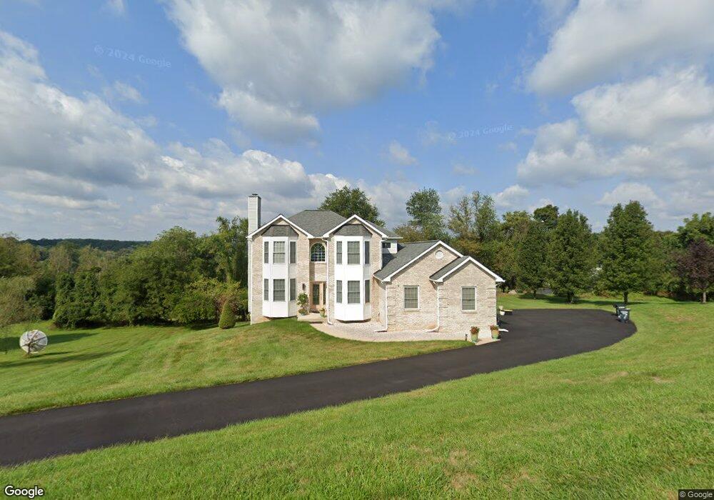
7 Deep Powder Ct Woodstock, MD 21163
Estimated Value: $597,000 - $696,000
--
Bed
4
Baths
2,624
Sq Ft
$243/Sq Ft
Est. Value
About This Home
This home is located at 7 Deep Powder Ct, Woodstock, MD 21163 and is currently estimated at $638,326, approximately $243 per square foot. 7 Deep Powder Ct is a home located in Baltimore County with nearby schools including Randallstown Elementary School, Windsor Mill Middle School, and Randallstown High School.
Ownership History
Date
Name
Owned For
Owner Type
Purchase Details
Closed on
Jul 25, 2019
Sold by
Gilliam Russell L and Banks Deborah V
Bought by
Banks Deborah V and Gilliam Russell L
Current Estimated Value
Purchase Details
Closed on
Jul 24, 1998
Sold by
Stirn Donald R
Bought by
Gilliam Russell L and Banks Deborah V
Purchase Details
Closed on
Nov 12, 1997
Sold by
Brinklow Construction Inc
Bought by
Stirn Donald R
Purchase Details
Closed on
Apr 7, 1995
Sold by
Washington Homes
Bought by
Brinklow Construction Inc
Home Financials for this Owner
Home Financials are based on the most recent Mortgage that was taken out on this home.
Original Mortgage
$210,320
Interest Rate
8.66%
Create a Home Valuation Report for This Property
The Home Valuation Report is an in-depth analysis detailing your home's value as well as a comparison with similar homes in the area
Home Values in the Area
Average Home Value in this Area
Purchase History
| Date | Buyer | Sale Price | Title Company |
|---|---|---|---|
| Banks Deborah V | -- | None Available | |
| Gilliam Russell L | $238,000 | -- | |
| Stirn Donald R | $200,000 | -- | |
| Brinklow Construction Inc | $72,000 | -- |
Source: Public Records
Mortgage History
| Date | Status | Borrower | Loan Amount |
|---|---|---|---|
| Previous Owner | Brinklow Construction Inc | $210,320 |
Source: Public Records
Tax History Compared to Growth
Tax History
| Year | Tax Paid | Tax Assessment Tax Assessment Total Assessment is a certain percentage of the fair market value that is determined by local assessors to be the total taxable value of land and additions on the property. | Land | Improvement |
|---|---|---|---|---|
| 2025 | $4,974 | $440,100 | -- | -- |
| 2024 | $4,974 | $407,300 | $110,700 | $296,600 |
| 2023 | $2,469 | $402,500 | $0 | $0 |
| 2022 | $4,836 | $397,700 | $0 | $0 |
| 2021 | $4,512 | $392,900 | $110,700 | $282,200 |
| 2020 | $4,626 | $378,000 | $0 | $0 |
| 2019 | $4,401 | $363,100 | $0 | $0 |
| 2018 | $4,242 | $348,200 | $105,700 | $242,500 |
| 2017 | $4,259 | $348,200 | $0 | $0 |
| 2016 | $4,365 | $348,200 | $0 | $0 |
| 2015 | $4,365 | $352,500 | $0 | $0 |
| 2014 | $4,365 | $352,500 | $0 | $0 |
Source: Public Records
Map
Nearby Homes
- 3200 Peddicoat Ct
- 2508 Offutt Rd
- 9605 Mendoza Rd
- 3525 Cabot Rd
- 3518 Orchard Shade Rd
- 3517 Kings Point Rd
- 3538 Corn Stream Rd
- 9311 Colorado Ave
- 9804 Marriottsville Rd
- 9302 Silver Charm Dr
- 3320 Offutt Rd
- 3618 Granite Rd
- 9401 Summer Squal Dr
- 10301 Marriottsville Rd
- 3332 Offutt Rd
- 3402 Offutt Rd
- 3803 Marriottsville Rd
- 30 Sheraton Rd
- 9210 Liberty Rd
- 3903 Red Deer Cir
- 5 Deep Powder Ct
- 11 Deep Powder Ct
- 9 Deep Powder Ct
- 3 Deep Powder Ct
- 2656 Offutt Rd
- 2644 Offutt Rd
- 13 Deep Powder Ct
- 15 Deep Powder Ct
- 21 Deep Powder Ct
- 2640 Offutt Rd
- 1 Deep Powder Ct
- 17 Deep Powder Ct
- 4 Deep Powder Ct
- 23 Deep Powder Ct
- 2 Deep Powder Ct
- 6 Deep Powder Ct
- 2639 Offutt Rd
- 25 Deep Powder Ct
- 2645 Offutt Rd
- 2635 Offutt Rd