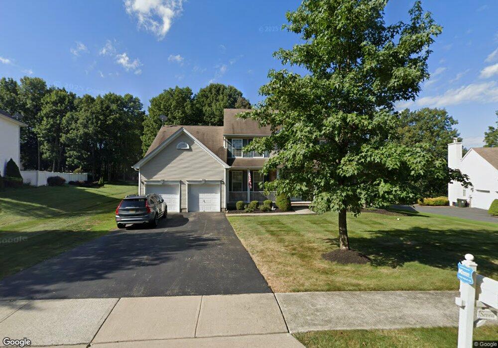
7 Dorset Dr Hackettstown, NJ 07840
Estimated Value: $810,000 - $890,000
--
Bed
--
Bath
3,049
Sq Ft
$281/Sq Ft
Est. Value
About This Home
This home is located at 7 Dorset Dr, Hackettstown, NJ 07840 and is currently estimated at $858,090, approximately $281 per square foot. 7 Dorset Dr is a home located in Morris County with nearby schools including Mt Olive Middle School and Mount Olive High School.
Ownership History
Date
Name
Owned For
Owner Type
Purchase Details
Closed on
Oct 30, 2009
Sold by
Daddio William and Daddio Doris A
Bought by
Goldkind Michael and Goldkind Anessa
Current Estimated Value
Home Financials for this Owner
Home Financials are based on the most recent Mortgage that was taken out on this home.
Original Mortgage
$487,179
Outstanding Balance
$319,083
Interest Rate
5.06%
Mortgage Type
FHA
Estimated Equity
$539,007
Purchase Details
Closed on
Dec 27, 2002
Sold by
K Land No 53 Llc
Bought by
Merritt Maria
Home Financials for this Owner
Home Financials are based on the most recent Mortgage that was taken out on this home.
Original Mortgage
$342,570
Interest Rate
5.91%
Purchase Details
Closed on
Dec 12, 2002
Sold by
K Land No 53
Bought by
Daddio William and Quint Doris
Home Financials for this Owner
Home Financials are based on the most recent Mortgage that was taken out on this home.
Original Mortgage
$342,570
Interest Rate
5.91%
Create a Home Valuation Report for This Property
The Home Valuation Report is an in-depth analysis detailing your home's value as well as a comparison with similar homes in the area
Home Values in the Area
Average Home Value in this Area
Purchase History
| Date | Buyer | Sale Price | Title Company |
|---|---|---|---|
| Goldkind Michael | $504,000 | Multiple | |
| Merritt Maria | $488,570 | -- | |
| Daddio William | $471,705 | -- |
Source: Public Records
Mortgage History
| Date | Status | Borrower | Loan Amount |
|---|---|---|---|
| Open | Goldkind Michael | $487,179 | |
| Previous Owner | Merritt Maria | $342,570 | |
| Previous Owner | Daddio William | $353,700 |
Source: Public Records
Tax History Compared to Growth
Tax History
| Year | Tax Paid | Tax Assessment Tax Assessment Total Assessment is a certain percentage of the fair market value that is determined by local assessors to be the total taxable value of land and additions on the property. | Land | Improvement |
|---|---|---|---|---|
| 2025 | $17,369 | $498,400 | $156,000 | $342,400 |
| 2024 | $16,382 | $498,400 | $156,000 | $342,400 |
| 2023 | $16,382 | $498,400 | $156,000 | $342,400 |
| 2022 | $16,736 | $498,400 | $156,000 | $342,400 |
| 2021 | $16,736 | $498,400 | $156,000 | $342,400 |
| 2020 | $16,512 | $498,400 | $156,000 | $342,400 |
| 2019 | $16,457 | $498,400 | $156,000 | $342,400 |
| 2018 | $15,765 | $482,100 | $156,000 | $326,100 |
| 2017 | $15,490 | $482,100 | $156,000 | $326,100 |
| 2016 | $14,998 | $482,100 | $156,000 | $326,100 |
| 2015 | $15,350 | $482,100 | $156,000 | $326,100 |
| 2014 | $15,365 | $482,100 | $156,000 | $326,100 |
Source: Public Records
Map
Nearby Homes
- 20 Mine Hill Rd
- 45 Saunders Ln
- 43 Saunders Ln
- 33 Saxton Dr
- 634 Willow Grove St
- 55 Saxton Dr
- 1 Bridle Ln
- 305 Tulsa Ct Unit 67A05
- 6316 Belmont Dr Unit 16
- 2 Brock Ln
- 169 Winding Hill Dr
- 101 Kemper Ct
- 3-A Old Bilby Rd
- 96 Winding Hill Dr
- 5 Francis Terrace
- 1 Crestview Dr
- 00 Russling Rd
- 942 County Road 517
- 28 Mine Hill Rd
- 16 Whipporwill Rd
- 5 Dorset Dr
- 9 Dorset Dr
- 3 Dorset Dr
- 158 Stephens State Park Rd
- 12 Dorset Dr
- 160 Stephens State Park Rd
- 160 Stephens Park Rd
- 156 Stephens State Park Rd
- 13 Dorset Dr
- 162 Stephens State Park Rd
- 14 Dorset Dr
- 15 Dorset Dr
- 162 Stephens Park Rd
- 17 Dorset Dr
- 168 Stephens State Park Rd
- 28 Dorset Dr
- 19 Dorset Dr
- 147 Stephens Park Rd
- 147 Stephens State Park Rd
- 26 Dorset Dr