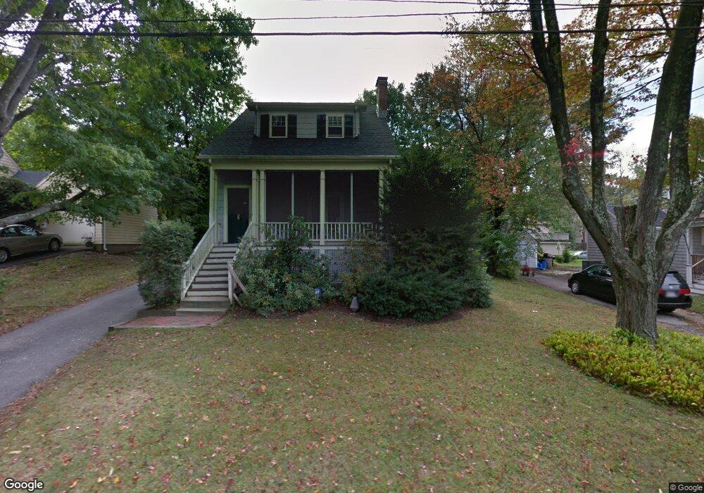
7 Eaton Rd Lexington, MA 02420
North Lexington NeighborhoodEstimated Value: $1,164,734 - $1,411,000
3
Beds
2
Baths
1,558
Sq Ft
$799/Sq Ft
Est. Value
About This Home
This home is located at 7 Eaton Rd, Lexington, MA 02420 and is currently estimated at $1,244,684, approximately $798 per square foot. 7 Eaton Rd is a home located in Middlesex County with nearby schools including Joseph Estabrook Elementary School, William Diamond Middle School, and Lexington High School.
Ownership History
Date
Name
Owned For
Owner Type
Purchase Details
Closed on
Jul 18, 2002
Sold by
Guttenberg Richard and Ellin Marlene
Bought by
Fopiano Michael and Fopiano Christine S
Current Estimated Value
Home Financials for this Owner
Home Financials are based on the most recent Mortgage that was taken out on this home.
Original Mortgage
$472,000
Outstanding Balance
$196,501
Interest Rate
6.73%
Mortgage Type
Purchase Money Mortgage
Estimated Equity
$1,048,183
Purchase Details
Closed on
May 1, 1996
Sold by
Kilbridge Peter M and Kovacs Dora Marta
Bought by
Guttenberg Richard and Guttenberg Ellen Marlene
Purchase Details
Closed on
Apr 18, 1995
Sold by
Webb Herbert F and Webb Jeanette P
Bought by
Kilbridge Peter M and Kilbridge Dora M
Create a Home Valuation Report for This Property
The Home Valuation Report is an in-depth analysis detailing your home's value as well as a comparison with similar homes in the area
Home Values in the Area
Average Home Value in this Area
Purchase History
| Date | Buyer | Sale Price | Title Company |
|---|---|---|---|
| Fopiano Michael | $590,000 | -- | |
| Guttenberg Richard | $330,500 | -- | |
| Kilbridge Peter M | $320,000 | -- |
Source: Public Records
Mortgage History
| Date | Status | Borrower | Loan Amount |
|---|---|---|---|
| Open | Fopiano Michael | $472,000 | |
| Previous Owner | Kilbridge Peter M | $189,000 | |
| Previous Owner | Kilbridge Peter M | $240,000 |
Source: Public Records
Tax History Compared to Growth
Tax History
| Year | Tax Paid | Tax Assessment Tax Assessment Total Assessment is a certain percentage of the fair market value that is determined by local assessors to be the total taxable value of land and additions on the property. | Land | Improvement |
|---|---|---|---|---|
| 2025 | $13,502 | $1,104,000 | $773,000 | $331,000 |
| 2024 | $12,777 | $1,043,000 | $737,000 | $306,000 |
| 2023 | $12,103 | $931,000 | $670,000 | $261,000 |
| 2022 | $11,633 | $843,000 | $609,000 | $234,000 |
| 2021 | $11,195 | $778,000 | $555,000 | $223,000 |
| 2020 | $10,847 | $772,000 | $555,000 | $217,000 |
| 2019 | $10,406 | $737,000 | $529,000 | $208,000 |
| 2018 | $9,853 | $689,000 | $503,000 | $186,000 |
| 2017 | $9,578 | $661,000 | $492,000 | $169,000 |
| 2016 | $8,950 | $613,000 | $448,000 | $165,000 |
| 2015 | $8,485 | $571,000 | $408,000 | $163,000 |
| 2014 | $8,391 | $541,000 | $371,000 | $170,000 |
Source: Public Records
Map
Nearby Homes
- 3a Nowers Rd
- 101 Burlington St
- 18 Robinson Rd
- 231 Bedford St
- 103 N Hancock St
- 25 Flintlock Rd
- 17 Hamilton Rd
- 125 Burlington St
- 24 Vaille Ave
- 93 Bedford St Unit 201
- 93 Bedford St Unit 308
- 93 Bedford St Unit 101
- 12 Coolidge Ave
- 36 Adams St
- 83 Winter St
- 45 Hancock St
- 18 Heritage Dr
- 75 Westview St
- 21 Balfour St
- 3 Brown Rd
- 101 Bertwell Rd
- 11 Eaton Rd
- 66 Simonds Rd
- 66 Simonds Rd Unit 66
- 62 Simonds Rd
- 70 Simonds Rd
- 10 Eaton Rd
- 4 Eaton Rd
- 12 Eaton Rd
- 74 Simonds Rd
- 19 Eaton Rd
- 16 Eaton Rd
- 104 Bertwell Rd
- 100 Bertwell Rd
- 67 Simonds Rd
- 108 Bertwell Rd
- 54 Simonds Rd
- 54 Simonds Rd
- 54 Simonds Rd Unit 54 Simonds Rd
- 78 Simonds Rd