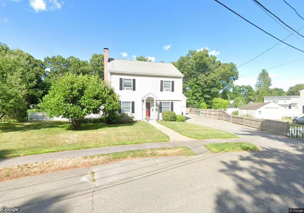
7 Euclid Cir Natick, MA 01760
Estimated Value: $890,017 - $1,041,000
3
Beds
2
Baths
1,583
Sq Ft
$592/Sq Ft
Est. Value
About This Home
This home is located at 7 Euclid Cir, Natick, MA 01760 and is currently estimated at $937,754, approximately $592 per square foot. 7 Euclid Cir is a home located in Middlesex County with nearby schools including Natick High School, Wilson Middle School, and Bennett-Hemenway (Ben-Hem) Elementary School.
Ownership History
Date
Name
Owned For
Owner Type
Purchase Details
Closed on
Mar 17, 2022
Sold by
Jennings Michael L and Jennings Jessica A
Bought by
Jennings Jessica A
Current Estimated Value
Home Financials for this Owner
Home Financials are based on the most recent Mortgage that was taken out on this home.
Original Mortgage
$472,400
Outstanding Balance
$442,550
Interest Rate
4.16%
Mortgage Type
Stand Alone Refi Refinance Of Original Loan
Estimated Equity
$495,204
Purchase Details
Closed on
Jul 21, 2004
Sold by
Gilleran Mary F
Bought by
Foster Jerald M
Create a Home Valuation Report for This Property
The Home Valuation Report is an in-depth analysis detailing your home's value as well as a comparison with similar homes in the area
Home Values in the Area
Average Home Value in this Area
Purchase History
| Date | Buyer | Sale Price | Title Company |
|---|---|---|---|
| Jennings Jessica A | -- | None Available | |
| Jennings Jessica A | -- | None Available | |
| Foster Jerald M | $325,000 | -- | |
| Foster Jerald M | $325,000 | -- |
Source: Public Records
Mortgage History
| Date | Status | Borrower | Loan Amount |
|---|---|---|---|
| Open | Jennings Jessica A | $472,400 | |
| Closed | Jennings Jessica A | $472,400 | |
| Previous Owner | Foster Jerald M | $379,865 | |
| Previous Owner | Foster Jerald M | $384,094 | |
| Previous Owner | Foster Jerald M | $385,000 |
Source: Public Records
Tax History
| Year | Tax Paid | Tax Assessment Tax Assessment Total Assessment is a certain percentage of the fair market value that is determined by local assessors to be the total taxable value of land and additions on the property. | Land | Improvement |
|---|---|---|---|---|
| 2025 | $9,762 | $816,200 | $452,100 | $364,100 |
| 2024 | $9,489 | $774,000 | $425,400 | $348,600 |
| 2023 | $9,215 | $729,000 | $407,000 | $322,000 |
| 2022 | $8,940 | $670,200 | $367,800 | $302,400 |
| 2021 | $8,641 | $634,900 | $346,800 | $288,100 |
| 2020 | $8,426 | $619,100 | $331,000 | $288,100 |
| 2019 | $7,869 | $619,100 | $331,000 | $288,100 |
| 2018 | $8,066 | $618,100 | $315,200 | $302,900 |
| 2017 | $7,708 | $571,400 | $274,100 | $297,300 |
| 2016 | $7,431 | $547,600 | $253,100 | $294,500 |
| 2015 | $7,197 | $520,800 | $253,100 | $267,700 |
Source: Public Records
Map
Nearby Homes
- 9 Euclid Cir
- 5 Euclid Ave
- 11 Euclid Cir
- 3 Euclid Ave
- 24 Longfellow Rd
- 10 Longfellow Rd
- 22 Longfellow Rd
- 22 Longfellow Rd Unit 22
- 26 Longfellow Rd
- 12 Longfellow Rd
- 13 Euclid Ave
- 20 Longfellow Rd
- 10 Euclid Ave
- 28 Longfellow Rd
- 16 Longfellow Rd
- 8 Longfellow Rd
- 18 Longfellow Rd
- 9 Leland Rd
- 9 Leland Rd Unit 9
- 8 Euclid Ave
Your Personal Tour Guide
Ask me questions while you tour the home.