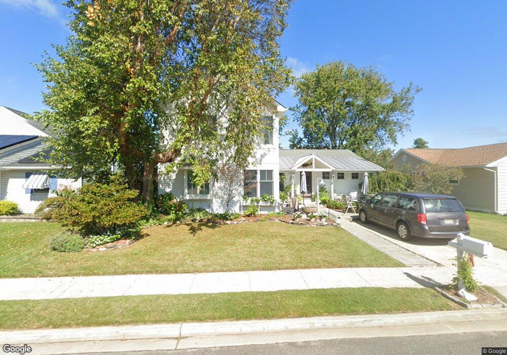
7 Explorer Rd Brigantine, NJ 08203
Estimated Value: $609,000 - $951,000
3
Beds
2
Baths
2,459
Sq Ft
$315/Sq Ft
Est. Value
About This Home
This home is located at 7 Explorer Rd, Brigantine, NJ 08203 and is currently estimated at $775,157, approximately $315 per square foot. 7 Explorer Rd is a home located in Atlantic County with nearby schools including Brigantine Elementary School and New Hope Christian Academy/Robinson Small Learning Center.
Ownership History
Date
Name
Owned For
Owner Type
Purchase Details
Closed on
Mar 20, 2008
Sold by
Volpe Robert and Volpe Diane
Bought by
Balmer Thomas R and Balmer Robyn L
Current Estimated Value
Home Financials for this Owner
Home Financials are based on the most recent Mortgage that was taken out on this home.
Original Mortgage
$237,500
Outstanding Balance
$150,481
Interest Rate
6.06%
Mortgage Type
Purchase Money Mortgage
Estimated Equity
$624,676
Purchase Details
Closed on
May 17, 2007
Sold by
Volpe Robert and Volpe Diane
Bought by
Volpe Robert and Volpe Diane
Create a Home Valuation Report for This Property
The Home Valuation Report is an in-depth analysis detailing your home's value as well as a comparison with similar homes in the area
Home Values in the Area
Average Home Value in this Area
Purchase History
| Date | Buyer | Sale Price | Title Company |
|---|---|---|---|
| Balmer Thomas R | $325,000 | Commonwealth Land Title Insu | |
| Volpe Robert | -- | None Available |
Source: Public Records
Mortgage History
| Date | Status | Borrower | Loan Amount |
|---|---|---|---|
| Open | Balmer Thomas R | $237,500 |
Source: Public Records
Tax History
| Year | Tax Paid | Tax Assessment Tax Assessment Total Assessment is a certain percentage of the fair market value that is determined by local assessors to be the total taxable value of land and additions on the property. | Land | Improvement |
|---|---|---|---|---|
| 2025 | $6,853 | $364,500 | $214,200 | $150,300 |
| 2024 | $6,853 | $364,500 | $214,200 | $150,300 |
Source: Public Records
Map
Nearby Homes
- 105 Lagoon Blvd
- 4311 Harbor Beach Blvd
- 316 Gull Cove
- 330 Gull Cove
- 5 Beacon Ln
- 4240 Atlantic Brigantine Blvd Unit 104
- 134 44th St S Unit D
- 8 Marc Ln
- 6 Bramble Dr
- 4901 Harbor Beach P3 Blvd Unit P3
- 4901 Harbor Beach Blvd Unit A 3
- 4901 Harbor Beach Blvd Unit G9
- 4901 Harbor Beach Blvd Unit F-2
- 4901 Harbor Beach Blvd Unit M12
- 4901 Harbor Beach Blvd Unit Q-15
- 4901 Harbor Beach Blvd Unit N20
- 4901 Harbor Beach Blvd Unit C-13
- 4901 Harbor Beach Blvd Unit K-9
- 4901 Harbor Beach Blvd Unit P-8
- 4540 W Brigantine Ave Unit S109
Your Personal Tour Guide
Ask me questions while you tour the home.