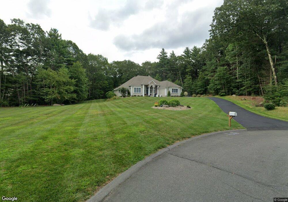
7 Falcon Heights Wilbraham, MA 01095
Estimated Value: $741,000 - $1,015,000
3
Beds
4
Baths
2,545
Sq Ft
$329/Sq Ft
Est. Value
About This Home
This home is located at 7 Falcon Heights, Wilbraham, MA 01095 and is currently estimated at $837,418, approximately $329 per square foot. 7 Falcon Heights is a home located in Hampden County with nearby schools including Minnechaug Regional High School and Wilbraham & Monson Academy.
Ownership History
Date
Name
Owned For
Owner Type
Purchase Details
Closed on
Jul 29, 2022
Sold by
Rossini John M and Rossini Cynthia A
Bought by
Hyder Michael J and Hyder Ashley L
Current Estimated Value
Home Financials for this Owner
Home Financials are based on the most recent Mortgage that was taken out on this home.
Original Mortgage
$400,000
Outstanding Balance
$382,231
Interest Rate
5.78%
Mortgage Type
Purchase Money Mortgage
Estimated Equity
$455,187
Purchase Details
Closed on
Apr 10, 2015
Sold by
Fnma
Bought by
Rossini John M and Rossini Cynthia A
Home Financials for this Owner
Home Financials are based on the most recent Mortgage that was taken out on this home.
Original Mortgage
$456,000
Interest Rate
3.77%
Mortgage Type
Purchase Money Mortgage
Purchase Details
Closed on
Oct 8, 2014
Sold by
Hanson Douglas I and Luso Fcu
Bought by
Fnma
Purchase Details
Closed on
Dec 28, 1999
Sold by
Coons Gregory A and Coons Amy B
Bought by
Hanson Douglas I and Hanson Beverly A
Home Financials for this Owner
Home Financials are based on the most recent Mortgage that was taken out on this home.
Original Mortgage
$392,400
Interest Rate
7.61%
Mortgage Type
Purchase Money Mortgage
Create a Home Valuation Report for This Property
The Home Valuation Report is an in-depth analysis detailing your home's value as well as a comparison with similar homes in the area
Home Values in the Area
Average Home Value in this Area
Purchase History
| Date | Buyer | Sale Price | Title Company |
|---|---|---|---|
| Hyder Michael J | $739,000 | None Available | |
| Rossini John M | $480,000 | -- | |
| Fnma | $494,340 | -- | |
| Fnma | $494,340 | -- | |
| Hanson Douglas I | $110,000 | -- |
Source: Public Records
Mortgage History
| Date | Status | Borrower | Loan Amount |
|---|---|---|---|
| Open | Hyder Michael J | $400,000 | |
| Previous Owner | Rossini John M | $456,000 | |
| Previous Owner | Hanson Douglas I | $392,000 | |
| Previous Owner | Hanson Douglas I | $392,400 |
Source: Public Records
Tax History Compared to Growth
Tax History
| Year | Tax Paid | Tax Assessment Tax Assessment Total Assessment is a certain percentage of the fair market value that is determined by local assessors to be the total taxable value of land and additions on the property. | Land | Improvement |
|---|---|---|---|---|
| 2025 | $14,617 | $817,500 | $164,400 | $653,100 |
| 2024 | $13,857 | $749,000 | $158,400 | $590,600 |
| 2023 | $111 | $665,200 | $164,400 | $500,800 |
| 2022 | $11,120 | $542,700 | $134,400 | $408,300 |
| 2021 | $3,727 | $521,800 | $134,700 | $387,100 |
| 2020 | $11,678 | $521,800 | $134,700 | $387,100 |
| 2019 | $3,424 | $450,900 | $134,700 | $316,200 |
| 2018 | $10,713 | $473,200 | $134,700 | $338,500 |
| 2017 | $10,410 | $473,200 | $134,700 | $338,500 |
| 2016 | $10,083 | $466,800 | $148,700 | $318,100 |
| 2015 | $9,747 | $466,800 | $148,700 | $318,100 |
Source: Public Records
Map
Nearby Homes
- 603 Glendale Rd
- 60 Lakeshore Dr
- 733 Monson Rd
- 474-480 Mountain Rd
- 474 Mountain Rd
- 6 Hilltop Park
- 72 Beebe Rd
- 20 Old Orchard Rd
- 17 Peak Rd
- 182 Mountain Rd
- 254 Ames Rd
- 2 Bayberry Dr Unit 51
- 68 Monson Rd
- 2 Vista Rd
- 187 Hovey Rd
- 183 Hovey Rd
- L16 Wilbraham St
- 79 High Pine Cir
- 69 High Pine Cir
- 54 High Pine Cir
- 7 Falcon Heights
- 9 Falcon Heights
- 5 Falcon Heights
- Lot 6 Falcon Heights Rd
- Lot 4 Falcon Heights Rd
- 6 Falcon Heights
- 11 Falcon Heights
- 8 Falcon Heights Rd
- 8 Falcon Heights
- 8 Falcon Heights
- 8 Falcon Heights
- 3 Falcon Heights
- 15 Falcon Heights
- 12 Falcon Heights
- 22 Red Gap Rd
- 24 Red Gap Rd
- 22 Deerfield Dr
- 1 Autumn Rd
- 18 Deerfield Dr
- 20 Deerfield Dr