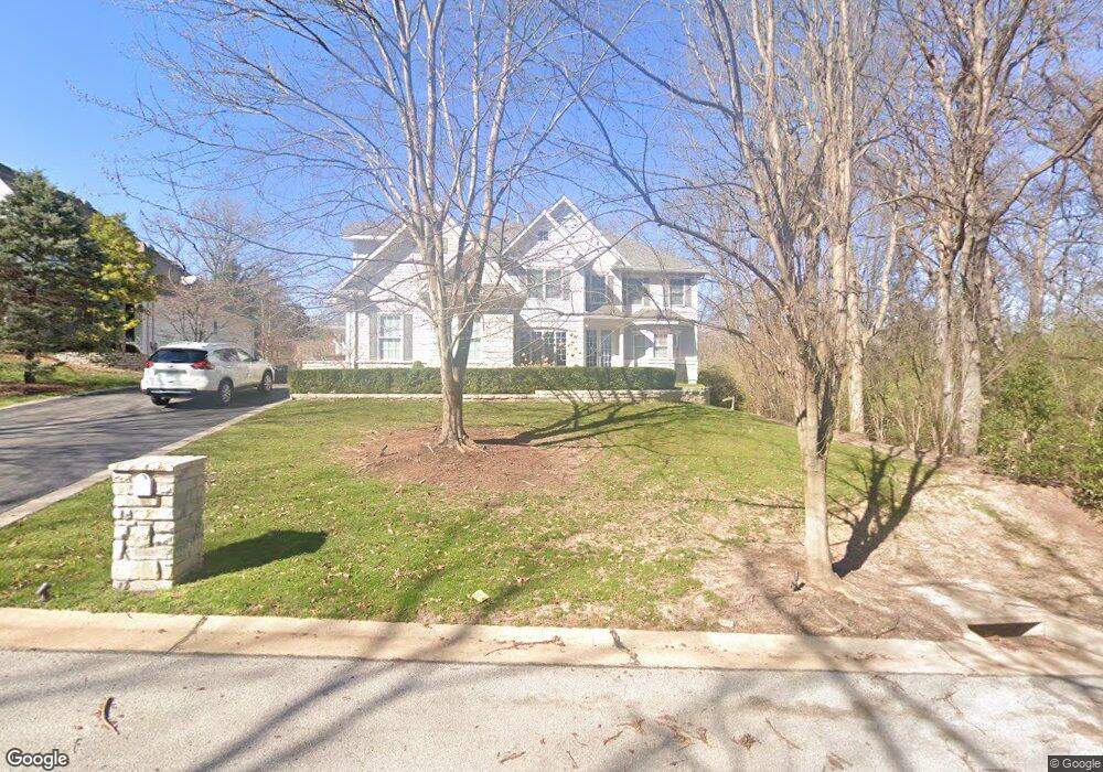
7 Faron Hill Rd Saint Louis, MO 63141
Estimated Value: $1,510,000 - $1,703,000
6
Beds
7
Baths
4,418
Sq Ft
$364/Sq Ft
Est. Value
About This Home
This home is located at 7 Faron Hill Rd, Saint Louis, MO 63141 and is currently estimated at $1,607,471, approximately $363 per square foot. 7 Faron Hill Rd is a home located in St. Louis County with nearby schools including Ladue 5th Grade Center, Spoede Elementary School, and Ladue Middle.
Ownership History
Date
Name
Owned For
Owner Type
Purchase Details
Closed on
Jul 15, 2011
Sold by
Shurmur Patrick C and Shurmur Jennifer L
Bought by
Scales Daryl H and Newsom Scales Connie M
Current Estimated Value
Home Financials for this Owner
Home Financials are based on the most recent Mortgage that was taken out on this home.
Original Mortgage
$759,200
Outstanding Balance
$515,851
Interest Rate
4.25%
Mortgage Type
New Conventional
Estimated Equity
$1,091,620
Purchase Details
Closed on
Jul 27, 2009
Sold by
Hodes Robert D
Bought by
Shurmur Patrick C and Shurmur Jennifer L
Home Financials for this Owner
Home Financials are based on the most recent Mortgage that was taken out on this home.
Original Mortgage
$693,750
Interest Rate
4.75%
Mortgage Type
Purchase Money Mortgage
Purchase Details
Closed on
Oct 30, 2008
Sold by
Hoffman Sheila Rose and Hodes Sheila Rose Hoffman
Bought by
Hodes Robert D
Create a Home Valuation Report for This Property
The Home Valuation Report is an in-depth analysis detailing your home's value as well as a comparison with similar homes in the area
Home Values in the Area
Average Home Value in this Area
Purchase History
| Date | Buyer | Sale Price | Title Company |
|---|---|---|---|
| Scales Daryl H | -- | Freedom Title Llc | |
| Shurmur Patrick C | $925,000 | None Available | |
| Hodes Robert D | -- | None Available |
Source: Public Records
Mortgage History
| Date | Status | Borrower | Loan Amount |
|---|---|---|---|
| Open | Scales Daryl H | $759,200 | |
| Previous Owner | Shurmur Patrick C | $693,750 |
Source: Public Records
Tax History Compared to Growth
Tax History
| Year | Tax Paid | Tax Assessment Tax Assessment Total Assessment is a certain percentage of the fair market value that is determined by local assessors to be the total taxable value of land and additions on the property. | Land | Improvement |
|---|---|---|---|---|
| 2025 | $17,285 | $264,990 | $62,620 | $202,370 |
| 2024 | $17,285 | $248,120 | $59,490 | $188,630 |
| 2023 | $17,263 | $248,120 | $59,490 | $188,630 |
| 2022 | $16,783 | $232,180 | $50,880 | $181,300 |
| 2021 | $19,151 | $267,040 | $50,880 | $216,160 |
| 2020 | $15,068 | $207,330 | $50,880 | $156,450 |
| 2019 | $14,807 | $207,330 | $50,880 | $156,450 |
| 2018 | $14,755 | $190,820 | $34,680 | $156,140 |
| 2017 | $14,733 | $190,820 | $34,680 | $156,140 |
| 2016 | $14,577 | $184,070 | $31,310 | $152,760 |
| 2015 | $13,906 | $184,070 | $31,310 | $152,760 |
| 2014 | $13,099 | $167,980 | $23,810 | $144,170 |
Source: Public Records
Map
Nearby Homes
- 2 Wedgewood Ln
- 556 N Graeser Rd
- 814 Mary Meadows Ln
- 866 Deaver Ln
- 817 Larkin Ave
- 18 Sona Ln
- 832 Larkin Ave
- 12 Morwood Ln
- 970 N Spoede Rd Unit 24
- 10 Spoede Woods Dr
- 1 Allegro Ln
- 1033 Wilton Royal Dr Unit 210
- 1033 Wilton Royal Dr Unit 107
- 1033 Wilton Royal Dr Unit 204
- 1060 Port Diane Dr
- 11017 Sandistan Dr
- 1054 Willow Brook Dr
- 11220 Trieste Dr
- 10469 Briarbend Dr Unit 3
- 50 Willow Brook Dr
- 5 Faron Hill Rd
- 3 Faron Hill Rd
- 678 Graeser Rd
- 5 Wedgewood Ln
- 12 Winfield Pointe Ln
- 718 Graeser Rd
- 809 Deaver Ln
- 803 Deaver Ln
- 6 Wedgewood Ln
- 4 Wedgewood Ln
- 815 Deaver Ln
- 11 Winfield Pointe Ln
- 626 Graeser Rd
- 3 Wedgewood Ln
- 726 Graeser Rd
- 710 Graeser Rd
- 7 Wedgewood Ln
- 2 Winfield Pointe Ln
- 26 Colonial Hills Pkwy
- 10 Winfield Pointe Ln