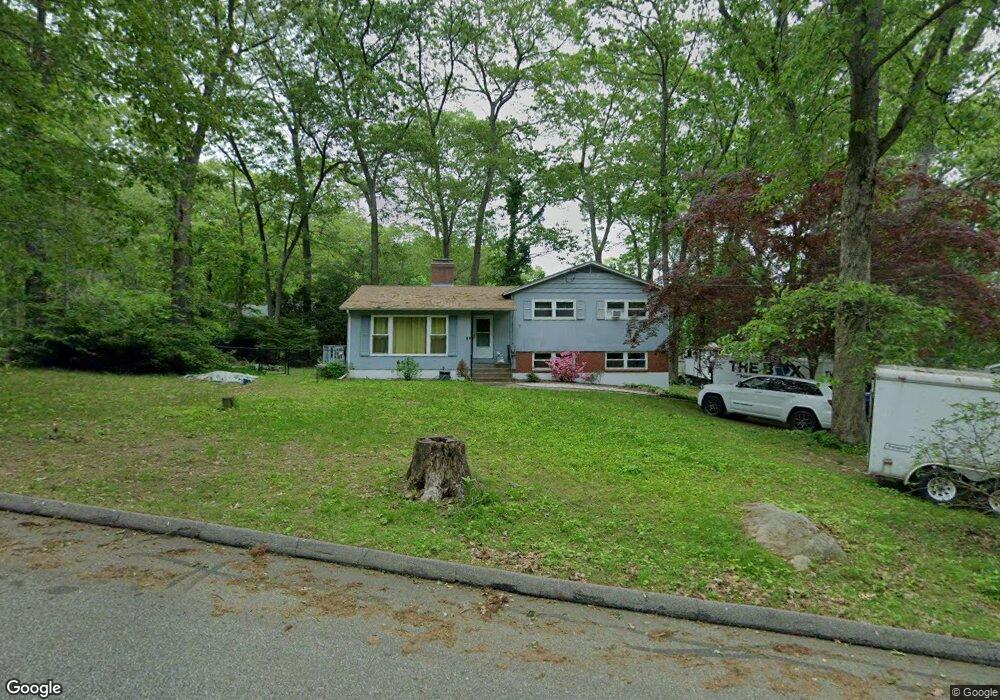
7 Forest Ln Gales Ferry, CT 06335
Estimated Value: $375,000 - $398,136
3
Beds
2
Baths
1,207
Sq Ft
$318/Sq Ft
Est. Value
About This Home
This home is located at 7 Forest Ln, Gales Ferry, CT 06335 and is currently estimated at $383,534, approximately $317 per square foot. 7 Forest Ln is a home located in New London County with nearby schools including Ledyard Middle School, Ledyard High School, and Integrated Day Charter School.
Ownership History
Date
Name
Owned For
Owner Type
Purchase Details
Closed on
May 31, 2006
Sold by
Grayson Theodora R and Hollis Gloria A
Bought by
Ohanlon Terrence and Ohanlon Donna
Current Estimated Value
Home Financials for this Owner
Home Financials are based on the most recent Mortgage that was taken out on this home.
Original Mortgage
$235,800
Outstanding Balance
$138,476
Interest Rate
6.55%
Estimated Equity
$245,058
Purchase Details
Closed on
Apr 20, 1999
Sold by
Macewen George B and Macewen Sharon M
Bought by
Grayson Theodora R and Hollis Gloria A
Home Financials for this Owner
Home Financials are based on the most recent Mortgage that was taken out on this home.
Original Mortgage
$107,200
Interest Rate
7.13%
Purchase Details
Closed on
Jul 11, 1988
Sold by
Weller Gary
Bought by
Macewen George
Home Financials for this Owner
Home Financials are based on the most recent Mortgage that was taken out on this home.
Original Mortgage
$137,700
Interest Rate
10.54%
Create a Home Valuation Report for This Property
The Home Valuation Report is an in-depth analysis detailing your home's value as well as a comparison with similar homes in the area
Home Values in the Area
Average Home Value in this Area
Purchase History
| Date | Buyer | Sale Price | Title Company |
|---|---|---|---|
| Ohanlon Terrence | $262,000 | -- | |
| Grayson Theodora R | $134,000 | -- | |
| Macewen George | $153,000 | -- |
Source: Public Records
Mortgage History
| Date | Status | Borrower | Loan Amount |
|---|---|---|---|
| Open | Macewen George | $235,800 | |
| Previous Owner | Macewen George | $107,200 | |
| Previous Owner | Macewen George | $137,700 |
Source: Public Records
Tax History Compared to Growth
Tax History
| Year | Tax Paid | Tax Assessment Tax Assessment Total Assessment is a certain percentage of the fair market value that is determined by local assessors to be the total taxable value of land and additions on the property. | Land | Improvement |
|---|---|---|---|---|
| 2025 | $5,002 | $134,680 | $43,400 | $91,280 |
| 2024 | $4,727 | $134,260 | $43,400 | $90,860 |
| 2023 | $4,640 | $134,260 | $43,400 | $90,860 |
| 2022 | $4,541 | $134,260 | $43,400 | $90,860 |
| 2021 | $4,511 | $134,260 | $43,400 | $90,860 |
| 2020 | $4,636 | $132,580 | $45,500 | $87,080 |
| 2019 | $4,648 | $132,580 | $45,500 | $87,080 |
| 2018 | $4,546 | $132,580 | $45,500 | $87,080 |
| 2017 | $4,314 | $132,580 | $45,500 | $87,080 |
| 2016 | $4,229 | $132,580 | $45,500 | $87,080 |
| 2015 | $4,030 | $132,580 | $45,500 | $87,080 |
| 2014 | $4,209 | $138,320 | $45,500 | $92,820 |
Source: Public Records
Map
Nearby Homes
- 5 Bittersweet Dr
- 15 Drawbridge Rd
- 16 Marlene Dr
- 3 Holdsworth Rd
- 0 Clarks Falls Unit 24089817
- 123A Whalehead Rd
- 11 Willow Ln
- 7 Briarwood Ct
- 421 Kitemaug Rd
- 2 Garden Ct
- 7 Barn Rd
- 65 Dydo Dr
- 5 Arrowhead Dr
- 6 Arrowhead Dr
- 178 Route 2a
- 165 Massapeag Rd
- 104 Route 2a
- 6 Route 117
- 16 Marty's Way
- 127 Massapeag Rd
- 9 Forest Ln
- 20 N Glenwoods Rd
- 18 N Glenwoods Rd
- 22 N Glenwoods Rd
- 2 Forest Ln
- 8 Forest Ln
- 13 Forest Ln
- 26 N Glenwoods Rd
- 12 N Glenwoods Rd
- 14 Forest Ln
- 21 N Glenwoods Rd
- 17 N Glenwoods Rd
- 15 N Glenwoods Rd
- 12 Forest Ln
- 11 N Glenwoods Rd
- 10 Forest Ln
- 34 Brewster Dr
- 25 N Glenwoods Rd
- 8 N Glenwoods Rd
- 16 Forest Ln