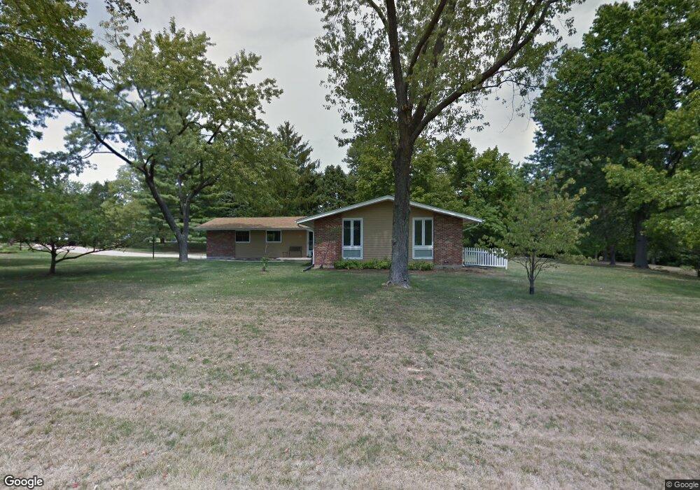
7 Forsythia Ln Saint Louis, MO 63132
Estimated Value: $382,000 - $486,959
3
Beds
3
Baths
1,807
Sq Ft
$241/Sq Ft
Est. Value
About This Home
This home is located at 7 Forsythia Ln, Saint Louis, MO 63132 and is currently estimated at $435,740, approximately $241 per square foot. 7 Forsythia Ln is a home located in St. Louis County with nearby schools including Spoede Elementary School, Ladue 5th Grade Center, and Ladue Middle.
Ownership History
Date
Name
Owned For
Owner Type
Purchase Details
Closed on
Apr 29, 2011
Sold by
Waggoner C Max and Waggoner Carol Levinson
Bought by
Waggoner Carroll Max and Waggoner Carol Levinson
Current Estimated Value
Purchase Details
Closed on
Sep 24, 2003
Sold by
Waggoner C Max and Waggoner Carol Levinson
Bought by
Waggoner C Max and Waggoner Carol Levinson
Home Financials for this Owner
Home Financials are based on the most recent Mortgage that was taken out on this home.
Original Mortgage
$78,700
Interest Rate
6.25%
Mortgage Type
Unknown
Create a Home Valuation Report for This Property
The Home Valuation Report is an in-depth analysis detailing your home's value as well as a comparison with similar homes in the area
Home Values in the Area
Average Home Value in this Area
Purchase History
| Date | Buyer | Sale Price | Title Company |
|---|---|---|---|
| Waggoner Carroll Max | -- | None Available | |
| Waggoner C Max | -- | -- |
Source: Public Records
Mortgage History
| Date | Status | Borrower | Loan Amount |
|---|---|---|---|
| Closed | Waggoner C Max | $78,700 |
Source: Public Records
Tax History Compared to Growth
Tax History
| Year | Tax Paid | Tax Assessment Tax Assessment Total Assessment is a certain percentage of the fair market value that is determined by local assessors to be the total taxable value of land and additions on the property. | Land | Improvement |
|---|---|---|---|---|
| 2025 | $5,163 | $89,190 | $59,000 | $30,190 |
| 2024 | $5,163 | $73,210 | $40,930 | $32,280 |
| 2023 | $5,222 | $73,210 | $40,930 | $32,280 |
| 2022 | $4,559 | $61,620 | $40,930 | $20,690 |
| 2021 | $4,532 | $61,620 | $40,930 | $20,690 |
| 2020 | $4,216 | $56,640 | $33,920 | $22,720 |
| 2019 | $4,081 | $56,640 | $33,920 | $22,720 |
| 2018 | $3,846 | $49,270 | $28,770 | $20,500 |
| 2017 | $3,832 | $49,270 | $28,770 | $20,500 |
| 2016 | $3,619 | $45,000 | $20,960 | $24,040 |
| 2015 | $3,468 | $45,000 | $20,960 | $24,040 |
| 2014 | -- | $44,190 | $15,500 | $28,690 |
Source: Public Records
Map
Nearby Homes
- 9704 Grandview Dr
- 828 Newcastle Dr
- 740 Payson Dr
- 9455 Crockett Dr
- 25 Crabapple Ct
- 12 Stacy Dr
- 10328 Forest Brook Ln Unit H
- 10340 Corbeil Dr Unit 86
- 10344 Forest Brook Ln Unit C
- 10352 Forest Brook Ln Unit H
- 1193 Noa Ln Unit 30
- 9425 Olie Way Rd Unit 29
- 1185 Noa Lane Rd Unit 32
- 1189 Noa Lane Rd Unit 31
- 1181 Rd Unit 33
- 1253 Dielman Rd
- 4 Downey Ln
- 5 Downey Ln
- 10387 Forest Brook Ln
- 9820 Warington Square
- 9 Forsythia Ln
- 2 Forsythia Ln
- 8 Forsythia Ln
- 10 Forsythia Ln
- 9730 Grandview Dr
- 3 Forsythia Ln
- 11 Forsythia Ln
- 1 Forsythia Ln
- 12 Forsythia Ln
- 6 Forsythia Ln
- 5 Forsythia Ln
- 9726 Grandview Dr
- 15 Forsythia Ln
- 14 Forsythia Ln
- 41 Queensbrook Place
- 43 Queensbrook Place
- 9737 Grandview Dr
- 39 Queensbrook Place
- 9722 Grandview Dr
- 9743 Grandview Dr