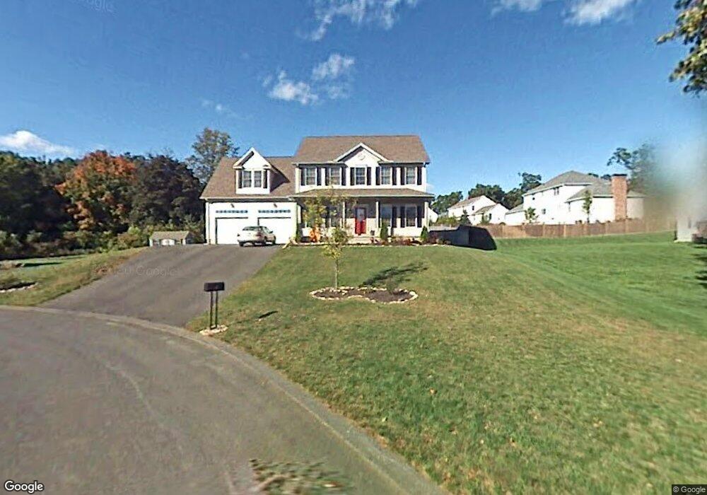
7 Frank Cir Westfield, MA 01085
Estimated Value: $651,332 - $774,000
4
Beds
3
Baths
2,800
Sq Ft
$251/Sq Ft
Est. Value
About This Home
This home is located at 7 Frank Cir, Westfield, MA 01085 and is currently estimated at $703,333, approximately $251 per square foot. 7 Frank Cir is a home located in Hampden County with nearby schools including Westfield High School, St Thomas The Apostle School, and Saint Mary High School.
Ownership History
Date
Name
Owned For
Owner Type
Purchase Details
Closed on
Jun 1, 2011
Sold by
Ringenbach Alan R and Ringenbach Darleen
Bought by
Shrewsbury Scott A and Shrewsbury Vicki W
Current Estimated Value
Home Financials for this Owner
Home Financials are based on the most recent Mortgage that was taken out on this home.
Original Mortgage
$321,937
Interest Rate
4.85%
Mortgage Type
Purchase Money Mortgage
Purchase Details
Closed on
Jun 22, 2005
Sold by
In John Michael Joseph
Bought by
Ringenbach Alan R and Ringenbach Darleen
Home Financials for this Owner
Home Financials are based on the most recent Mortgage that was taken out on this home.
Original Mortgage
$339,200
Interest Rate
5.82%
Mortgage Type
Purchase Money Mortgage
Purchase Details
Closed on
Jun 11, 2004
Sold by
Scarfo Constr Inc
Bought by
In John Michael Joseph
Home Financials for this Owner
Home Financials are based on the most recent Mortgage that was taken out on this home.
Original Mortgage
$249,900
Interest Rate
5.99%
Mortgage Type
Purchase Money Mortgage
Create a Home Valuation Report for This Property
The Home Valuation Report is an in-depth analysis detailing your home's value as well as a comparison with similar homes in the area
Home Values in the Area
Average Home Value in this Area
Purchase History
| Date | Buyer | Sale Price | Title Company |
|---|---|---|---|
| Shrewsbury Scott A | $360,000 | -- | |
| Ringenbach Alan R | $424,222 | -- | |
| In John Michael Joseph | $82,500 | -- |
Source: Public Records
Mortgage History
| Date | Status | Borrower | Loan Amount |
|---|---|---|---|
| Previous Owner | Shrewsbury Scott A | $321,937 | |
| Previous Owner | Ringenbach Alan R | $339,200 | |
| Previous Owner | Ringenbach Alan R | $42,400 | |
| Previous Owner | In John Michael Joseph | $249,900 |
Source: Public Records
Tax History Compared to Growth
Tax History
| Year | Tax Paid | Tax Assessment Tax Assessment Total Assessment is a certain percentage of the fair market value that is determined by local assessors to be the total taxable value of land and additions on the property. | Land | Improvement |
|---|---|---|---|---|
| 2025 | $8,672 | $571,300 | $142,100 | $429,200 |
| 2024 | $8,736 | $547,000 | $129,400 | $417,600 |
| 2023 | $8,463 | $498,400 | $123,400 | $375,000 |
| 2022 | $8,147 | $440,600 | $109,600 | $331,000 |
| 2021 | $7,905 | $418,700 | $103,500 | $315,200 |
| 2020 | $7,864 | $408,500 | $103,500 | $305,000 |
| 2019 | $7,701 | $391,500 | $98,900 | $292,600 |
| 2018 | $7,579 | $391,500 | $98,900 | $292,600 |
| 2017 | $7,387 | $380,400 | $100,200 | $280,200 |
| 2016 | $7,181 | $369,400 | $100,200 | $269,200 |
| 2015 | $6,812 | $367,400 | $100,200 | $267,200 |
| 2014 | $5,100 | $367,400 | $100,200 | $267,200 |
Source: Public Records
Map
Nearby Homes
- 242 Eastwood Dr
- 346 E Mountain Rd
- 0 E Mountain Rd
- 0 Little River Road ( Rear )
- 120 Woodcliff Dr
- 103 Feeding Hills Rd
- 0 Feeding Hills Rd
- 244 Union St
- 99 Hillcrest Cir
- 94 Pineridge Dr
- 60 Shaker Rd
- 169 Chilson Rd
- 119 Union St Unit 4
- 0 Holyoke Rd
- 138 Main St Unit 13
- 138 Main St Unit 11
- 111 Union St Unit 6
- 26 Deepwoods Dr
- 14 Lynnwood Dr
- 13 William St