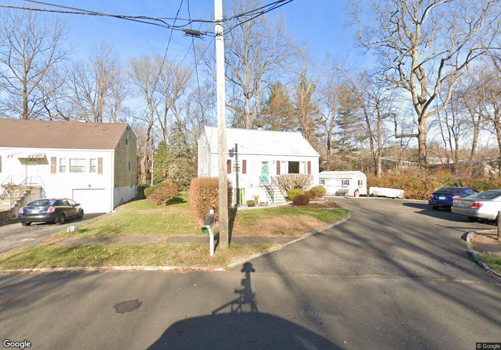
7 Freedman Dr Norwalk, CT 06854
West Norwalk NeighborhoodEstimated Value: $648,669 - $677,000
5
Beds
3
Baths
1,428
Sq Ft
$465/Sq Ft
Est. Value
About This Home
This home is located at 7 Freedman Dr, Norwalk, CT 06854 and is currently estimated at $663,917, approximately $464 per square foot. 7 Freedman Dr is a home located in Fairfield County with nearby schools including Fox Run Elementary School, Ponus Ridge Middle School, and Brien Mcmahon High School.
Ownership History
Date
Name
Owned For
Owner Type
Purchase Details
Closed on
May 22, 2014
Sold by
Labonte Norman
Bought by
Labonte Norman
Current Estimated Value
Purchase Details
Closed on
Feb 1, 1999
Sold by
Labonte Norman and Labonte Juanita
Bought by
Labonte Norman J
Create a Home Valuation Report for This Property
The Home Valuation Report is an in-depth analysis detailing your home's value as well as a comparison with similar homes in the area
Home Values in the Area
Average Home Value in this Area
Purchase History
| Date | Buyer | Sale Price | Title Company |
|---|---|---|---|
| Labonte Norman | -- | -- | |
| Labonte Norman J | $200,000 | -- | |
| Labonte Norman | -- | -- | |
| Labonte Norman J | $200,000 | -- |
Source: Public Records
Mortgage History
| Date | Status | Borrower | Loan Amount |
|---|---|---|---|
| Open | Labonte Norman J | $221,815 | |
| Closed | Labonte Norman J | $226,902 |
Source: Public Records
Tax History Compared to Growth
Tax History
| Year | Tax Paid | Tax Assessment Tax Assessment Total Assessment is a certain percentage of the fair market value that is determined by local assessors to be the total taxable value of land and additions on the property. | Land | Improvement |
|---|---|---|---|---|
| 2025 | $8,471 | $353,760 | $148,900 | $204,860 |
| 2024 | $8,346 | $353,760 | $148,900 | $204,860 |
| 2023 | $6,269 | $249,140 | $103,990 | $145,150 |
| 2022 | $6,152 | $249,140 | $103,990 | $145,150 |
| 2021 | $5,992 | $249,140 | $103,990 | $145,150 |
| 2020 | $5,989 | $249,140 | $103,990 | $145,150 |
| 2019 | $5,821 | $249,140 | $103,990 | $145,150 |
| 2018 | $5,904 | $221,450 | $107,970 | $113,480 |
| 2017 | $5,701 | $221,450 | $107,970 | $113,480 |
| 2016 | $5,647 | $221,450 | $107,970 | $113,480 |
| 2015 | $5,631 | $221,450 | $107,970 | $113,480 |
| 2014 | $5,558 | $221,450 | $107,970 | $113,480 |
Source: Public Records
Map
Nearby Homes
- 10 Ledgebrook Dr Unit 1
- 146 Gillies Ln Unit 146
- 6 Orlando Rd
- 29 Nash Place
- 29 Priscilla Rd
- 1 Horizon Dr Unit 2
- 39 Chatham Dr
- 13 Joemar Rd
- 63 Ferris Ave
- 14 Windward Rd
- 8 Crown Ave
- 14 Ferris Ave Unit 9
- 6 W Couch St
- 59 Taylor Ave
- 47 Taylor Ave
- 17 Woodlawn Ave
- 218 N Taylor Ave
- 3 Wynne Rd
- 105 Richards Ave Unit 2305
- 42 Stuart Ave Unit A1
- 5 Freedman Dr
- 29 Ledgebrook Dr
- 3 Freedman Dr
- 2 Freedman Dr
- 21 Ledgebrook Dr Unit G1
- 21 Ledgebrook Dr
- 23 Ledgebrook Dr
- 22 Ledgebrook Dr
- 23 Ledgebrook Dr Unit 23
- 22 Ledgebrook Dr Unit 22
- 22 Ledgebrook Dr Unit GL2
- 27 Ledgebrook Dr
- 6 Freedman Dr
- 12 Ledgebrook Dr
- 35 Ledgebrook Dr
- 36 Ledgebrook Dr
- 36 Ledgebrook Dr Unit 36
- 9 Freedman Dr
- 33 Ledgebrook Dr
- 32 Ledgebrook Dr