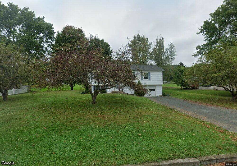
7 Garside St Mansfield, PA 16933
Estimated Value: $186,000 - $238,000
3
Beds
1
Bath
1,176
Sq Ft
$187/Sq Ft
Est. Value
About This Home
This home is located at 7 Garside St, Mansfield, PA 16933 and is currently estimated at $219,457, approximately $186 per square foot. 7 Garside St is a home located in Tioga County with nearby schools including Warren L. Miller Elementary School, North Penn-Mansfield Jr./Sr. High School, and New Covenant Academy.
Ownership History
Date
Name
Owned For
Owner Type
Purchase Details
Closed on
Feb 15, 2017
Sold by
Orchowski Bradley S and Orchowski Sheila A
Bought by
Orchowski Bradley S
Current Estimated Value
Purchase Details
Closed on
Dec 21, 2007
Sold by
Krutsick Walter J
Bought by
Orchowski Bradley S and Orchowski Sheila A
Home Financials for this Owner
Home Financials are based on the most recent Mortgage that was taken out on this home.
Original Mortgage
$99,000
Outstanding Balance
$18,207
Interest Rate
6.27%
Mortgage Type
New Conventional
Estimated Equity
$201,250
Create a Home Valuation Report for This Property
The Home Valuation Report is an in-depth analysis detailing your home's value as well as a comparison with similar homes in the area
Home Values in the Area
Average Home Value in this Area
Purchase History
| Date | Buyer | Sale Price | Title Company |
|---|---|---|---|
| Orchowski Bradley S | -- | None Available | |
| Orchowski Bradley S | $110,000 | None Available |
Source: Public Records
Mortgage History
| Date | Status | Borrower | Loan Amount |
|---|---|---|---|
| Open | Orchowski Bradley S | $99,000 |
Source: Public Records
Tax History Compared to Growth
Tax History
| Year | Tax Paid | Tax Assessment Tax Assessment Total Assessment is a certain percentage of the fair market value that is determined by local assessors to be the total taxable value of land and additions on the property. | Land | Improvement |
|---|---|---|---|---|
| 2025 | $3,530 | $187,550 | $27,920 | $159,630 |
| 2024 | $4,995 | $187,550 | $27,920 | $159,630 |
| 2023 | $3,046 | $91,530 | $19,260 | $72,270 |
| 2022 | $3,015 | $91,530 | $19,260 | $72,270 |
| 2021 | $2,982 | $91,530 | $19,260 | $72,270 |
| 2020 | $2,966 | $91,530 | $19,260 | $72,270 |
| 2019 | $2,954 | $91,530 | $19,260 | $72,270 |
| 2018 | $2,907 | $91,530 | $19,260 | $72,270 |
| 2017 | -- | $91,530 | $19,260 | $72,270 |
| 2016 | $2,793 | $91,530 | $19,260 | $72,270 |
| 2015 | -- | $91,530 | $19,260 | $72,270 |
| 2014 | -- | $91,530 | $19,260 | $72,270 |
Source: Public Records
Map
Nearby Homes
- 11 Garside St
- - Townview Dr
- 0 Cherry Ridge Dr
- 28 Sherwood St
- 44 W Elmira St
- 342 Smoke Rise
- 72 Saint James St
- - S Main St
- 120 S Main St
- 175 Saint James St
- 2141-2165 S Main St
- 0 Fourth St
- Lot 14 Buckrun Rd
- 209 Mulberry Ln
- 16547 Route 6
- 101 Hemlock Dr
- 62 Canoe Camp Creek Rd
- 18789 Route 6
- 877 Odell Rd
- 2313 Pennsylvania 660
- 9 Garside St
- 5 Garside St
- 10 Garside St
- 8 Garside St
- 12 Garside St
- 303 Extension St
- 6 Garside St
- 14 Garside St
- 50 Wakefield Terrace
- 40 Wakefield Terrace
- 136 Decker St
- 4 Garside St
- 110 Decker St
- 60 Wakefield Terrace
- 16 Garside St
- 108 Decker St
- 70 Wakefield Terrace
- 20 Wakefield Terrace
- 1 Garside St
- 2 Garside St