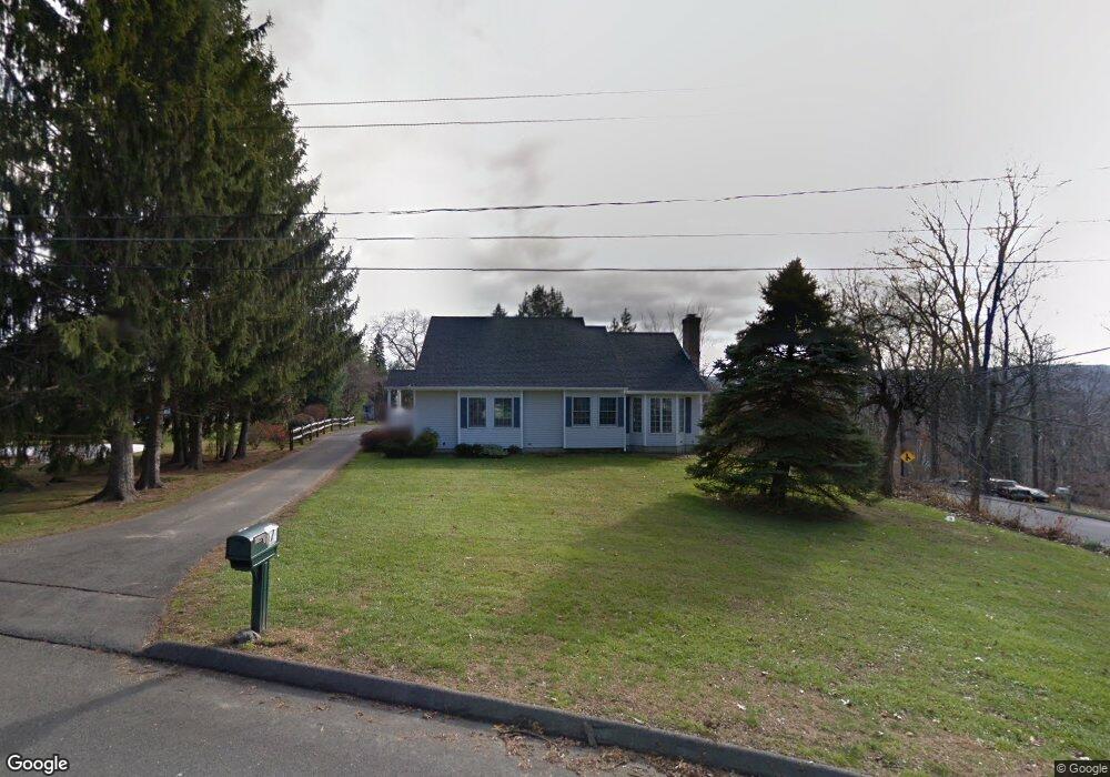
7 George St Middlebury, CT 06762
Estimated Value: $962,714
6
Beds
3
Baths
3,489
Sq Ft
$276/Sq Ft
Est. Value
About This Home
This home is located at 7 George St, Middlebury, CT 06762 and is currently estimated at $962,714, approximately $275 per square foot. 7 George St is a home located in New Haven County with nearby schools including Middlebury Elementary School, Memorial Middle School, and Pomperaug Regional High School.
Ownership History
Date
Name
Owned For
Owner Type
Purchase Details
Closed on
Dec 14, 1998
Sold by
Bunker Linda and Ciaramella Nancy
Bought by
Conn Inst For Blind
Current Estimated Value
Purchase Details
Closed on
Feb 22, 1988
Sold by
Mazzalupo Frank
Bought by
Bunker Linda
Home Financials for this Owner
Home Financials are based on the most recent Mortgage that was taken out on this home.
Original Mortgage
$130,000
Interest Rate
10.45%
Mortgage Type
Purchase Money Mortgage
Create a Home Valuation Report for This Property
The Home Valuation Report is an in-depth analysis detailing your home's value as well as a comparison with similar homes in the area
Home Values in the Area
Average Home Value in this Area
Purchase History
| Date | Buyer | Sale Price | Title Company |
|---|---|---|---|
| Conn Inst For Blind | $299,000 | -- | |
| Conn Inst For Blind | $299,000 | -- | |
| Bunker Linda | $276,000 | -- |
Source: Public Records
Mortgage History
| Date | Status | Borrower | Loan Amount |
|---|---|---|---|
| Open | Bunker Linda | $438,000 | |
| Previous Owner | Bunker Linda | $130,000 |
Source: Public Records
Tax History Compared to Growth
Tax History
| Year | Tax Paid | Tax Assessment Tax Assessment Total Assessment is a certain percentage of the fair market value that is determined by local assessors to be the total taxable value of land and additions on the property. | Land | Improvement |
|---|---|---|---|---|
| 2025 | $0 | $383,300 | $80,100 | $303,200 |
| 2024 | $8,650 | $383,300 | $80,100 | $303,200 |
| 2023 | $8,650 | $383,300 | $80,100 | $303,200 |
| 2022 | $0 | $383,300 | $80,100 | $303,200 |
| 2021 | $0 | $279,600 | $91,300 | $188,300 |
| 2020 | $0 | $279,600 | $91,300 | $188,300 |
| 2019 | $0 | $279,600 | $91,300 | $188,300 |
| 2018 | $0 | $279,600 | $91,300 | $188,300 |
| 2017 | $0 | $279,600 | $91,300 | $188,300 |
| 2016 | $8,650 | $287,200 | $108,200 | $179,000 |
| 2015 | $8,650 | $287,200 | $108,200 | $179,000 |
| 2014 | $8,426 | $287,200 | $108,200 | $179,000 |
Source: Public Records
Map
Nearby Homes
- 116 Yale Ave
- 73 Yale Ave
- 32 Yale Ave
- 3 Pine Ridge Unit 23
- 0 Ferndale Ave
- 141 Joshua Town Rd
- 51 Cross Rd
- 1 Richardson Dr
- 1 Umberfield Rd
- 61 Campfield Rd
- 383 Leonard Rd
- 0 Mason Ave
- 105 Jericho Rd
- 120 Mason Ave
- 126 Colonial Ave
- 110 Wooster Ave
- 197 Hickory Hill Dr
- 72 Carriage Dr
- 587 Shadduck Rd
- 25 Parkwood Ave