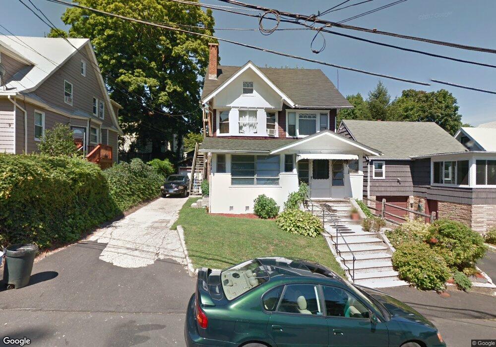
7 Gibson Ct Norwalk, CT 06854
Brookside NeighborhoodEstimated Value: $438,000 - $761,000
3
Beds
3
Baths
2,019
Sq Ft
$318/Sq Ft
Est. Value
About This Home
This home is located at 7 Gibson Ct, Norwalk, CT 06854 and is currently estimated at $642,704, approximately $318 per square foot. 7 Gibson Ct is a home located in Fairfield County with nearby schools including Jefferson Marine Science Elementary School, Ponus Ridge Middle School, and Brien Mcmahon High School.
Ownership History
Date
Name
Owned For
Owner Type
Purchase Details
Closed on
Oct 25, 2021
Sold by
Browder Laurine
Bought by
Castor Kurt and Mitchell Carol
Current Estimated Value
Home Financials for this Owner
Home Financials are based on the most recent Mortgage that was taken out on this home.
Original Mortgage
$309,294
Outstanding Balance
$282,659
Interest Rate
2.8%
Mortgage Type
FHA
Estimated Equity
$360,045
Create a Home Valuation Report for This Property
The Home Valuation Report is an in-depth analysis detailing your home's value as well as a comparison with similar homes in the area
Home Values in the Area
Average Home Value in this Area
Purchase History
| Date | Buyer | Sale Price | Title Company |
|---|---|---|---|
| Castor Kurt | $315,000 | None Available | |
| Castor Kurt | $315,000 | None Available |
Source: Public Records
Mortgage History
| Date | Status | Borrower | Loan Amount |
|---|---|---|---|
| Open | Castor Kurt | $309,294 | |
| Closed | Castor Kurt | $309,294 |
Source: Public Records
Tax History
| Year | Tax Paid | Tax Assessment Tax Assessment Total Assessment is a certain percentage of the fair market value that is determined by local assessors to be the total taxable value of land and additions on the property. | Land | Improvement |
|---|---|---|---|---|
| 2025 | $9,115 | $381,390 | $126,690 | $254,700 |
| 2024 | $8,980 | $381,390 | $126,690 | $254,700 |
| 2023 | $6,191 | $246,780 | $110,330 | $136,450 |
| 2022 | $6,057 | $246,780 | $110,330 | $136,450 |
| 2021 | $5,915 | $246,780 | $110,330 | $136,450 |
| 2020 | $5,912 | $246,780 | $110,330 | $136,450 |
| 2019 | $5,754 | $246,780 | $110,330 | $136,450 |
| 2018 | $5,031 | $189,090 | $105,950 | $83,140 |
| 2017 | $4,856 | $189,090 | $105,950 | $83,140 |
| 2016 | $4,810 | $189,090 | $105,950 | $83,140 |
| 2015 | $4,797 | $189,090 | $105,950 | $83,140 |
| 2014 | $4,735 | $189,090 | $105,950 | $83,140 |
Source: Public Records
Map
Nearby Homes
- 187 Flax Hill Rd Unit D5
- 15 Madison St Unit B7
- 115 Flax Hill Rd Unit 10
- 225 Flax Hill Rd Unit 2
- 6 Norton Place
- 47 Taylor Ave
- 10 Keith St
- 22 Doctor Martin Luther King Junior Dr Unit B1
- 28 Chestnut St
- 94 Washington St Unit 6
- 94 Washington St Unit 20
- 83 Washington St Unit 3C
- 6 W Couch St
- 126 Washington St Unit 304
- 125 Washington St Unit 206
- 131 Washington St Unit 204
- 8 Crown Ave
- 12 Arbor Ct
- 33 N Water St Unit 505
- 33 N Water St Unit 804
- 5 Gibson Ct
- 9 Gibson Ct
- 3 Gibson Ct
- 168 Flax Hill Rd
- 162 Flax Hill Rd
- 8 Gibson Ct
- 10 Gibson Ct
- 178 Flax Hill Rd Unit C204
- 178 Flax Hill Rd Unit C203
- 178 Flax Hill Rd Unit C202
- 178 Flax Hill Rd Unit C201
- 178 Flax Hill Rd Unit C102
- 178 Flax Hill Rd Unit C101
- 178 Flax Hill Rd Unit B208
- 178 Flax Hill Rd Unit B207
- 178 Flax Hill Rd Unit B206
- 178 Flax Hill Rd Unit B205
- 178 Flax Hill Rd Unit B204
- 178 Flax Hill Rd Unit B203
- 178 Flax Hill Rd Unit B202
Your Personal Tour Guide
Ask me questions while you tour the home.