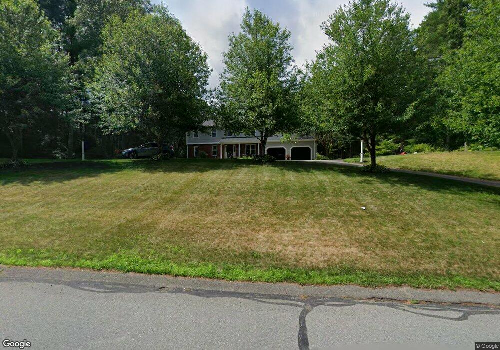
7 High Pines Dr Kingston, MA 02364
Estimated Value: $785,000 - $1,013,000
4
Beds
3
Baths
2,408
Sq Ft
$373/Sq Ft
Est. Value
About This Home
This home is located at 7 High Pines Dr, Kingston, MA 02364 and is currently estimated at $897,431, approximately $372 per square foot. 7 High Pines Dr is a home located in Plymouth County with nearby schools including Kingston Elementary School, Silver Lake Regional High School, and Kingston Intermediate School.
Ownership History
Date
Name
Owned For
Owner Type
Purchase Details
Closed on
Mar 5, 2004
Sold by
Romano Michael T and Romano Cynthia A
Bought by
Romano Cynthia A
Current Estimated Value
Purchase Details
Closed on
Jun 28, 2002
Sold by
Bondar Cheryl and Bondar David S
Bought by
Romano Michael T and Romano Cynthia A
Purchase Details
Closed on
Aug 14, 1995
Sold by
Edison Dev Corp
Bought by
Bondar Cheryl D and Bondar David S
Create a Home Valuation Report for This Property
The Home Valuation Report is an in-depth analysis detailing your home's value as well as a comparison with similar homes in the area
Home Values in the Area
Average Home Value in this Area
Purchase History
| Date | Buyer | Sale Price | Title Company |
|---|---|---|---|
| Romano Cynthia A | -- | -- | |
| Romano Michael T | $429,500 | -- | |
| Bondar Cheryl D | $220,000 | -- |
Source: Public Records
Mortgage History
| Date | Status | Borrower | Loan Amount |
|---|---|---|---|
| Open | Bondar Cheryl D | $325,500 | |
| Closed | Bondar Cheryl D | $325,000 |
Source: Public Records
Tax History Compared to Growth
Tax History
| Year | Tax Paid | Tax Assessment Tax Assessment Total Assessment is a certain percentage of the fair market value that is determined by local assessors to be the total taxable value of land and additions on the property. | Land | Improvement |
|---|---|---|---|---|
| 2025 | $9,511 | $733,300 | $237,000 | $496,300 |
| 2024 | $8,755 | $688,800 | $237,000 | $451,800 |
| 2023 | $8,715 | $652,300 | $237,000 | $415,300 |
| 2022 | $8,458 | $580,100 | $215,500 | $364,600 |
| 2021 | $4,475 | $535,400 | $215,500 | $319,900 |
| 2020 | $8,534 | $524,200 | $215,500 | $308,700 |
| 2019 | $4,294 | $517,800 | $224,100 | $293,700 |
| 2018 | $8,019 | $487,500 | $227,600 | $259,900 |
| 2017 | $7,885 | $477,900 | $217,900 | $260,000 |
| 2016 | $7,535 | $427,900 | $199,400 | $228,500 |
| 2015 | $7,311 | $431,600 | $199,400 | $232,200 |
| 2014 | $7,311 | $438,300 | $202,500 | $235,800 |
Source: Public Records
Map
Nearby Homes
- 41 High Pines Dr
- 420 Elm St
- 2 Continental Ct
- 7 Hemlock St
- 39 South St
- 294 Country Club Way
- 34 Fairway Dr
- 484 Country Club Way
- 91 Monks Hill Rd
- 16 Copper Beech Dr Marion Dr
- 25 Nelson St
- 79 Wapping Rd
- 83 Wapping Rd
- 97 Wapping Rd
- 14 Wapping Rd
- 26 Brookings Dr
- 228 Main St
- 231 Main St
- Lot 17-1 Howland's Ln
- 2 Clinton Terrace
- 11 High Pines Dr
- 120 Indian Pond Rd
- 10 High Pines Dr
- 115 Indian Pond Rd
- 14 High Pines Dr
- 2 Jasons Hill Ln
- 26 Round Hill Rd
- 125 Indian Pond Rd
- 25 High Pines Dr
- 109 Indian Pond Rd
- 3 Pine Cone Dr
- 4 Holly Tree Dr
- 11 Pine Cone Dr
- 108 Indian Pond Rd
- 16 Fox Den Rd
- 4 Jasons Hill Ln
- 105 Indian Pond Rd
- 129 Indian Pond Rd
- 33 High Pines Dr
- 128 Indian Pond Rd