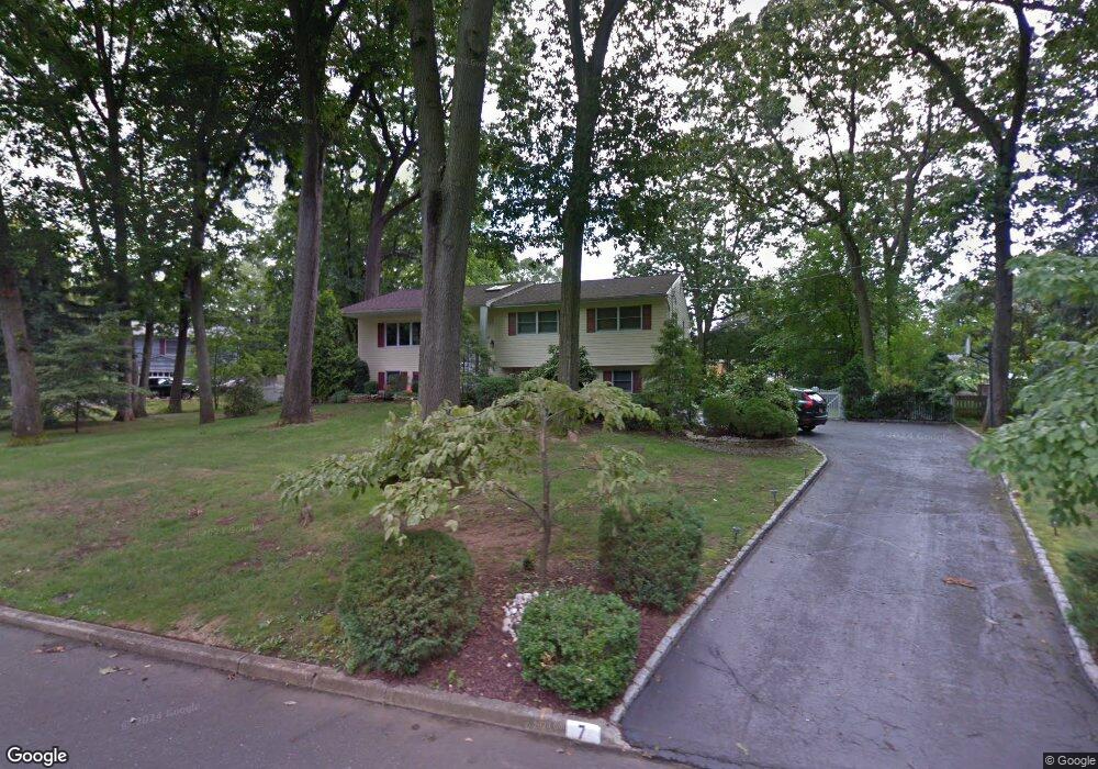
7 High Point Rd Lincroft, NJ 07738
Estimated Value: $846,283 - $1,109,000
4
Beds
3
Baths
2,150
Sq Ft
$449/Sq Ft
Est. Value
About This Home
This home is located at 7 High Point Rd, Lincroft, NJ 07738 and is currently estimated at $966,071, approximately $449 per square foot. 7 High Point Rd is a home located in Monmouth County with nearby schools including Lincroft Elementary School, Thompson Middle School, and Middletown - South High School.
Ownership History
Date
Name
Owned For
Owner Type
Purchase Details
Closed on
Aug 19, 2011
Sold by
Desocio David M and Desocio Marie
Bought by
Rosenstock Brett and Quartararo Nancy
Current Estimated Value
Home Financials for this Owner
Home Financials are based on the most recent Mortgage that was taken out on this home.
Original Mortgage
$415,000
Outstanding Balance
$286,670
Interest Rate
4.52%
Mortgage Type
New Conventional
Estimated Equity
$679,401
Purchase Details
Closed on
Sep 19, 1995
Sold by
Pyle Stephen
Bought by
Desocio David and Desocio Marie
Home Financials for this Owner
Home Financials are based on the most recent Mortgage that was taken out on this home.
Original Mortgage
$90,000
Interest Rate
7.37%
Purchase Details
Closed on
Oct 25, 1994
Sold by
Nylund Leslie
Bought by
Pyle Stephen and Pyle Marie Bell
Home Financials for this Owner
Home Financials are based on the most recent Mortgage that was taken out on this home.
Original Mortgage
$168,000
Interest Rate
8.65%
Create a Home Valuation Report for This Property
The Home Valuation Report is an in-depth analysis detailing your home's value as well as a comparison with similar homes in the area
Home Values in the Area
Average Home Value in this Area
Purchase History
| Date | Buyer | Sale Price | Title Company |
|---|---|---|---|
| Rosenstock Brett | $520,000 | First American Title Ins Co | |
| Desocio David | $235,000 | -- | |
| Pyle Stephen | $238,000 | -- |
Source: Public Records
Mortgage History
| Date | Status | Borrower | Loan Amount |
|---|---|---|---|
| Open | Rosenstock Brett | $415,000 | |
| Previous Owner | Desocio David | $90,000 | |
| Previous Owner | Pyle Stephen | $168,000 |
Source: Public Records
Tax History
| Year | Tax Paid | Tax Assessment Tax Assessment Total Assessment is a certain percentage of the fair market value that is determined by local assessors to be the total taxable value of land and additions on the property. | Land | Improvement |
|---|---|---|---|---|
| 2025 | $11,017 | $745,500 | $476,300 | $269,200 |
| 2024 | $9,347 | $669,700 | $405,400 | $264,300 |
Source: Public Records
Map
Nearby Homes
- 1 E Point Rd
- 202 Woodland Dr
- 45 Turnberry Dr
- 97 Lawley Dr
- 8 Glenwood Dr
- 158 Cloverdale Cir
- 31 Branford Cir
- 19 Meadow Dr
- 4 Rivers Edge Dr
- 47 Willow Rd
- 7 Boxwood Terrace Unit 250
- 29 Rambling Meadow Ct
- 15 Pica Place
- 18 Pica Place
- 33 Chapin Ave
- 56 Plum St
- 29 Dickinson Ct Unit 7
- 30 Raven Rd
- 6 Buchhop Ln
- 7 Buchhop Ln
- 5 High Point Rd
- 9 High Point Rd
- 8 High Point Rd
- 3 High Point Rd
- 6 High Point Rd
- 10 High Point Rd
- 3 E Point Rd
- 4 High Point Rd
- 12 High Point Rd
- 13 High Point Rd
- 1 N Point Rd
- 4 E Point Rd
- 64 Swimming River Rd
- 60 Swimming River Rd
- 68 Swimming River Rd
- 14 High Point Rd
- 317 Laurel Ave
- 6 E Point Rd
- 15 High Point Rd
- 72 Swimming River Rd
Your Personal Tour Guide
Ask me questions while you tour the home.