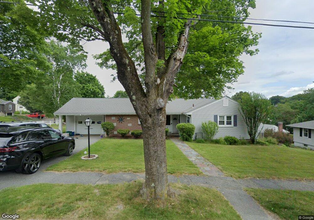
7 Hillsboro Rd Unit 4 Worcester, MA 01605
Burncoat NeighborhoodEstimated Value: $449,536 - $477,000
3
Beds
3
Baths
1,314
Sq Ft
$351/Sq Ft
Est. Value
About This Home
This home is located at 7 Hillsboro Rd Unit 4, Worcester, MA 01605 and is currently estimated at $460,884, approximately $350 per square foot. 7 Hillsboro Rd Unit 4 is a home located in Worcester County with nearby schools including Jacob Hiatt Magnet School, Chandler Magnet, and Thorndyke Road School.
Ownership History
Date
Name
Owned For
Owner Type
Purchase Details
Closed on
Aug 17, 2015
Sold by
Nelson Linda L
Bought by
Curci Nicholas M
Current Estimated Value
Home Financials for this Owner
Home Financials are based on the most recent Mortgage that was taken out on this home.
Original Mortgage
$229,837
Outstanding Balance
$181,072
Interest Rate
4.08%
Mortgage Type
VA
Estimated Equity
$279,812
Create a Home Valuation Report for This Property
The Home Valuation Report is an in-depth analysis detailing your home's value as well as a comparison with similar homes in the area
Home Values in the Area
Average Home Value in this Area
Purchase History
| Date | Buyer | Sale Price | Title Company |
|---|---|---|---|
| Curci Nicholas M | $225,000 | -- |
Source: Public Records
Mortgage History
| Date | Status | Borrower | Loan Amount |
|---|---|---|---|
| Open | Curci Nicholas M | $229,837 |
Source: Public Records
Tax History Compared to Growth
Tax History
| Year | Tax Paid | Tax Assessment Tax Assessment Total Assessment is a certain percentage of the fair market value that is determined by local assessors to be the total taxable value of land and additions on the property. | Land | Improvement |
|---|---|---|---|---|
| 2025 | $5,607 | $425,100 | $118,700 | $306,400 |
| 2024 | $5,471 | $397,900 | $118,700 | $279,200 |
| 2023 | $5,310 | $370,300 | $103,200 | $267,100 |
| 2022 | $4,721 | $310,400 | $82,600 | $227,800 |
| 2021 | $4,770 | $293,000 | $66,100 | $226,900 |
| 2020 | $4,566 | $268,600 | $66,100 | $202,500 |
| 2019 | $4,291 | $238,400 | $59,500 | $178,900 |
| 2018 | $4,147 | $219,300 | $59,500 | $159,800 |
| 2017 | $4,215 | $219,300 | $59,500 | $159,800 |
| 2016 | $4,174 | $202,500 | $43,800 | $158,700 |
| 2015 | $3,910 | $194,800 | $43,800 | $151,000 |
| 2014 | $3,806 | $194,800 | $43,800 | $151,000 |
Source: Public Records
Map
Nearby Homes
- 29 Tylee Ave
- 8 Cherry Blossom Cir Unit 50
- 23 Viele Ave
- 276 Saint Nicholas Ave
- 80 Clark St
- 314 Burncoat St
- 3 Granville Ave
- 48 Wilkinson St
- 131 Airlie St
- 14 Housatonic St
- 15 Ericsson St
- 43 Fales St
- 40 Francis St
- 37 Kenwood Ave
- 13 Fatima Ln
- 37 Uncatena Ave
- 3 Huron Ave
- 21 Trinity Ave
- 68 Housatonic St
- 36 Melrose St
- 7 Hillsboro Rd
- 5 Hillsboro Rd
- 3 Hillsboro Rd Unit 25
- 3 Hillsboro Rd Unit 2
- 3 Hillsboro Rd
- 1 Hillsboro Rd Unit 1
- 1 Hillsboro Rd
- 137 Bay State Rd
- 9 Hillsboro Rd
- 11 Hillsboro Rd Unit 4
- 11 Hillsboro Rd
- 122 Longmeadow Ave
- 13 Hillsboro Rd Unit 5
- 13 Hillsboro Rd
- 148 Bay State Rd
- 6 Hillsboro Rd
- 8 Hillsboro Rd
- 0 Hillsboro Rd Unit 64 72308891
- 0 Hillsboro Rd Unit 65 72257259
- 0 Hillsboro Rd Unit 37 72234446