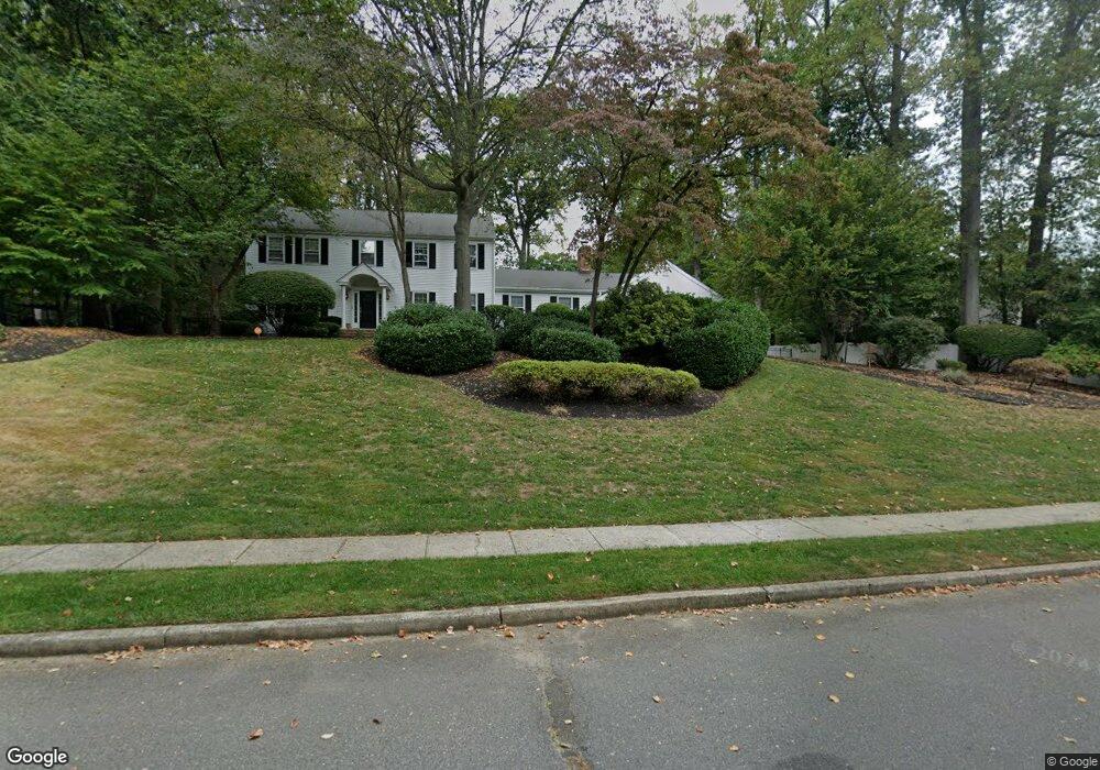
7 Howland Rd Middletown, NJ 07748
New Monmouth NeighborhoodEstimated Value: $1,027,000 - $1,183,000
4
Beds
4
Baths
2,320
Sq Ft
$471/Sq Ft
Est. Value
About This Home
This home is located at 7 Howland Rd, Middletown, NJ 07748 and is currently estimated at $1,091,636, approximately $470 per square foot. 7 Howland Rd is a home located in Monmouth County with nearby schools including Nut Swamp Elementary School, Thompson Middle School, and Middletown - South High School.
Ownership History
Date
Name
Owned For
Owner Type
Purchase Details
Closed on
Jan 6, 2005
Sold by
Day Joseph J
Bought by
Macdonald William R and Macdonald Deirdre C
Current Estimated Value
Home Financials for this Owner
Home Financials are based on the most recent Mortgage that was taken out on this home.
Original Mortgage
$542,400
Outstanding Balance
$274,211
Interest Rate
5.77%
Mortgage Type
New Conventional
Estimated Equity
$817,425
Create a Home Valuation Report for This Property
The Home Valuation Report is an in-depth analysis detailing your home's value as well as a comparison with similar homes in the area
Home Values in the Area
Average Home Value in this Area
Purchase History
| Date | Buyer | Sale Price | Title Company |
|---|---|---|---|
| Macdonald William R | $678,000 | -- |
Source: Public Records
Mortgage History
| Date | Status | Borrower | Loan Amount |
|---|---|---|---|
| Open | Macdonald William R | $542,400 |
Source: Public Records
Tax History
| Year | Tax Paid | Tax Assessment Tax Assessment Total Assessment is a certain percentage of the fair market value that is determined by local assessors to be the total taxable value of land and additions on the property. | Land | Improvement |
|---|---|---|---|---|
| 2025 | $14,872 | $928,400 | $494,500 | $433,900 |
| 2024 | $14,000 | $904,100 | $440,300 | $463,800 |
Source: Public Records
Map
Nearby Homes
- 3 Deridder Ct
- 7 Cormorant Dr
- 234 Borden Rd
- 49 Stork Ct
- 911 Middletown Lincroft Rd
- 77 Bunker Hill Dr
- 129 Four Winds Dr
- 185 Ballantine Rd
- 158 Willow Grove Dr
- 7 Shire Way
- 41 Polly Way
- 6 Twin Brooks Ct
- 45 Galloping Hill Cir
- 164 Heights Terrace
- 246 Sunnyside Rd
- 30 Winchester Ln
- 33 Winchester Ln
- 7 Boxwood Terrace Unit 250
- 86 Stillwell Rd
- 17 Spalding Dr
Your Personal Tour Guide
Ask me questions while you tour the home.