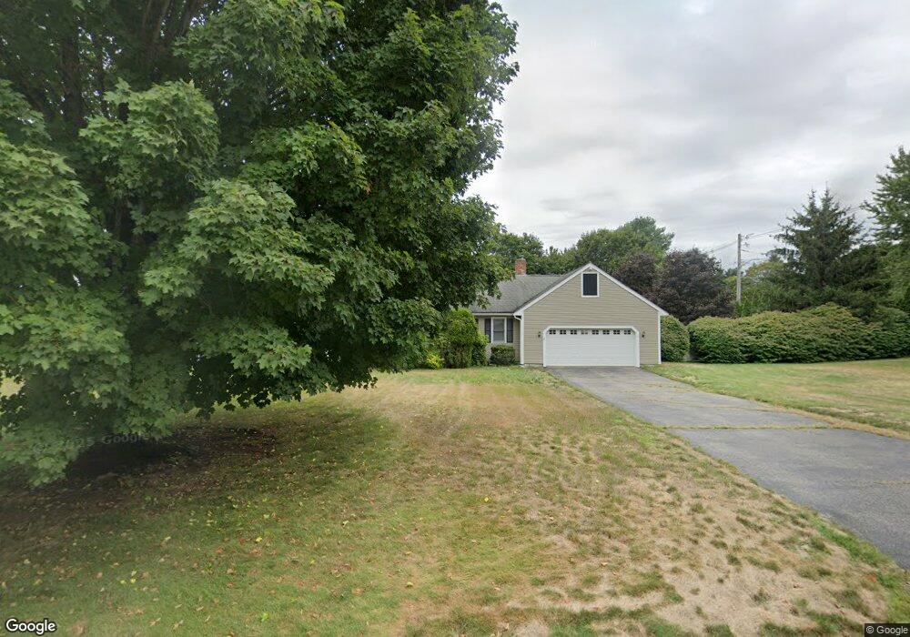
7 Indian Brook Ln Hanover, MA 02339
Estimated Value: $794,000 - $1,031,000
4
Beds
3
Baths
2,224
Sq Ft
$412/Sq Ft
Est. Value
About This Home
This home is located at 7 Indian Brook Ln, Hanover, MA 02339 and is currently estimated at $915,623, approximately $411 per square foot. 7 Indian Brook Ln is a home located in Plymouth County with nearby schools including Hanover High School and Cardinal Cushing Centers.
Ownership History
Date
Name
Owned For
Owner Type
Purchase Details
Closed on
Sep 30, 2022
Sold by
Lee Thomas F and Lee Mary E
Bought by
Lee Ret
Current Estimated Value
Purchase Details
Closed on
Aug 29, 1996
Sold by
Iag Fcu
Bought by
Lee Thomas F and Lee Mary E
Home Financials for this Owner
Home Financials are based on the most recent Mortgage that was taken out on this home.
Original Mortgage
$188,000
Interest Rate
8.18%
Mortgage Type
Purchase Money Mortgage
Purchase Details
Closed on
Feb 7, 1996
Sold by
Lindsey Dana H
Bought by
Iag Fcu
Create a Home Valuation Report for This Property
The Home Valuation Report is an in-depth analysis detailing your home's value as well as a comparison with similar homes in the area
Home Values in the Area
Average Home Value in this Area
Purchase History
| Date | Buyer | Sale Price | Title Company |
|---|---|---|---|
| Lee Ret | -- | None Available | |
| Lee Thomas F | $235,000 | -- | |
| Iag Fcu | $180,000 | -- |
Source: Public Records
Mortgage History
| Date | Status | Borrower | Loan Amount |
|---|---|---|---|
| Previous Owner | Iag Fcu | $154,000 | |
| Previous Owner | Iag Fcu | $188,000 | |
| Previous Owner | Iag Fcu | $231,000 |
Source: Public Records
Tax History
| Year | Tax Paid | Tax Assessment Tax Assessment Total Assessment is a certain percentage of the fair market value that is determined by local assessors to be the total taxable value of land and additions on the property. | Land | Improvement |
|---|---|---|---|---|
| 2025 | $9,643 | $780,800 | $269,400 | $511,400 |
| 2024 | $7,841 | $610,700 | $244,900 | $365,800 |
| 2023 | $8,238 | $610,700 | $244,900 | $365,800 |
| 2022 | $9,313 | $610,700 | $244,900 | $365,800 |
| 2021 | $9,290 | $568,900 | $222,600 | $346,300 |
| 2020 | $9,037 | $554,100 | $222,600 | $331,500 |
| 2019 | $8,751 | $533,300 | $222,600 | $310,700 |
| 2018 | $8,203 | $503,900 | $222,600 | $281,300 |
| 2015 | $7,403 | $458,400 | $190,400 | $268,000 |
Source: Public Records
Map
Nearby Homes
- 95 Tecumseh Dr
- 75 School St
- 561 Circuit St
- 36 Grove St
- 51 Cervelli Farm Dr
- 37 Dr
- 23 Cervelli Farm Dr
- 38 Cervelli Farm Dr
- 9 Cervelli Farm Dr
- 250 Center St
- 108 Waterford Dr
- 114 Graham Hill Dr
- 823 Market St
- 139 Fairwood Dr
- 430 Brook Bend Rd
- 62 Larchmont Ln
- 506 Main St
- 168 Larchmont Ln
- 696 Summer St
- 35 Sproul Rd
Your Personal Tour Guide
Ask me questions while you tour the home.