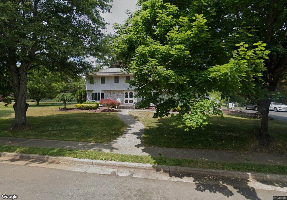
7 Kennedy Dr Marlboro, NJ 07746
Estimated Value: $868,807 - $988,000
4
Beds
3
Baths
2,574
Sq Ft
$357/Sq Ft
Est. Value
About This Home
This home is located at 7 Kennedy Dr, Marlboro, NJ 07746 and is currently estimated at $917,952, approximately $356 per square foot. 7 Kennedy Dr is a home located in Monmouth County with nearby schools including Marlboro Elementary School, Marlboro Middle School, and Marlboro High School.
Ownership History
Date
Name
Owned For
Owner Type
Purchase Details
Closed on
Oct 29, 1993
Sold by
Korfin Ira
Bought by
Ball Martin and Ball Robin
Current Estimated Value
Home Financials for this Owner
Home Financials are based on the most recent Mortgage that was taken out on this home.
Original Mortgage
$162,000
Interest Rate
6.79%
Create a Home Valuation Report for This Property
The Home Valuation Report is an in-depth analysis detailing your home's value as well as a comparison with similar homes in the area
Home Values in the Area
Average Home Value in this Area
Purchase History
| Date | Buyer | Sale Price | Title Company |
|---|---|---|---|
| Ball Martin | $262,000 | -- |
Source: Public Records
Mortgage History
| Date | Status | Borrower | Loan Amount |
|---|---|---|---|
| Closed | Ball Martin | $162,000 |
Source: Public Records
Tax History Compared to Growth
Tax History
| Year | Tax Paid | Tax Assessment Tax Assessment Total Assessment is a certain percentage of the fair market value that is determined by local assessors to be the total taxable value of land and additions on the property. | Land | Improvement |
|---|---|---|---|---|
| 2025 | $11,555 | $463,300 | $172,800 | $290,500 |
| 2024 | $11,045 | $463,300 | $172,800 | $290,500 |
| 2023 | $11,045 | $463,300 | $172,800 | $290,500 |
| 2022 | $10,762 | $463,300 | $172,800 | $290,500 |
| 2021 | $10,656 | $463,300 | $172,800 | $290,500 |
| 2020 | $10,651 | $463,300 | $172,800 | $290,500 |
| 2019 | $10,656 | $463,300 | $172,800 | $290,500 |
| 2018 | $10,475 | $463,300 | $172,800 | $290,500 |
| 2017 | $10,271 | $463,300 | $172,800 | $290,500 |
| 2016 | $10,230 | $463,300 | $172,800 | $290,500 |
| 2015 | $9,455 | $434,700 | $163,900 | $270,800 |
| 2014 | $8,700 | $395,800 | $133,900 | $261,900 |
Source: Public Records
Map
Nearby Homes
- 11 Liberty Rd
- 68 Rockwell Cir
- 308 Pilot St
- 102 Pilot St
- 69 School Rd W
- 126 Wyncrest Rd
- 16 Jacata Rd
- 21 Alberta Dr
- 29 School Rd W
- 9 Adams St
- 108 Scarborough Way
- 15 Adams St
- 211 Bradwick Way
- 680 - 21.22 County Road 520
- 680 - 21.21 County Road 520
- 680 - 21.2 County Road 520
- 680 - 21.19 County Road 520
- 680 - 21.18 County Road 520
- 680 - 21.17 County Road 520
- 680 - 21.16 County Road 520