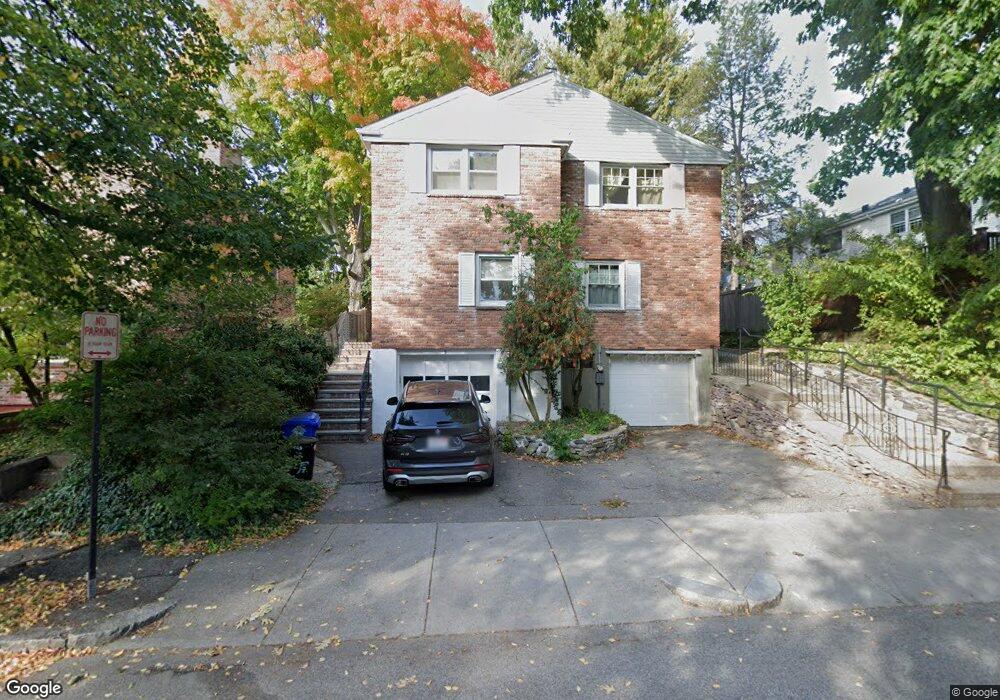
7 Kent Square Unit 2 Brookline, MA 02446
Coolidge Corner NeighborhoodEstimated Value: $1,356,000 - $1,416,434
3
Beds
3
Baths
1,560
Sq Ft
$882/Sq Ft
Est. Value
About This Home
This home is located at 7 Kent Square Unit 2, Brookline, MA 02446 and is currently estimated at $1,376,109, approximately $882 per square foot. 7 Kent Square Unit 2 is a home located in Norfolk County with nearby schools including Amos A. Lawrence School, Brookline High School, and St. Mary of the Assumption Elementary School.
Ownership History
Date
Name
Owned For
Owner Type
Purchase Details
Closed on
Oct 20, 2016
Sold by
Hale Deborah B
Bought by
Deborah Hale Irt
Current Estimated Value
Purchase Details
Closed on
Oct 12, 2004
Sold by
Hale Deborah B and Hale Roger L
Bought by
Barkmeir Claudia and Kraus Nigel
Purchase Details
Closed on
Jun 26, 1989
Sold by
Oppenheim Frank G
Bought by
Hale Roger L
Home Financials for this Owner
Home Financials are based on the most recent Mortgage that was taken out on this home.
Original Mortgage
$135,000
Interest Rate
10.84%
Mortgage Type
Purchase Money Mortgage
Create a Home Valuation Report for This Property
The Home Valuation Report is an in-depth analysis detailing your home's value as well as a comparison with similar homes in the area
Home Values in the Area
Average Home Value in this Area
Purchase History
| Date | Buyer | Sale Price | Title Company |
|---|---|---|---|
| Deborah Hale Irt | -- | -- | |
| Barkmeir Claudia | -- | -- | |
| Deborah Hale Irt | -- | -- | |
| Barkmeir Claudia | -- | -- | |
| Hale Roger L | $275,000 | -- |
Source: Public Records
Mortgage History
| Date | Status | Borrower | Loan Amount |
|---|---|---|---|
| Previous Owner | Hale Roger L | $135,000 |
Source: Public Records
Tax History
| Year | Tax Paid | Tax Assessment Tax Assessment Total Assessment is a certain percentage of the fair market value that is determined by local assessors to be the total taxable value of land and additions on the property. | Land | Improvement |
|---|---|---|---|---|
| 2025 | $14,630 | $1,482,300 | $1,076,500 | $405,800 |
| 2024 | $13,933 | $1,426,100 | $1,035,100 | $391,000 |
| 2023 | $12,619 | $1,265,700 | $854,800 | $410,900 |
| 2022 | $12,283 | $1,205,400 | $814,000 | $391,400 |
| 2021 | $11,358 | $1,159,000 | $782,700 | $376,300 |
| 2020 | $10,230 | $1,082,500 | $711,600 | $370,900 |
| 2019 | $9,660 | $1,030,900 | $677,700 | $353,200 |
| 2018 | $8,139 | $860,400 | $527,400 | $333,000 |
| 2017 | $8,073 | $817,100 | $497,700 | $319,400 |
| 2016 | $7,958 | $763,700 | $465,100 | $298,600 |
| 2015 | $7,199 | $674,100 | $395,100 | $279,000 |
| 2014 | $7,341 | $644,500 | $359,200 | $285,300 |
Source: Public Records
Map
Nearby Homes
- 15 Kent Square
- 216 Aspinwall Ave
- 216 Aspinwall Ave Unit 3
- 61 Toxteth St
- 65 Francis St Unit A
- 6 Parkway Rd Unit 6
- 20 Chapel St Unit APH4
- 20 Chapel St Unit A303
- 20 Chapel St Unit A703
- 58 Kent St Unit 303
- 58 Kent St Unit 301
- 58 Kent St Unit 305
- 58 Kent St Unit 402
- 58 Kent St Unit 404
- 378 Riverway Unit 3
- 60 Longwood Ave Unit 802
- 60 Longwood Ave Unit 307
- 100 Sewall Ave Unit 5
- 45 Longwood Ave Unit 812
- 820-824 Huntington Ave
- 9 Kent Square
- 9 Kent Square
- 9 Kent Square Unit 1
- 9 Kent Square
- 7 Kent Square
- 7 Kent Square Unit 1
- 11 Kent Square
- 11 Kent Square Unit 3
- 11 Kent Square Unit 1
- 13 Kent Square
- 212 Kent St
- 212 Kent St Unit 23
- 212 Kent St Unit 44
- 212 Kent St Unit B1
- 212 Kent St Unit 38
- 212 Kent St Unit 212
- 3 Kent Square
- 214 Kent St Unit 44
- 214 Kent St Unit 24
- 214 Kent St Unit 3
Your Personal Tour Guide
Ask me questions while you tour the home.