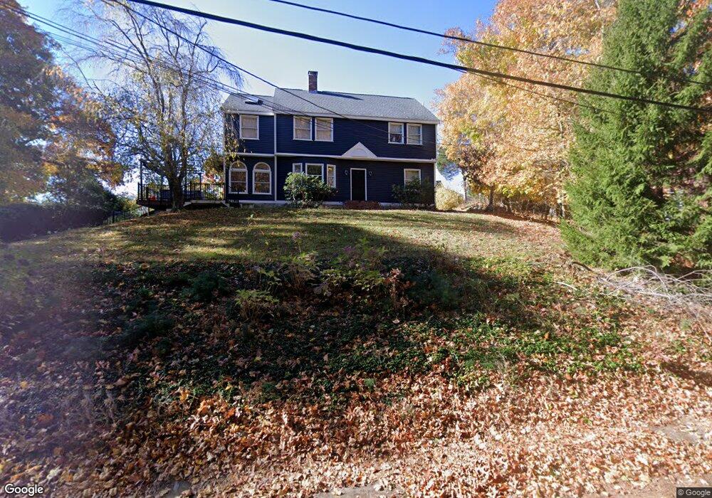
7 Lake Attitash Way Amesbury, MA 01913
Estimated Value: $779,924 - $936,000
4
Beds
3
Baths
2,316
Sq Ft
$368/Sq Ft
Est. Value
About This Home
This home is located at 7 Lake Attitash Way, Amesbury, MA 01913 and is currently estimated at $851,731, approximately $367 per square foot. 7 Lake Attitash Way is a home located in Essex County with nearby schools including Amesbury High School and Amesbury Seventh-Day Adventist School.
Ownership History
Date
Name
Owned For
Owner Type
Purchase Details
Closed on
Jul 10, 1998
Sold by
Nunn William T and Nunn Linda D
Bought by
Launsey Charles R and Launsey Susan B
Current Estimated Value
Purchase Details
Closed on
Aug 1, 1995
Sold by
Murphy-Baird Maureen
Bought by
Nunn William T and Nunn Linda D
Purchase Details
Closed on
Feb 28, 1990
Sold by
Rd Lake Attitash
Bought by
Murphy Gaird Maureen
Create a Home Valuation Report for This Property
The Home Valuation Report is an in-depth analysis detailing your home's value as well as a comparison with similar homes in the area
Home Values in the Area
Average Home Value in this Area
Purchase History
| Date | Buyer | Sale Price | Title Company |
|---|---|---|---|
| Launsey Charles R | $232,500 | -- | |
| Nunn William T | $180,000 | -- | |
| Murphy Gaird Maureen | $210,000 | -- |
Source: Public Records
Mortgage History
| Date | Status | Borrower | Loan Amount |
|---|---|---|---|
| Open | Murphy Gaird Maureen | $175,000 | |
| Closed | Murphy Gaird Maureen | $209,000 | |
| Closed | Murphy Gaird Maureen | $209,000 |
Source: Public Records
Tax History Compared to Growth
Tax History
| Year | Tax Paid | Tax Assessment Tax Assessment Total Assessment is a certain percentage of the fair market value that is determined by local assessors to be the total taxable value of land and additions on the property. | Land | Improvement |
|---|---|---|---|---|
| 2025 | $9,905 | $647,400 | $223,100 | $424,300 |
| 2024 | $9,439 | $603,500 | $210,400 | $393,100 |
| 2023 | $8,855 | $541,900 | $182,900 | $359,000 |
| 2022 | $8,477 | $479,200 | $159,100 | $320,100 |
| 2021 | $7,992 | $437,900 | $123,000 | $314,900 |
| 2020 | $7,130 | $415,000 | $118,300 | $296,700 |
| 2019 | $7,210 | $392,500 | $118,300 | $274,200 |
| 2018 | $7,102 | $374,000 | $112,600 | $261,400 |
| 2017 | $7,274 | $364,600 | $112,600 | $252,000 |
| 2016 | $7,061 | $348,200 | $112,600 | $235,600 |
| 2015 | $6,912 | $336,500 | $112,600 | $223,900 |
| 2014 | $6,715 | $320,200 | $112,600 | $207,600 |
Source: Public Records
Map
Nearby Homes
- 4 Acadia Kimball Rd
- 1 Acadia Kimball Rd Unit 1
- 2 Alnette Rd
- 1 Tuxbury Ln
- 20 Hillside Ct
- 1 Bisson Ln
- 3 Greystone Rd
- 152 Kimball Rd
- 160 Haverhill Rd
- 10 Sharon Cir
- 188 Lions Mouth Rd
- 5 Moncrief St Unit 5
- 3 B St
- 6 B St
- 34 Emery St
- 20 Mason Ct
- 10 Mason Ct Unit 10
- 61 E Main St
- 16 Glen Devin St
- 31 Whitter Meadows Dr Unit 31
- 9 Lake Attitash Way
- 5 Lake Attitash Way
- 6 Lake Attitash Way
- 1 Beech Ln
- 3 Beech Ln
- 5 Beech Ln
- 10 Mockingbird Hill Rd
- 7 Beech Ln
- 6 Lake Attitash Rd
- 87 Kimball Rd
- 6 Mockingbird Hill Rd
- 9 Beech Ln
- 77 Lake Attitash Rd
- 12 Mockingbird Hill Rd
- 75 Lake Attitash Rd
- 77 1/2 Lake Attitash Rd
- 89 Kimball Rd
- 89 Kimball Rd
- 73 Lake Attitash Rd
- 79 Lake Attitash Rd