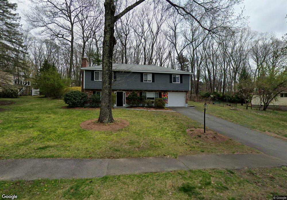
7 Laurie Ln Framingham, MA 01701
Nobscot NeighborhoodEstimated Value: $645,000 - $752,000
3
Beds
3
Baths
1,248
Sq Ft
$550/Sq Ft
Est. Value
About This Home
This home is located at 7 Laurie Ln, Framingham, MA 01701 and is currently estimated at $686,359, approximately $549 per square foot. 7 Laurie Ln is a home located in Middlesex County with nearby schools including Framingham High School and Sudbury Valley School.
Ownership History
Date
Name
Owned For
Owner Type
Purchase Details
Closed on
Jul 21, 2024
Sold by
Singer David P and Singer Randy M
Bought by
Singer Randy M
Current Estimated Value
Purchase Details
Closed on
Nov 16, 1995
Sold by
Karas Steven R and Karas Lynne S
Bought by
Singer David P and Singer Randy M
Home Financials for this Owner
Home Financials are based on the most recent Mortgage that was taken out on this home.
Original Mortgage
$161,500
Interest Rate
7.53%
Mortgage Type
Purchase Money Mortgage
Create a Home Valuation Report for This Property
The Home Valuation Report is an in-depth analysis detailing your home's value as well as a comparison with similar homes in the area
Home Values in the Area
Average Home Value in this Area
Purchase History
| Date | Buyer | Sale Price | Title Company |
|---|---|---|---|
| Singer Randy M | -- | None Available | |
| Singer Randy M | -- | None Available | |
| Singer David P | $170,000 | -- | |
| Singer David P | $170,000 | -- |
Source: Public Records
Mortgage History
| Date | Status | Borrower | Loan Amount |
|---|---|---|---|
| Previous Owner | Singer David P | $161,500 |
Source: Public Records
Tax History Compared to Growth
Tax History
| Year | Tax Paid | Tax Assessment Tax Assessment Total Assessment is a certain percentage of the fair market value that is determined by local assessors to be the total taxable value of land and additions on the property. | Land | Improvement |
|---|---|---|---|---|
| 2025 | $6,994 | $585,800 | $272,800 | $313,000 |
| 2024 | $6,858 | $550,400 | $243,700 | $306,700 |
| 2023 | $6,477 | $494,800 | $217,500 | $277,300 |
| 2022 | $6,135 | $446,500 | $197,400 | $249,100 |
| 2021 | $6,018 | $428,300 | $189,700 | $238,600 |
| 2020 | $6,028 | $402,400 | $172,400 | $230,000 |
| 2019 | $5,723 | $372,100 | $172,400 | $199,700 |
| 2018 | $5,562 | $340,800 | $165,900 | $174,900 |
| 2017 | $5,386 | $322,300 | $161,100 | $161,200 |
| 2016 | $5,285 | $304,100 | $161,100 | $143,000 |
| 2015 | $5,241 | $294,100 | $161,400 | $132,700 |
Source: Public Records
Map
Nearby Homes
- 32 Lyman Rd
- 301 Winch St
- 769 Edgell Rd
- 641 Grove St
- 36 Ruthellen Rd
- 270 Edmands Rd
- 18 Lomas Dr
- 915 Edgell Rd Unit 85
- 4 Pioneer Rd Unit 4
- 7 Pioneer Rd Unit 7
- 5 Pioneer Rd Unit 5
- 484 Edgell Rd
- 9 Hawk Ln Unit 28
- 28 Garvey Rd
- 18 Eagle Ln Unit 21
- 21 Blackberry Ln
- Arcadia Plan at Millwood Preserve
- 463 Edmands Rd
- 78 Apple d or Rd
- 30 Elda Rd
- 9 Laurie Ln
- 5 Laurie Ln
- 34 Claudette Cir
- 12 Claudette Cir
- 32 Claudette Cir
- 10 Claudette Cir
- 8 Laurie Ln
- 6 Laurie Ln
- 36 Claudette Cir
- 14 Claudette Cir
- 8 Claudette Cir
- 4 Laurie Ln
- 16 Claudette Cir
- 30 Claudette Cir
- 18 Claudette Cir
- 38 Claudette Cir
- 28 Claudette Cir
- 2 Laurie Ln
- 49 Claudette Cir
- 50 Agnes Dr