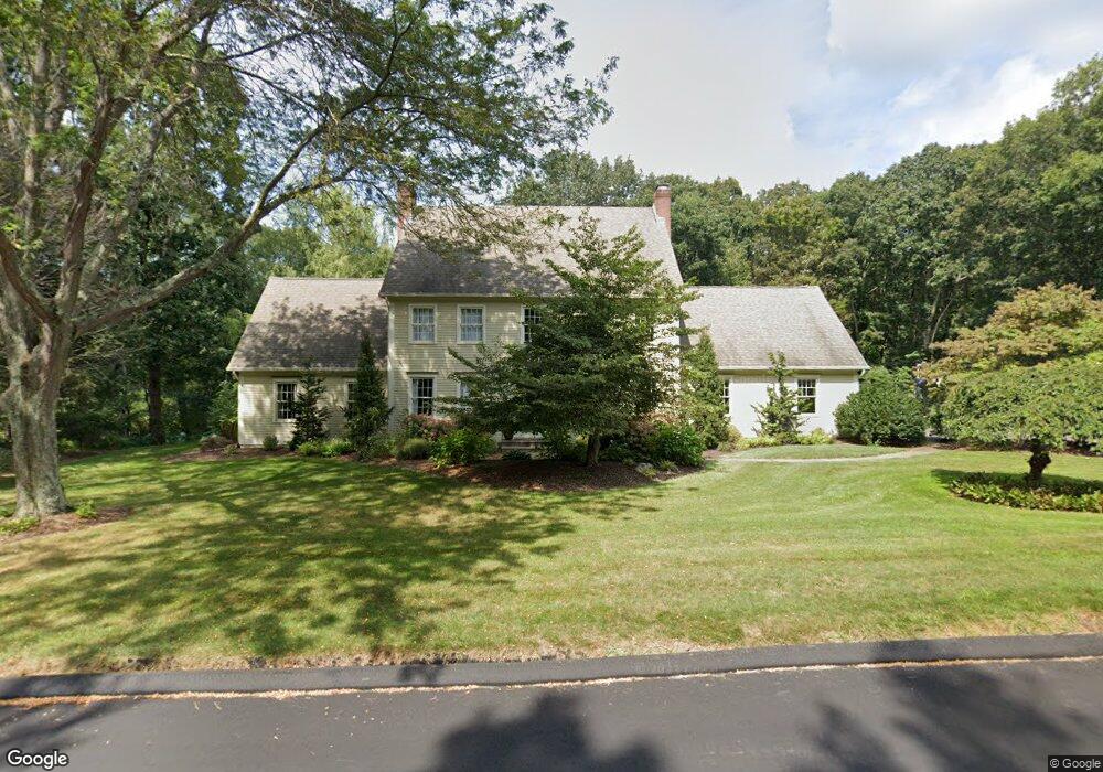
7 Lawlor Rd Tolland, CT 06084
Estimated Value: $745,542 - $820,000
4
Beds
3
Baths
3,094
Sq Ft
$249/Sq Ft
Est. Value
About This Home
This home is located at 7 Lawlor Rd, Tolland, CT 06084 and is currently estimated at $769,636, approximately $248 per square foot. 7 Lawlor Rd is a home located in Tolland County with nearby schools including Birch Grove Primary School, Tolland Intermediate School, and Tolland Middle School.
Ownership History
Date
Name
Owned For
Owner Type
Purchase Details
Closed on
Nov 16, 2009
Sold by
Chzaszcz David
Bought by
Biondi Scott and Biondi Angla
Current Estimated Value
Home Financials for this Owner
Home Financials are based on the most recent Mortgage that was taken out on this home.
Original Mortgage
$320,000
Interest Rate
4.98%
Purchase Details
Closed on
Jan 25, 1994
Sold by
Colonial Bldrs Ne
Bought by
Chzaszcz David and Chzaszcz Joan
Create a Home Valuation Report for This Property
The Home Valuation Report is an in-depth analysis detailing your home's value as well as a comparison with similar homes in the area
Home Values in the Area
Average Home Value in this Area
Purchase History
| Date | Buyer | Sale Price | Title Company |
|---|---|---|---|
| Biondi Scott | $470,000 | -- | |
| Biondi Scott | $470,000 | -- | |
| Chzaszcz David | $325,112 | -- | |
| Chzaszcz David | $325,112 | -- |
Source: Public Records
Mortgage History
| Date | Status | Borrower | Loan Amount |
|---|---|---|---|
| Open | Chzaszcz David | $118,000 | |
| Open | Chzaszcz David | $290,500 | |
| Closed | Chzaszcz David | $320,000 |
Source: Public Records
Tax History Compared to Growth
Tax History
| Year | Tax Paid | Tax Assessment Tax Assessment Total Assessment is a certain percentage of the fair market value that is determined by local assessors to be the total taxable value of land and additions on the property. | Land | Improvement |
|---|---|---|---|---|
| 2025 | $12,537 | $461,100 | $113,500 | $347,600 |
| 2024 | $11,422 | $302,400 | $100,700 | $201,700 |
| 2023 | $11,289 | $302,400 | $100,700 | $201,700 |
| 2022 | $11,062 | $302,400 | $100,700 | $201,700 |
| 2021 | $11,222 | $302,400 | $100,700 | $201,700 |
| 2020 | $10,902 | $302,400 | $100,700 | $201,700 |
| 2019 | $11,471 | $318,200 | $103,300 | $214,900 |
| 2018 | $11,137 | $318,200 | $103,300 | $214,900 |
| 2017 | $10,879 | $318,200 | $103,300 | $214,900 |
| 2016 | $10,879 | $318,200 | $103,300 | $214,900 |
| 2015 | $10,615 | $318,200 | $103,300 | $214,900 |
| 2014 | $10,147 | $326,800 | $114,300 | $212,500 |
Source: Public Records
Map
Nearby Homes
- 208 New Rd
- 197 New Rd
- 93 Dockerel Rd
- 28 Columbine Rd
- 64 Columbine Rd
- 15 Elm Rd
- 109 Timber Trail
- 15 Carter Dr
- 50 Josephine Way
- 39 Josephine Way
- 41 Timber Trail
- 38 Josephine Way
- 32 Josephine Way
- 26 Josephine Way
- 69 Tolland Farms Rd
- 129 Mile Hill Rd
- 101 Dockerel Rd
- 247 Mountain Spring Rd
- 95 Old Kent Rd N
- 60 Mile Hill Rd
- 83 Cedar Swamp Rd
- 20 Lawlor Rd
- 51 Cedar Swamp Rd
- 56 Cedar Swamp Rd
- 80 Cedar Swamp Rd
- 43 Cedar Swamp Rd
- 31 Lawlor Rd
- 30 Lawlor Rd
- 44 Cedar Swamp Rd
- 487 Mile Hill Rd
- 38 Lawlor Rd
- 35 Cedar Swamp Rd
- 474 Mile Hill Rd
- 36 Cedar Swamp Rd
- 451 Mile Hill Rd
- 495 Mile Hill Rd
- 423 Mile Hill Rd
- 484 Mile Hill Rd
- 464 Mile Hill Rd
- 43 Lawlor Rd