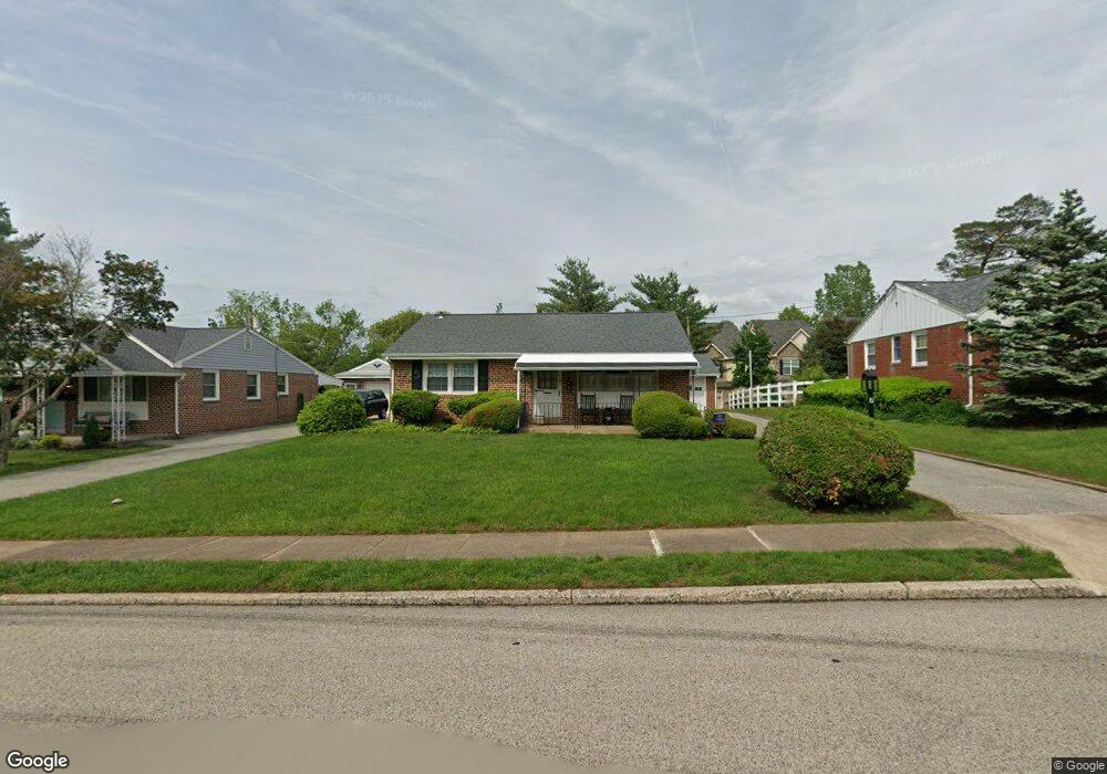
7 Lawnton Rd Norristown, PA 19401
East Norriton Township NeighborhoodEstimated Value: $288,000 - $331,819
3
Beds
1
Bath
1,120
Sq Ft
$280/Sq Ft
Est. Value
About This Home
This home is located at 7 Lawnton Rd, Norristown, PA 19401 and is currently estimated at $313,205, approximately $279 per square foot. 7 Lawnton Rd is a home located in Montgomery County with nearby schools including Cole Manor Elementary School, East Norriton Middle School, and Charles Blockson Middle School.
Ownership History
Date
Name
Owned For
Owner Type
Purchase Details
Closed on
Dec 23, 2024
Sold by
Swetkowski David M
Bought by
Swetkowski Ryan David and Swetkowski Lorraine
Current Estimated Value
Home Financials for this Owner
Home Financials are based on the most recent Mortgage that was taken out on this home.
Original Mortgage
$232,000
Outstanding Balance
$230,193
Interest Rate
6.84%
Mortgage Type
New Conventional
Estimated Equity
$83,012
Purchase Details
Closed on
Jan 27, 2023
Sold by
Swetkowski Mark S
Bought by
Swetkowski David M
Purchase Details
Closed on
Jan 1, 1958
Bought by
Swetkowski Leon and Swetkowski Dorothy
Create a Home Valuation Report for This Property
The Home Valuation Report is an in-depth analysis detailing your home's value as well as a comparison with similar homes in the area
Home Values in the Area
Average Home Value in this Area
Purchase History
| Date | Buyer | Sale Price | Title Company |
|---|---|---|---|
| Swetkowski Ryan David | $290,000 | Suburban Philadelphia Abstract | |
| Swetkowski David M | -- | -- | |
| Swetkowski David M | -- | None Listed On Document | |
| Swetkowski Leon | -- | -- |
Source: Public Records
Mortgage History
| Date | Status | Borrower | Loan Amount |
|---|---|---|---|
| Open | Swetkowski Ryan David | $232,000 |
Source: Public Records
Tax History Compared to Growth
Tax History
| Year | Tax Paid | Tax Assessment Tax Assessment Total Assessment is a certain percentage of the fair market value that is determined by local assessors to be the total taxable value of land and additions on the property. | Land | Improvement |
|---|---|---|---|---|
| 2025 | $4,969 | $105,470 | $47,860 | $57,610 |
| 2024 | $4,969 | $105,470 | $47,860 | $57,610 |
| 2023 | $4,911 | $105,470 | $47,860 | $57,610 |
| 2022 | $4,877 | $105,470 | $47,860 | $57,610 |
| 2021 | $4,847 | $105,470 | $47,860 | $57,610 |
| 2020 | $4,696 | $105,470 | $47,860 | $57,610 |
| 2019 | $4,587 | $105,470 | $47,860 | $57,610 |
| 2018 | $4,588 | $105,470 | $47,860 | $57,610 |
| 2017 | $4,321 | $105,470 | $47,860 | $57,610 |
| 2016 | $4,280 | $105,470 | $47,860 | $57,610 |
| 2015 | $4,055 | $105,470 | $47,860 | $57,610 |
| 2014 | $4,055 | $105,470 | $47,860 | $57,610 |
Source: Public Records
Map
Nearby Homes
- 2461 Merri Claude Dr
- 2413 Sentry Ct
- 2300 Sienna Dr
- 2306 Carol Ln
- 2100 3rd St
- 4 W Johnson Hwy
- 177 Godspeed Ct
- 1883 Arbor Place Dr Unit 87C
- 1883 Arbor Place Dr Unit 28E
- 1883 Arbor Place Dr Unit 86B
- 1883 Arbor Place Dr Unit 85A
- 1883 Arbor Place Dr Unit 30S
- 2551 Hillcrest Ave
- 1847 Arch St
- 1879 Harmony Ct Unit 72A
- 270 Harmony Ct Unit 77B
- 51 Zummo Way Unit CONDO
- 8 Zummo Way
- 1846 Arbor Place Dr Unit 46S
- 1840 Arbor Place Dr Unit 43E
- 9 Lawnton Rd
- 5 Lawnton Rd
- 3 Lawnton Rd
- 11 Lawnton Rd
- 23 Merri Claude Dr Unit 53
- 21 Merri Claude Dr
- 21 Merri Claude Dr Unit 54
- 8 Lawnton Rd
- 10 Lawnton Rd
- 17 Merri Claude Dr
- 13 Lawnton Rd
- 13 Merri Claude Dr
- 13 Merri Claude Dr Unit 58
- 12 Lawnton Rd
- 11 Merri Claude Dr
- 11 Merri Claude Dr Unit 59
- 9 Merri Claude Dr Unit 60
- 4 Lawnton Rd
- 7 Merri Claude Dr Unit 61
- 5 Merri Claude Dr