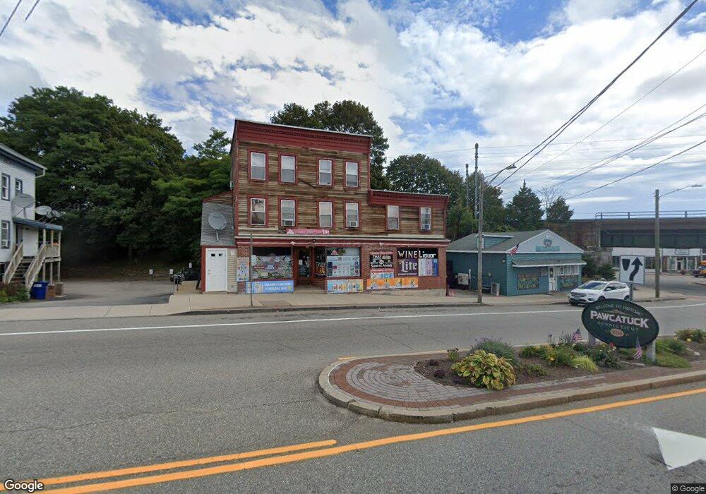
7 Liberty St Pawcatuck, CT 06379
Estimated Value: $965,490
--
Bed
--
Bath
--
Sq Ft
8,712
Sq Ft Lot
About This Home
This home is located at 7 Liberty St, Pawcatuck, CT 06379 and is currently estimated at $965,490. 7 Liberty St is a home located in New London County with nearby schools including Stonington Middle School, Stonington High School, and Pine Point School.
Ownership History
Date
Name
Owned For
Owner Type
Purchase Details
Closed on
Nov 10, 2022
Sold by
Phoumindr Thuy
Bought by
87 Oak Street Llc
Current Estimated Value
Home Financials for this Owner
Home Financials are based on the most recent Mortgage that was taken out on this home.
Original Mortgage
$537,500
Outstanding Balance
$520,741
Interest Rate
6.92%
Mortgage Type
Purchase Money Mortgage
Estimated Equity
$444,749
Purchase Details
Closed on
Apr 11, 2013
Sold by
Phoumindr Hatlasith
Bought by
Phoumindr Thuy
Create a Home Valuation Report for This Property
The Home Valuation Report is an in-depth analysis detailing your home's value as well as a comparison with similar homes in the area
Home Values in the Area
Average Home Value in this Area
Purchase History
| Date | Buyer | Sale Price | Title Company |
|---|---|---|---|
| 87 Oak Street Llc | $750,000 | None Available | |
| 87 Oak Street Llc | $750,000 | None Available | |
| Phoumindr Thuy | -- | -- | |
| Phoumindr Thuy | -- | -- |
Source: Public Records
Mortgage History
| Date | Status | Borrower | Loan Amount |
|---|---|---|---|
| Open | 87 Oak Street Llc | $537,500 | |
| Closed | 87 Oak Street Llc | $537,500 | |
| Previous Owner | Phoumindr Thuy | $200,000 |
Source: Public Records
Tax History Compared to Growth
Tax History
| Year | Tax Paid | Tax Assessment Tax Assessment Total Assessment is a certain percentage of the fair market value that is determined by local assessors to be the total taxable value of land and additions on the property. | Land | Improvement |
|---|---|---|---|---|
| 2025 | $7,123 | $358,300 | $85,500 | $272,800 |
| 2024 | $6,826 | $358,300 | $85,500 | $272,800 |
| 2023 | $6,826 | $358,300 | $85,500 | $272,800 |
| 2022 | $7,949 | $310,400 | $74,600 | $235,800 |
| 2021 | $7,962 | $310,400 | $74,600 | $235,800 |
| 2020 | $7,810 | $310,400 | $74,600 | $235,800 |
| 2019 | $7,794 | $310,400 | $74,600 | $235,800 |
| 2018 | $7,530 | $310,400 | $74,600 | $235,800 |
| 2017 | $7,280 | $295,700 | $79,300 | $216,400 |
| 2016 | $7,082 | $295,700 | $79,300 | $216,400 |
| 2015 | $6,647 | $295,700 | $79,300 | $216,400 |
| 2014 | $6,502 | $295,700 | $79,300 | $216,400 |
Source: Public Records
Map
Nearby Homes
- 7 Liberty St Unit 1
- 14 Liberty St
- 17 Liberty St
- 59 W Broad St
- 0 W Broad St Unit E251826
- 0 W Broad St Unit E255187
- 0 W Broad St Unit E259101
- 0 W Broad St Unit E10197828
- 0 W Broad St
- 0 W Broad St Unit 1000848
- 0 Mechanic St
- 43 W Broad St
- 9 Liberty St Unit 2
- 27 Liberty St
- 37 W Broad St
- 29 W Broad St
- 29 W Broad St Unit 2
- 29 W Broad St Unit 1
- 29 W Broad St Unit 3
- 13 Lincoln Ave