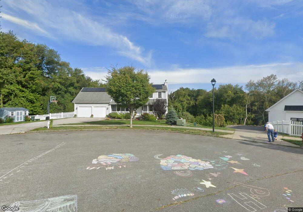
7 Lindsay Ln Pawcatuck, CT 06379
Estimated Value: $712,000 - $1,057,000
3
Beds
4
Baths
2,531
Sq Ft
$334/Sq Ft
Est. Value
About This Home
This home is located at 7 Lindsay Ln, Pawcatuck, CT 06379 and is currently estimated at $845,731, approximately $334 per square foot. 7 Lindsay Ln is a home located in New London County with nearby schools including Stonington Middle School, Stonington High School, and Pine Point School.
Ownership History
Date
Name
Owned For
Owner Type
Purchase Details
Closed on
May 17, 2010
Sold by
Stonington Meadows Llc
Bought by
Agins Daniel P and Agins Kimberly L
Current Estimated Value
Home Financials for this Owner
Home Financials are based on the most recent Mortgage that was taken out on this home.
Original Mortgage
$78,000
Interest Rate
5.11%
Create a Home Valuation Report for This Property
The Home Valuation Report is an in-depth analysis detailing your home's value as well as a comparison with similar homes in the area
Home Values in the Area
Average Home Value in this Area
Purchase History
| Date | Buyer | Sale Price | Title Company |
|---|---|---|---|
| Agins Daniel P | $97,950 | -- | |
| Agins Daniel P | $97,950 | -- |
Source: Public Records
Mortgage History
| Date | Status | Borrower | Loan Amount |
|---|---|---|---|
| Open | Agins Daniel P | $283,000 | |
| Closed | Agins Daniel P | $78,000 | |
| Previous Owner | Agins Daniel P | $200,000 |
Source: Public Records
Tax History Compared to Growth
Tax History
| Year | Tax Paid | Tax Assessment Tax Assessment Total Assessment is a certain percentage of the fair market value that is determined by local assessors to be the total taxable value of land and additions on the property. | Land | Improvement |
|---|---|---|---|---|
| 2025 | $8,233 | $429,900 | $67,900 | $362,000 |
| 2024 | $7,880 | $429,900 | $67,900 | $362,000 |
| 2023 | $7,807 | $429,900 | $67,900 | $362,000 |
| 2022 | $7,019 | $286,600 | $70,900 | $215,700 |
| 2021 | $6,706 | $271,600 | $70,900 | $200,700 |
| 2020 | $6,565 | $271,600 | $70,900 | $200,700 |
| 2019 | $6,384 | $262,400 | $70,900 | $191,500 |
| 2018 | $6,146 | $261,400 | $70,900 | $190,500 |
| 2017 | $5,679 | $238,000 | $63,000 | $175,000 |
| 2016 | $5,488 | $238,000 | $63,000 | $175,000 |
| 2015 | $5,253 | $238,000 | $63,000 | $175,000 |
| 2014 | $5,041 | $238,000 | $63,000 | $175,000 |
Source: Public Records
Map
Nearby Homes
- 93A S Broad St
- 28 Palmer Neck Rd
- 214 S Broad St
- 0 River Unit 24129909
- 0 River Unit 24127051
- 811 Stonington Rd
- 106 S Anguilla Rd
- 168 S Anguilla Rd
- 258 Palmer Neck Rd
- 21 W Enterprise Ave
- 70 River Rd
- 2 Pawcatuck Ave
- 16 Summertime Cir
- 19 Summertime Cir
- Roosevelt Plan at The Enclave at Barn Island
- Monroe Plan at The Enclave at Barn Island
- Lincoln Plan at The Enclave at Barn Island
- 298 Elm St
- 14 Summertime Cir
- 446 Greenhaven Rd
- 5 Lindsay Ln
- 5 Lindsey Ln
- 9 Lindsay Ln
- 9 Lindsay Ln
- 9 Lindsey Ln
- 4 Lindsey Ln
- 14 Skiff Ln
- 113 Greenhaven Rd
- 8 Lindsay Ln
- 109 Greenhaven Rd
- 85 Greenhaven Rd
- 4 Lindsay Ln
- 6 Lindsay Ln
- 103 Greenhaven Rd
- 81 Greenhaven Rd
- 95 Greenhaven Rd
- 123 Greenhaven Rd
- 87 Greenhaven Rd
- 79 Greenhaven Rd
- 80 Mistuxet Ave