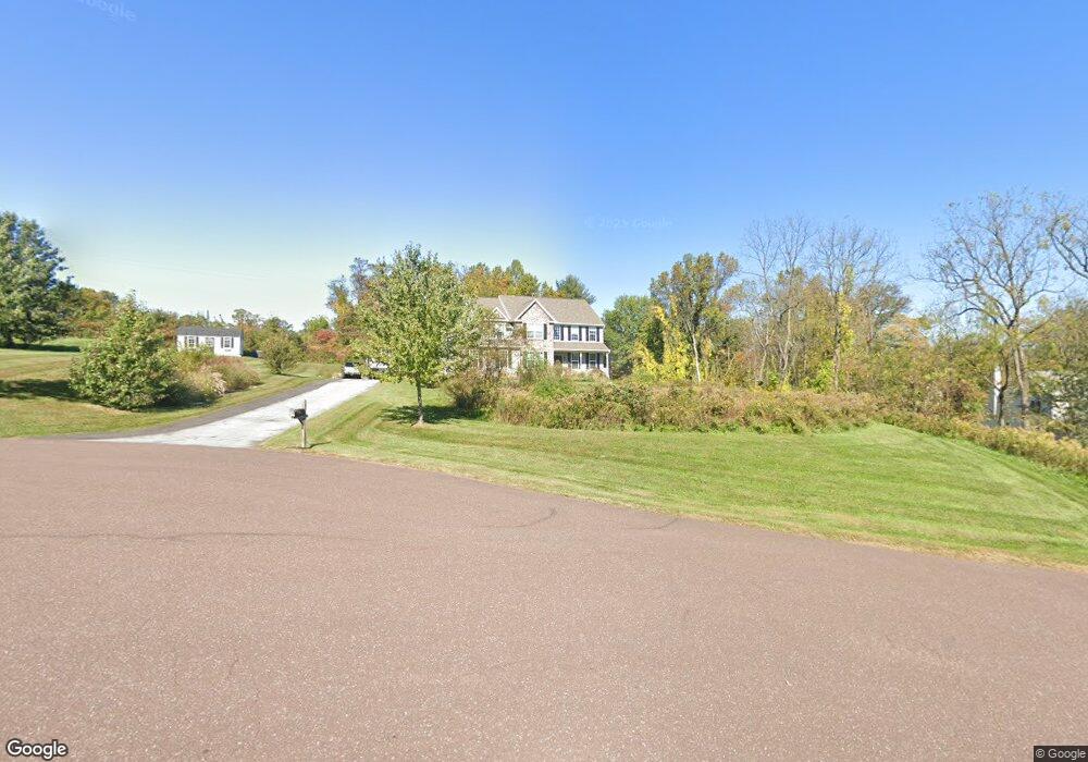
7 Maack Rd Pottstown, PA 19465
Estimated Value: $779,000 - $833,000
4
Beds
5
Baths
3,066
Sq Ft
$261/Sq Ft
Est. Value
About This Home
This home is located at 7 Maack Rd, Pottstown, PA 19465 and is currently estimated at $799,779, approximately $260 per square foot. 7 Maack Rd is a home located in Chester County with nearby schools including French Creek Elementary School, Owen J Roberts Middle School, and Owen J Roberts High School.
Ownership History
Date
Name
Owned For
Owner Type
Purchase Details
Closed on
Sep 18, 2012
Sold by
Mullray Timothy D
Bought by
Giovinazzo Thomas D and Giovinazzo Kelly L
Current Estimated Value
Home Financials for this Owner
Home Financials are based on the most recent Mortgage that was taken out on this home.
Original Mortgage
$316,564
Outstanding Balance
$219,001
Interest Rate
3.12%
Mortgage Type
Construction
Estimated Equity
$580,778
Purchase Details
Closed on
Jun 14, 2012
Sold by
Fulmer Road Associates Lp
Bought by
Mullray Timothy D
Create a Home Valuation Report for This Property
The Home Valuation Report is an in-depth analysis detailing your home's value as well as a comparison with similar homes in the area
Home Values in the Area
Average Home Value in this Area
Purchase History
| Date | Buyer | Sale Price | Title Company |
|---|---|---|---|
| Giovinazzo Thomas D | $85,000 | None Available | |
| Mullray Timothy D | -- | None Available |
Source: Public Records
Mortgage History
| Date | Status | Borrower | Loan Amount |
|---|---|---|---|
| Open | Giovinazzo Thomas D | $316,564 |
Source: Public Records
Tax History Compared to Growth
Tax History
| Year | Tax Paid | Tax Assessment Tax Assessment Total Assessment is a certain percentage of the fair market value that is determined by local assessors to be the total taxable value of land and additions on the property. | Land | Improvement |
|---|---|---|---|---|
| 2025 | $10,407 | $247,340 | $57,230 | $190,110 |
| 2024 | $10,407 | $247,340 | $57,230 | $190,110 |
| 2023 | $10,260 | $247,340 | $57,230 | $190,110 |
| 2022 | $10,097 | $247,340 | $57,230 | $190,110 |
| 2021 | $9,977 | $247,340 | $57,230 | $190,110 |
| 2020 | $9,353 | $237,850 | $57,230 | $180,620 |
| 2019 | $9,182 | $237,850 | $57,230 | $180,620 |
| 2018 | $9,008 | $237,850 | $57,230 | $180,620 |
| 2017 | $8,800 | $237,850 | $57,230 | $180,620 |
| 2016 | $1,762 | $237,850 | $57,230 | $180,620 |
| 2015 | $1,762 | $237,850 | $57,230 | $180,620 |
| 2014 | $1,762 | $237,850 | $57,230 | $180,620 |
Source: Public Records
Map
Nearby Homes
- 287 Kulp Rd
- 537 Schoolhouse Rd
- 1547 Pottstown Pike
- 1378 S Hanover St
- 446 Neiman Rd
- 746 W Hoffecker Rd
- 5 N Savanna Dr
- 124 Bucktown Crossing Unit 31C
- 28 Wil-Be Dr
- 3 Brower Ln
- 780 E Cedarville Rd
- 1025 Darby Ct
- 108 Hartman Rd
- 10 Ashwood Dr
- 723 Saylors Mill Rd
- 25 Hastings Ln
- 1378 Sheep Hill Rd
- 848 S Keim St
- 1228 Sheep Hill Rd
- 1189 Foxview Rd