7 Mae Ln Wallingford, CT 06492
Estimated Value: $790,000 - $922,000
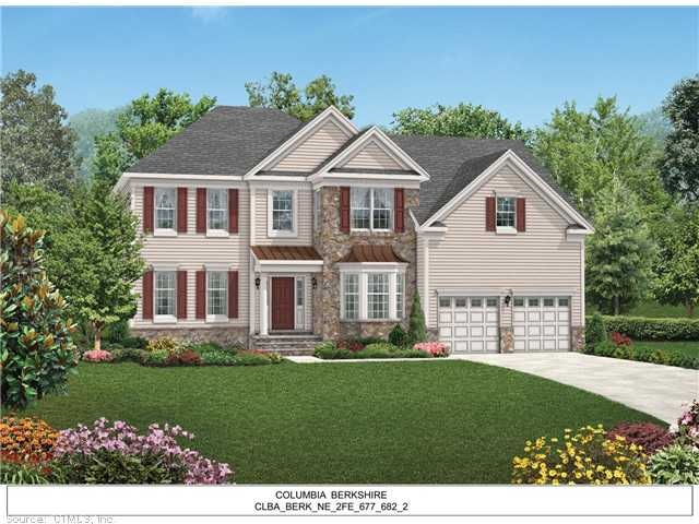
Highlights
- Colonial Architecture
- 2 Car Attached Garage
- Level Lot
- 1 Fireplace
- Central Air
About This Home
As of January 2013This home is located at 7 Mae Ln, Wallingford, CT 06492 since 13 June 2012 and is currently estimated at $849,199, approximately $267 per square foot. This property was built in 2012. 7 Mae Ln is a home located in New Haven County with nearby schools including Moses Y Beach Elementary School, Rock Hill Elementary School, and Dag Hammarskjold Middle School.
Home Details
Home Type
- Single Family
Year Built
- Built in 2012
Lot Details
- 0.25 Acre Lot
- Level Lot
Home Design
- Colonial Architecture
- Vinyl Siding
Interior Spaces
- 3,170 Sq Ft Home
- 1 Fireplace
- Basement Fills Entire Space Under The House
Bedrooms and Bathrooms
- 4 Bedrooms
Parking
- 2 Car Attached Garage
- Driveway
Schools
- Moses Beach Elementary School
- Lyman Hall High School
Utilities
- Central Air
- Heating System Uses Natural Gas
- Cable TV Available
Community Details
- Estates At Walling Subdivision
Home Values in the Area
Average Home Value in this Area
Property History
| Date | Event | Price | List to Sale | Price per Sq Ft |
|---|---|---|---|---|
| 01/18/2013 01/18/13 | Sold | $563,000 | +8.1% | $178 / Sq Ft |
| 06/16/2012 06/16/12 | Pending | -- | -- | -- |
| 06/13/2012 06/13/12 | For Sale | $520,995 | -- | $164 / Sq Ft |
Tax History
| Year | Tax Paid | Tax Assessment Tax Assessment Total Assessment is a certain percentage of the fair market value that is determined by local assessors to be the total taxable value of land and additions on the property. | Land | Improvement |
|---|---|---|---|---|
| 2025 | $12,747 | $528,500 | $109,700 | $418,800 |
| 2024 | $11,145 | $363,500 | $98,200 | $265,300 |
| 2023 | $10,665 | $363,500 | $98,200 | $265,300 |
| 2022 | $10,556 | $363,500 | $98,200 | $265,300 |
| 2021 | $10,367 | $363,500 | $98,200 | $265,300 |
| 2020 | $6,155 | $379,100 | $104,800 | $274,300 |
| 2019 | $11,736 | $379,100 | $104,800 | $274,300 |
| 2018 | $11,736 | $379,100 | $104,800 | $274,300 |
| 2017 | $6,142 | $379,100 | $104,800 | $274,300 |
| 2016 | $10,573 | $379,100 | $104,800 | $274,300 |
| 2015 | $10,708 | $389,800 | $104,800 | $285,000 |
| 2014 | $10,482 | $389,800 | $104,800 | $285,000 |
Map
Source: SmartMLS
MLS Number: G624831
APN: WALL-000065-000000-000080
Disclaimer: Certain information contained herein is derived from information provided by parties other than Homes.com. All information provided is deemed reliable, but is not guaranteed to be accurate and should be independently verified.
![]() IDX information is provided exclusively for personal, non-commercial use, and may not be used for any purpose other than to identify prospective properties consumers may be interested in purchasing. Information is deemed reliable but not guaranteed.
IDX information is provided exclusively for personal, non-commercial use, and may not be used for any purpose other than to identify prospective properties consumers may be interested in purchasing. Information is deemed reliable but not guaranteed.
- 5 Mae Ln
- 101 Grieb Rd
- 5 Kish Place
- 1 Dean Dr
- 570 N Main St
- 71 Cedar Ln
- 65 Brooklawn Dr
- 380 Main St Unit 3
- 380 Main St Unit 7
- 380 Main St Unit 4
- 380 Main St Unit 16
- 380 Main St Unit 13
- 380 Main St Unit 14
- 396 Main St Unit 2
- 6 North Ln
- 230 Main St Unit 18
- 46 Walnut Ln
- 54 High St
- 15 Hanover St
- 67 Royal Oak Cir
Ask me questions while you tour the home.