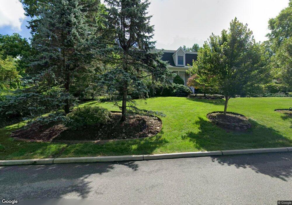
7 Malcolm Rd Mahwah, NJ 07430
Estimated Value: $1,088,365 - $1,240,000
--
Bed
--
Bath
3,074
Sq Ft
$370/Sq Ft
Est. Value
About This Home
This home is located at 7 Malcolm Rd, Mahwah, NJ 07430 and is currently estimated at $1,138,841, approximately $370 per square foot. 7 Malcolm Rd is a home located in Bergen County with nearby schools including Mahwah High School.
Ownership History
Date
Name
Owned For
Owner Type
Purchase Details
Closed on
Dec 31, 2013
Sold by
Howard Christopher M and Howard Jennifer A
Bought by
Silberfarb Daniel and Silberfarb Anna
Current Estimated Value
Home Financials for this Owner
Home Financials are based on the most recent Mortgage that was taken out on this home.
Original Mortgage
$350,000
Outstanding Balance
$99,032
Interest Rate
4.45%
Mortgage Type
New Conventional
Estimated Equity
$1,039,809
Purchase Details
Closed on
Oct 17, 2002
Sold by
Pierson John R
Bought by
Howard Christopher M
Home Financials for this Owner
Home Financials are based on the most recent Mortgage that was taken out on this home.
Original Mortgage
$536,000
Interest Rate
6.03%
Purchase Details
Closed on
May 12, 1998
Sold by
Rj Trawinski Development Corp
Bought by
Pierson John Robert
Home Financials for this Owner
Home Financials are based on the most recent Mortgage that was taken out on this home.
Original Mortgage
$215,000
Interest Rate
7.08%
Purchase Details
Closed on
Aug 25, 1997
Sold by
Caputo Marie
Bought by
Rj Trawinski Development Corp
Create a Home Valuation Report for This Property
The Home Valuation Report is an in-depth analysis detailing your home's value as well as a comparison with similar homes in the area
Home Values in the Area
Average Home Value in this Area
Purchase History
| Date | Buyer | Sale Price | Title Company |
|---|---|---|---|
| Silberfarb Daniel | $679,500 | -- | |
| Howard Christopher M | $670,000 | -- | |
| Pierson John Robert | $430,000 | First American Title Ins Co | |
| Rj Trawinski Development Corp | $135,000 | -- |
Source: Public Records
Mortgage History
| Date | Status | Borrower | Loan Amount |
|---|---|---|---|
| Open | Silberfarb Daniel | $350,000 | |
| Previous Owner | Howard Christopher M | $536,000 | |
| Previous Owner | Pierson John Robert | $215,000 |
Source: Public Records
Tax History Compared to Growth
Tax History
| Year | Tax Paid | Tax Assessment Tax Assessment Total Assessment is a certain percentage of the fair market value that is determined by local assessors to be the total taxable value of land and additions on the property. | Land | Improvement |
|---|---|---|---|---|
| 2025 | $14,312 | $693,400 | $324,500 | $368,900 |
| 2024 | $14,125 | $693,400 | $324,500 | $368,900 |
| 2023 | $13,674 | $693,400 | $324,500 | $368,900 |
| 2022 | $13,674 | $693,400 | $324,500 | $368,900 |
| 2021 | $13,528 | $693,400 | $324,500 | $368,900 |
| 2020 | $13,202 | $693,400 | $324,500 | $368,900 |
| 2019 | $12,766 | $693,400 | $324,500 | $368,900 |
| 2018 | $12,585 | $693,400 | $324,500 | $368,900 |
| 2017 | $12,384 | $693,400 | $324,500 | $368,900 |
| 2016 | $12,114 | $693,400 | $324,500 | $368,900 |
| 2015 | $11,947 | $693,400 | $324,500 | $368,900 |
| 2014 | $11,746 | $693,400 | $324,500 | $368,900 |
Source: Public Records
Map
Nearby Homes
- 12 Alcott Rd
- 37 Hillside Ave
- 13 Winter Terrace
- 66 Thunderhead Place
- 2120 Gunston Ct
- 2256 Margaret Ct Unit 21A
- 2115 Henry Ct Unit 1
- 2054 Charles Ct
- 2130 Isabelle Ct
- 2170 Kent Ct
- 324 Franklin Turnpike
- 2 Reid Ct
- 16 Gardner St
- 199 Parkside Dr
- 12 Sagamore Ave
- 155 Parkside Dr Unit 155
- 235 Parkside Dr Unit 235
- 129 Parkside Dr
- 199 Island Rd
- 208 Parkside Dr